Norcott Hill, Northchurch, Hertfordshire.
- Land size
- 5.33 acres
- Bedrooms
- 2
- Bathrooms
- 1
Key Features
- Stunning location
- Rural on the edge of The Ashridge Estate
- Bungalow with lots of potential
- Direct riding onto the Estate in beautiful woods
- Far reaching views
- Stableyard with 4 boxes and stores
- Approaching 5 acres of level pasture
- Idyllic setting
Description
Farmside we believe was built around the same time as its neighbour Norcott Hall, its purpose being as a workers cottage. This would date it to circa 1928 and there is no question that the property has an art deco appearance with tall ceilings and leaded crittall windows.
The location is exceptionally desirable boasting many draws and nestling at the top of a hill right on the edge of the beautiful Ashridge estate. The surroundings are fairly idyllic with very pretty scenery by way of fields and woodland and there is direct access to the superb bridleway network and footpaths through the estate. For the commuter the nearby station at Berkhamsted offers a half an hour rail service to London.
The residence sits in a plot of almost a third of an acre, the stable yard within said plot and then a stones throw away is the land comprising approaching 5 acres of level pasture that has a mains fed trough.
There is a lot of scope to increase the footprint of Farmside, either by extending outwards or upwards into the loft, or both, subject to the necessary consents of course. Currently there is a large hall, two bedrooms, a bathroom, kitchen and comfortable sitting room and a boot room that acts as a utility and tack room all of which is on one level. In the kitchen, which has underfloor heating, are a range of white units and marble worktops alongside some fitted shelving. A dishwasher is integrated, so too an induction hob and a double oven/grill. All the appliances are Neff and space and plumbing are also available for a washing machine. The sitting room is dual aspect and has a lovely working brick fireplace and both the bedrooms are of excellent dimensions. The property benefits from numerous cupboards, most of them a walk in size meaning there is no shortage of storage areas. Accessed separately to the main accommodation but attached is a great boot room that doubles as a utility room and tack room and there is the plumbing for a second washing machine.
OUTSIDE
Farmside occupies the middle of its plot with lawns to the front and rear. Down the side is the driveway and hardstanding up to the yard, the yard being on a concrete pad.
The stables are timber construction with a brick base and an onduline roof and comprise 3 standard boxes and a foaling box, the latter having the option to divide into a smaller box and a store. Adjacent to the stables is a timber shed/haystore.
Mains power, lighting and water are connected to the yard, the stables with internal and external lights.
The easterly view is to the Ashridge estates woodland and the westerly backdrop has fields with a treeline in the distance.
Less than a 200 yard walk is the grazing.
LOCATION
Norcott Hill is just to the south of Berkhamsted Common on the tip of the Ashridge Estate, an estate which dates back to the 13th century and an area of outstanding natural beauty with ancient trees, downlands and meadows covering some 5000 acres.
Berkhamsted lies some 2.7 miles distant, Tring 3.5 miles, Wendover 8.5 miles, Hemel Hempstead 8.5 miles and central London 36 miles. The A41 connecting to the M25 is 10 minutes drive. There are train stations at all the towns mentioned above but the closest at Berkhamsted provides a half an hour service into London.
There are prep schools, nurseries, primary, secondary and independent schools in Berkhamsted including the highly regarded Berkhamsted School that caters for day or boarding.
Berkhamsted also offers supermarkets, amenities, restaurants, an art deco cinema and many shops and boutiques along the long High Street.
COUNCIL TAX
Band E 2,815.93 2025/6
SERVICES
Mains electricity, electric underfloor heating in the kitchen.
Mains water via a metered supply.
Oil fired central heating
Private drainage, a septic tank shared with 2 neighbours that we are informed is emptied every 6 months at a total cost of approx. 200.00.
VIEWING
Strictly via the vendors agent W Humphries Ltd
Map Location
Property details
- Tenure
- Freehold
- Council Tax Band
- Ask Agent
- Date Posted
- 2026-03-07
Market Value Analysis
Compared with 218 Homes with Land listings in East Anglia (5+ acres).
Energy Performance Certificate
Energy Efficiency Rating
Based on UK Energy Performance Certificate standards (EU Directive 2002/91/EC)
Running costs are one side. Planning activity, flood history and ground risks for this location are in the full report.
Utilities & Restrictions
Utilities
- Electricity
- Ask Agent
- Water
- Ask Agent
- Heating
- Ask Agent
- Broadband
- Ask Agent
- Sewerage
- Ask Agent
Rights & Restrictions
- Public Rights of Way
- Ask Agent
- Private Rights of Way
- Ask Agent
- Listed Property
- Ask Agent
- Restrictions
- Ask Agent
Listed status, conservation areas and planning constraints for this location are in the full report.
Property Features
- Accessibility
- Ask Agent
- Parking
- Parking Available
- Garden
- Garden
Beyond the particulars: planning activity, flood history, heritage and ground risks, checked for this exact spot.
Connectivity
Broadband
Fastest speed available at this postcode
1.8 Gbps
Gigabit full fibre
Suitable for
- 4K streaming on every screen
- Full-time home working
- Online gaming & big downloads
Mobile signal
Predicted 4G and 5G signal; indoor signal depends on building materials.
Ofcom Connected Nations postcode-level predictions. Speeds and signal are modelled, not measured, and vary between addresses and providers.
Signal is the easy part. Planning activity, flood history and protected designations here are in the full report.
Nearest Schools
Primary
- St Mary's CofE Primary School, Northchurch1.1 milesNo Ofsted rating
- Ages
- 3 to 11
- Pupils
- 226
- Type
- Voluntary aided school
- Faith
- Church of England
- Aldbury Church of England Primary and Nursery School1.2 milesOfsted: Good
- Ages
- 3 to 11
- Pupils
- 104
- Type
- Voluntary controlled school
- Faith
- Church of England
- Bridgewater Primary School1.4 milesNo Ofsted rating
- Ages
- 3 to 11
- Pupils
- 459
- Type
- Community school
- Westfield Primary School1.4 milesOfsted: Requires improvement
- Ages
- 3 to 11
- Pupils
- 140
- Type
- Community school
- St Thomas More Roman Catholic Primary School, a Voluntary Academy2 milesOfsted: Requires improvement
- Ages
- 3 to 11
- Pupils
- 144
- Type
- Academy converter
- Faith
- Roman Catholic
Secondary
- Ashlyns School2.6 milesOfsted: Good
- Ages
- 11 to 18
- Pupils
- 1,561
- Type
- Foundation school
- Tring School2.6 milesNo Ofsted rating
- Ages
- 11 to 18
- Pupils
- 1,599
- Type
- Academy converter
- Faith
- Church of England
- John F Kennedy Catholic School4.5 milesOfsted report card · May 2026
- Ages
- 11 to 18
- Pupils
- 1,073
- Type
- Academy converter
- Faith
- Roman Catholic
- Laureate Academy5.2 milesOfsted: Good
- Ages
- 11 to 18
- Pupils
- 703
- Type
- Academy sponsor led
- Chesham Grammar School5.3 milesOfsted: Outstanding *
- Ages
- 11 to 18
- Pupils
- 1,331
- Type
- Academy converter
* Latest graded judgement covers quality of education only; no overall grade was issued under the 2024-25 inspection framework.
Distances are straight-line from the advertised location. Source: the national school registers (DfE, Welsh Government, Scottish Government) and Ofsted.
Schools are just the start: sold prices nearby, planning activity and any flood history are in the full report.
Amenities
Supermarket
GP surgery
Pharmacy
Hospital
Straight-line distances from the advertised location. Sources: NHS records, Geolytix supermarket locations, OS Open Greenspace and the national trails registers.
The area stacks up? Now check the location itself: planning nearby, protected designations and past flooding.
Getting Around
Nearest station
Nearest bus stop
Typical drive times
Straight-line distances from the advertised location; drive times are typical free-flow times over OpenStreetMap road data, so allow more at peak. Public transport locations from DfT NaPTAN.
Easy to reach matters. So do planning activity, flood history and ground risks: all in the full report.
Flood Risk
Environment Agency open data, checked around the advertised map pin for the listed acreage. Long-term risk counts flood defences; the planning map's flood zones do not. The map pin for this listing marks the postcode area rather than the exact location, so these readings describe the surrounding area. Provided by LandSale, not the listing agent, and not part of the agent's particulars. Risk varies across a holding, so verify before committing.
Rivers and the sea
Planning map: Flood Zone 1.
Surface water
Not at the pin: mapped about 10 metres away.
These bandings are the summary. Where this location sits on the flood maps, plus planning activity, heritage and ground risks, is in the full report.
Important notice: Information, maps and tags on this page are drawn from the advertising agent's marketing materials or generated automatically. LandSale has not verified them. Relying on these details is at your own risk, always carry out independent checks before committing to a purchase.
LandSale full disclaimer
Marketing information only - not formal particulars. The details on this website are provided for general guidance and do not constitute an offer or contract. Neither LandSale nor the advertising estate/land agent accepts responsibility for any inaccuracy.
1. Source of information
- Listing content: Core description, asking price, tenure, measurements, photographs and planning history originate from the marketing materials of the advertising estate or land agent. LandSale does not author this content and cannot guarantee its accuracy.
- Automated tags & categorisation: Property type, land-use class, acreage bands and similar labels may be applied by machine-learning models. They are intended as a helpful guide only and may not reflect the property's legal status or permitted use.
- Third-party & enriched data layers: Maps, boundary outlines, planning designations, soil reports, broadband coverage and other environmental or location-based insights are licensed from external suppliers. Such data are supplied “as is", may be incomplete or out of date and are subject to change without notice.
2. Verification required
Prospective purchasers must verify critical matters, including but not limited to planning permission, title boundaries, public rights of way, environmental constraints, acreage, services, access and VAT status, through their own inspections, specialist surveys, legal advisers and the selling agent before relying on the information or entering into any contract.
3. No warranty or liability
LandSale gives no warranty, express or implied, as to the accuracy, completeness or fitness for any particular purpose of the information displayed. LandSale shall not be liable for any loss, damage, cost or expense arising directly or indirectly from any use of or reliance on such information, save where liability may not be excluded by law.
4. Updates & feedback
If you believe any detail on this listing is inaccurate, please let us know. We will investigate and, where appropriate, update the listing or notify the agent.
© LandSale | Version 1.3 - August 2026
Listing agent
W Humphries, Waddesdon
74 High Street, Waddesdon, HP18 0JD
Similar properties for sale
- Price
- Offers in Excess of£1,250,000
- Size
- 2.5 acres
Added on 20/08/2026House with Land
- Price
- £849,950
- Size
- 6 acres
Nuffield Farm, Flaunden Lane, HP3, Bovingdon, Hertfordshire HP3 England
Added on 29/01/2026House with Land
- Price
- Offers in Region of£1,250,000
- Size
- 4.4 acres
Added on 25/06/2026Development Land
- Price
- £1,000,000
- Size
- 2 acres
Added on 15/05/2026Barn Conversion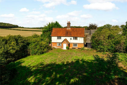
- Price
- Guide Price£950,000
- Size
- 4.93 acres
Little Hampden, Great Missenden, Buckinghamshire, HP16, Ellesborough, Buckinghamshire HP16 England
Added on 18/09/2026House with Land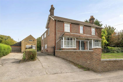
- Price
- Guide Price£980,000
- Size
- 2 acres
Luton Road, Chalton, Bedfordshire, LU4, Chalton, Central Bedfordshire LU4 England
Added on 22/09/2026House with Land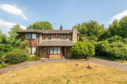
- Price
- Guide Price£875,000
- Size
- 2.74 acres
Old Uxbridge Road, West Hyde, WD3, South West Hertfordshire, Hertfordshire WD3 England
Added on 27/08/2026House with Land
- Price
- Guide Price£875,000
- Size
- 2.74 acres
Old Uxbridge Road, West Hyde, Rickmansworth, South West Hertfordshire, Hertfordshire WD3 England
Added on 27/08/2026House with Land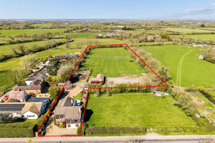
- Price
- Offers in Excess of£1,000,000
- Size
- 2.77 acres
Nash Road, Great Horwood, Great Horwood, Buckinghamshire MK17 England
Added on 13/05/2026Equestrian property
- Price
- £1,200,000
- Size
- 3.5 acres
Woburn Road, Lidlington, Bedford, Marston Moreteyne, Central Bedfordshire MK43 England
Added on 29/01/2026Equestrian property