Richards Castle, Ludlow, Shropshire, SY8
- Land size
- 5.23 acres
Key Features
- 5.23 acres in total
- 1.20 acres of pools
- Woodland
- Pools
Description
Rare opportunity to purchase two attractive large pools situated in surrounding woodland extending in total to approximately 5.23 acres.
The Pools at Mitnell offer a rare opportunity to aquire two attractive large pools situated in surrounding woodland extending in total to approximately 5.23 acres of which the area of the pools extends to about 1.20 acres.
The pools could be utilised for fishing use or recreational use subject to any necessary planning consents. There is a range of biodiversity including woodland, hedgerows and natural water providing a haven for wildlife. The nature of the property may offer additional biodiversity and natural capital opportunities.
The Pools at Mitnell provide an opportunity for prospective purchasers to run a fishery business with approximately 1.20 acres of water stocked with a variety of fish. The pools have formerly been used as a coarse fishery with hardcore paths and timber platforms providing easy access for anglers.
There is already a small Fishing Hut in place. The pools have previously been stocked with freshwater coarse fish including Koi Carp, Grass Carp, Roach, Rudd, Tench, and Bream.
There is mains electricity on site. Water supply is via a borehole nearby. Prospective purchasers will need to go their own research.
Directions
Travelling south turn right off the A49 opposite the turning to Ashford Carbonell about 300 metres south of the B4361 turning to Ludlow, the lane has no directional sign post. After one mile turn left into a no thro road and the gate to the pools is at the end of the lane on Right Hand Side.
What3words: ///chapters.prancing.startles
Location
The Pools at Mitnell are situated in a rural setting within the Parish of Richard’s Castle on the border of the counties of Herefordshire and Shropshire.
To the North of the village is the popular market town of Ludlow offering a wide range of amenities.
The local area offers access to a range of scenic walks over the Teme Valley, Shropshire Hills, Mary Webb trail, and Offa’s Dyke. They are conveniently located with the nearby A49 connecting the County Town of Shrewsbury in the North to the Cathedral City of Hereford in the South.
Tenure - Freehold with vacant possession
Public Footpath - Please refer to the land plan adjacent for the blue hatched line showing the public footpath.
Services - There is mains electricity on site. Water supply is via a borehole nearby. Prospective purchasers will need to go their own research.
Stewardship Scheme - In so far as we are aware the land is not the subject of any Environmental Stewardship Scheme.
Sporting, Timber And Mineral Rights - All standing timber or any sporting rights, if owned, are included in the sale.
Wayleaves, Easements And Rights Of Way - The property is sold subject to and with the benefit of all easements, quasi easements, wayleaves, and rights of way both declared and undeclared.
Planning - No planning enquiries have been made.
Local Authority - Shropshire Council Planning
Map Location
Property details
- Tenure
- Freehold
- Council Tax Band
- TBC
- Date Posted
- 2026-03-13
Utilities & Restrictions
Utilities
- Electricity
- Ask Agent
- Water
- Mains
- Heating
- Ask Agent
- Broadband
- Ask Agent
- Sewerage
- Ask Agent
Rights & Restrictions
- Public Rights of Way
- Ask Agent
- Private Rights of Way
- Ask Agent
- Listed Property
- Ask Agent
- Restrictions
- Ask Agent
Property Features
- Accessibility
- Ask Agent
- Parking
- Ask Agent
- Garden
- Ask Agent
Important notice: Information, maps and tags on this page are supplied by the advertising agent or generated automatically. LandSale has not verified them. Relying on these details is at your own risk, always carry out independent checks before committing to a purchase.
LandSale full disclaimer
Marketing information only - not formal particulars. The details on this website are provided for general guidance and do not constitute an offer or contract. Neither LandSale nor the advertising estate/land agent accepts responsibility for any inaccuracy.
1. Source of information
- Agent-supplied content: Core description, asking price, tenure, measurements, photographs and planning history are uploaded by the appointed agent, who remains solely responsible for their accuracy.
- Automated tags & categorisation: Property type, land-use class, acreage bands and similar labels may be applied by machine-learning models. They are intended as a helpful guide only and may not reflect the property's legal status or permitted use.
- Third-party & enriched data layers: Maps, boundary outlines, planning designations, soil reports, broadband coverage and other environmental or location-based insights are licensed from external suppliers. Such data are supplied “as is", may be incomplete or out of date and are subject to change without notice.
2. Verification required
Prospective purchasers must verify critical matters, including but not limited to planning permission, title boundaries, public rights of way, environmental constraints, acreage, services, access and VAT status, through their own inspections, specialist surveys, legal advisers and the selling agent before relying on the information or entering into any contract.
3. No warranty or liability
LandSale gives no warranty, express or implied, as to the accuracy, completeness or fitness for any particular purpose of the information displayed. LandSale shall not be liable for any loss, damage, cost or expense arising directly or indirectly from any use of or reliance on such information, save where liability may not be excluded by law.
4. Updates & feedback
If you believe any detail on this listing is inaccurate, please let us know. We will investigate and, where appropriate, update the listing or notify the agent.
© LandSale | Version 1.2 - January 2026
Similar properties for sale

- Price
- Guide Price£195,000
Added on 29/01/2026Pub
- Price
- £130,000
- Size
- 0.03 acres
Unit 16, Shifnal Industrial Estate, Shifnal, Shifnal, Shropshire TF11 8SD England
Added on 29/01/2026Industrial LandLeasehold
- Price
- Offers in Excess of£200,000
- Size
- 0.12 acres
Added on 18/07/2026Industrial LandLeasehold
- Price
- £205,000
- Size
- 0.04 acres
Added on 18/07/2026Industrial Land
- Price
- Guide Price£190,000
Added on 27/06/2026Commercial Land
- Price
- £195,000
Added on 17/07/2026Pub
- Price
- Guide Price£150,000
1 Freer Street, Walsall, West Midlands, WS1 1QD, Walsall and Bloxwich, Walsall WS1 1QF England
Added on 04/07/2026Commercial Land
- Price
- Offers in Region of£195,000
Dickin Arms 37 Noble Street, Wem, SY4 5DT, Wem Urban, Shropshire SY4 5EA England
Added on 29/01/2026Pub
- Price
- Offers in Region of£150,000
- Size
- 0.07 acres
83 New Summer Street, Hockley, Birmingham, B19 3TE, Birmingham Ladywood, Birmingham B19 3ST England
Added on 23/04/2026WarehouseLeasehold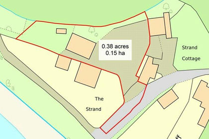
- Price
- Offers in Excess of£195,000
Westbury-on-Severn, Gloucestershire, GL14, Westbury-on-Severn, Gloucestershire GL14 1PG England
Added on 25/05/2026Warehouse