Land At Overton, Chapel Lane, Overton, Lancaster, Lancashire
- Land size
- 28.1 acres
Key Features
- 28.10 acres (9.45 hectares) of high quality meadow, pasture and amenity land
- Offered for sale in two individual lots or as a whole
- Mains water supplies
- Direct access off adjoining highways/ tracks
- Convenient and accessible location on the periphery of Overton village
- Part of Lot 1 subject to ‘clawback’ agreement
- Of interest to farmers, local land and property owners, developers, amenity purchasers or those with equestrian pursuits
Description
To be sold by Public Auction at The Golden Ball Hotel, Lancaster Road, Morecambe, LA3 3ER on Wednesday 24th June 2026 at 2.45pm. A brilliant opportunity to purchase a ring-fenced block of high quality, meadow, pasture and amenity land,
occupying a convenient position on the periphery of the village of Overton.
Offered for sale in two Lots
Lot 1: Meadow and Pasture – 23.35 acres (9.45 hectares)
Lot 2: Meadow/ Amenity Land – 4.75 acres (1.92 hectares)
In all about 28.10 acres (11.37 hectares)
Lot 1
Extending to approximately 23.35 acres (9.45 hectares)
[Shaded Red on the Sale Plan]
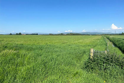
A significant enclosure of high quality, Grade 3, meadow land, capable of arable/ maize cropping, together with a further parcel (3.73 acres) of sound pasture. Lot 1 lies to the direct east of Chapel Lane, offering potential for residential ‘ribbon development’ [subject to the necessary consents].
The land benefits from mains water supplies.
Access to the meadowland is provided via two entranceways: off Chapel Lane to the west and Yenham Lane (double-gateway) to the north. The access points are marked ‘A1’ & ‘A2’ on the enclosed sale plan. The parcel of pasture land is accessed via a sole gateway along its southeasterly boundary.
The boundaries comprise predominantly mature hedgerows, with some sections of post/ wire fencing. Whilst largely stockproof, some lengths of the hedgerow boundaries would benefit from internal fencing.
Please note that the area hatched pink on the second plan enclosed within these particulars of sale is subject to a clawback agreement. The overage payment equates to 25% uplift in the value of the land, due on the earlier of either commencement of development or the grant of any planning approval of any non-agricultural or equestrian use for a period of 20 years, from the date of completion.
Lot 2
Extending to approximately 4.75 acres (1.92 hectares)
[Shaded Blue on the Sale Plan]
An excellent single field enclosure of good quality meadow land, of high amenity value, extending in all to approximately 4.75 acres. The parcel is classified as Grade 3 under the Agricultural Land Classification. The parcel benefits from mains water supplies.
Access is provided via a gateway positioned along the field’s westerly boundary, directly onto Church Grove and marked ‘A3’ on the sale plan. A further gateway is present along the southerly boundary, leading onto the adjoining trackway.
The boundaries consist of mature hedgerows, which are considered stockproof. Please note, however, that there is no physical boundary present along the northern edge of parcel, which directly adjoins Lot 1 (between points ‘B’ & ‘C’ on the sale plan). It will be incumbent for the successful purchaser of Lot 2 to erect a stockproof fence along this boundary section within 2 months from the date of completion.
Directions
From Junction 34 of the M6 motorway, head west along the ‘Bay Gateway’ for approximately 2.5 miles. At the traffic lights continue straight to remain on the same road and continue for a further 0.6 miles. At the roundabout head straight a continue for 1 mile. At the next roundabout, take the first exit onto Moss/ Lancaster Road. Remain on Lancaster Road until you enter the village of Overton. As you travel through the village take the left turning onto Chapel Lane. Continue for 0.2 miles and the land will be located on the left hand side and marked by the Selling Agent’s board.
What3Words: rebel.scope.prelude
Grid Reference: SD
Location
The land at Overton is situated on the eastern edge of the village of Overton, north of the Lune estuary. The field parcels lie approximately 3 miles southwest of Lancaster and 4 miles south of Morecambe.
The A683 public highway (Heysham Bypass) lies approximately 2 miles to the north.
Auction General
General Information and Stipulations
The following Stipulations where applicable shall be deemed as Special Conditions of Sale. In the event of any variance between the Stipulations and the Special Conditions of Sale then the latter will prevail. Purchasers will also be deemed to have had full notice of the Stipulations and the Special Conditions of Sale and the same will not be read out at the time of sale. The Special Conditions of Sale may be inspected at the Auctioneer’s Offices and also the offices of the Seller’s Solicitors FOURTEEN days prior to the sale.
N.B Prospective purchasers are requested to contact the Seller’s Solicitors to discuss legal matters pertinent to the Sale Contract and documentation.
Solicitors
JMW Solicitors LLP, 1 Byrom Place, Spinningfields, Manchester, M3 3HG Tel No.
Tenure
Freehold. Vacant possession upon completion.
The date fixed for completion is Thursday 20th August 2026 or earlier by mutual agreement.
Method of Sale
The property will be offered for sale as described in these particulars of sale. The vendors reserve the right to agree a sale prior to the auction date. The Auctioneer reserves the right to amalgamate the Lots at the time of the sale.
Water Supplies
Lot 1 benefits from mains water supplies. Lot 2 benefits from mains water supplies.
Planning Authority
Lancaster City Council -
Mines and Minerals
Included, insofar as we are aware.
Sporting Rights
Included, insofar as we are aware.
Common Rights
There are commons rights attached to the land on Colloway and Overton Marshes under CL193-Entry no.8, providing the right graze 48 head of cattle on the common, as detailed in column 4 of the register.
Should Lots 1 & 2 be sold separately the commons rights will be apportioned will be apportioned between the lots on a pro-rata acreage basis. On this basis, it is anticipated that Lot 1 will retain 39.89 rights and Lot 2 approximately 8.11 rights. NOTE - These are indicative figures and are subject to an application to the Commons Registration Authority.
Flood Zone
Please note that the 3.73 acre field parcel, formerly part of Lot 1, is shown as being located within Flood Zone 3 on the Environment Agency's Flood Risk map for planning.
Wayleave and Easements The sale is subject to all existing rights of way, drainage, light air support and other easements whether mentioned in these particulars or not.
Boundaries
The responsibility of the boundary fences are indicated with ‘T’ marks on the sale plan where known and are from the information provided by the sellers and are believed to be correct.
The successful purchaser of Lot 2 will be required to construct a suitable stockproof fence between points B and C on the plan attached to these particulars, within 2 months of the completion date.
Sale Plan
The Sale Plan has been prepared by the Selling Agent for the convenience of the prospective purchasers. It is deemed to be correct, but any error, omission or misstatement shall not affect the sale. Purchasers must satisfy themselves as to accuracy.
Clawback Agreement
The area hatched pink on the second plan enclosed within these particulars of sale is subject to a clawback agreement. The overage payment equates to 25% uplift in the value of the land, due on the earlier of either commencement of development or the grant of any planning approval of any non-agricultural or equestrian use for a period of 20 years, from the date of completion.
Money Laundering Regulations 2017
We are required by legislation to undertake checks on any potential purchaser prior to accepting their bid. Any interested party should either call into our Kendal Office with photographic ID, i.e., passport/driving licence and proof of address i.e., Council Tax/utility bill for copying prior to the auction or present copies at the Auctioneer’s desk prior to the commencement of the sale.
Viewings
The land may be inspected at any reasonable time by prospective buyers on foot, provided a copy of these particulars are in possession. We kindly request that all those viewing the land leave gates as found.
Map Location
Property details
- Tenure
- Freehold
- Council Tax Band
- TBC
- Date Posted
- 2026-05-19
Market Value Analysis
Compared with 7 Bare & Undeveloped Land listings in North West England (25+ acres).
Utilities & Restrictions
Utilities
- Electricity
- Ask Agent
- Water
- Ask Agent
- Heating
- Ask Agent
- Broadband
- Ask Agent
- Sewerage
- Ask Agent
Rights & Restrictions
- Public Rights of Way
- Ask Agent
- Private Rights of Way
- Ask Agent
- Listed Property
- Ask Agent
- Restrictions
- Ask Agent
Property Features
- Accessibility
- Ask Agent
- Parking
- Ask Agent
- Garden
- Ask Agent
Important notice: Information, maps and tags on this page are supplied by the advertising agent or generated automatically. LandSale has not verified them. Relying on these details is at your own risk, always carry out independent checks before committing to a purchase.
LandSale full disclaimer
Marketing information only - not formal particulars. The details on this website are provided for general guidance and do not constitute an offer or contract. Neither LandSale nor the advertising estate/land agent accepts responsibility for any inaccuracy.
1. Source of information
- Agent-supplied content: Core description, asking price, tenure, measurements, photographs and planning history are uploaded by the appointed agent, who remains solely responsible for their accuracy.
- Automated tags & categorisation: Property type, land-use class, acreage bands and similar labels may be applied by machine-learning models. They are intended as a helpful guide only and may not reflect the property's legal status or permitted use.
- Third-party & enriched data layers: Maps, boundary outlines, planning designations, soil reports, broadband coverage and other environmental or location-based insights are licensed from external suppliers. Such data are supplied “as is", may be incomplete or out of date and are subject to change without notice.
2. Verification required
Prospective purchasers must verify critical matters, including but not limited to planning permission, title boundaries, public rights of way, environmental constraints, acreage, services, access and VAT status, through their own inspections, specialist surveys, legal advisers and the selling agent before relying on the information or entering into any contract.
3. No warranty or liability
LandSale gives no warranty, express or implied, as to the accuracy, completeness or fitness for any particular purpose of the information displayed. LandSale shall not be liable for any loss, damage, cost or expense arising directly or indirectly from any use of or reliance on such information, save where liability may not be excluded by law.
4. Updates & feedback
If you believe any detail on this listing is inaccurate, please let us know. We will investigate and, where appropriate, update the listing or notify the agent.
© LandSale | Version 1.2 - January 2026
Similar properties for sale
- Price
- £460,000
- Size
- 51.44 acres
New Lane, Eagland Hill, Preston, Lancashire, Pilling, Lancashire PR3 6BA England
Added on 11/06/2026Arable Land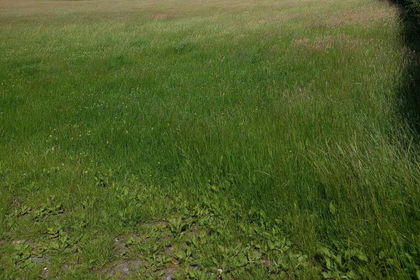
- Price
- Guide Price£465,000
- Size
- 42.27 acres
Added on 17/07/2026Agricultural Land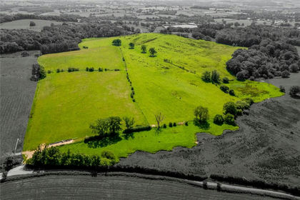
- Price
- Guide Price£430,000
- Size
- 93.93 acres
Wennington, Lancaster, North Yorkshire, Wennington, Lancashire LA2 8NY England
Added on 07/07/2026Agricultural Land
- Price
- Guide Price£450,000
- Size
- 39.25 acres
at Ridding Lane, Whalley, Clitheroe, BB7, Whalley, Lancashire BB7 9YH England
Added on 20/07/2026Farmland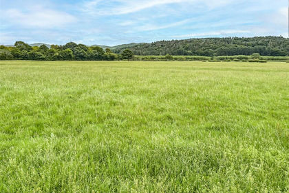
- Price
- Guide Price£400,000
- Size
- 41.66 acres
Added on 29/01/2026Grazing Land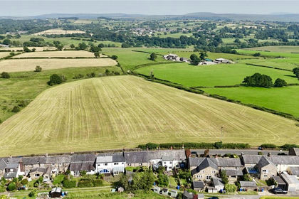
- Price
- Offers in Excess of£385,000
- Size
- 36.94 acres
Denham Lane, Brindle, Chorley, Lancashire, Brindle, Lancashire PR6 8PA England
Added on 20/07/2026Agricultural Land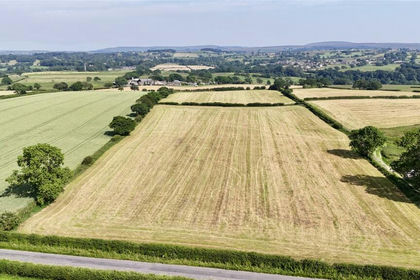
- Price
- Offers in Excess of£285,000
- Size
- 28.44 acres
Denham Lane, Brindle, Chorley, Lancashire, Brindle, Lancashire PR6 8PA England
Added on 17/07/2026Agricultural Land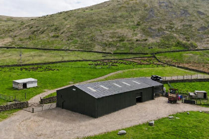
- Price
- Guide Price£430,000
- Size
- 29.5 acres
Lot 3 - Brockholes Farm, Tebay, CA10 3XT, Tebay, Westmorland and Furness CA10 3XT England
Added on 09/06/2026Farmland
- Price
- Guide Price£330,000
- Size
- 56.83 acres
Lot 2 - Brockholes Farm, Tebay, CA10 3XT, Tebay, Westmorland and Furness CA10 3XS England
Added on 09/06/2026Farmland