Barn & Land at Coedmore Lane, Allensmore, Hereford, Herefordshire, HR2
- Land size
- 2.18 acres
Key Features
- Available Freehold with Vacant Possession
- Extending in total to approximately 2.18 acres (0.88 hectares)
- Natural Water supply in the form of a capped well with services adjacent
- Spacious plot and garden curtilage and level 2.18 acre paddock
- Located in the historic settlement of Allensmore, close to the City of Hereford and with good accessibility to the towns of Abergavenny, Ross-on-Wye and Monmouth
- Planning consent for conversion to a modern detached two-bedroom residence
- Detached traditional block built barn
- Secluded rural location close to Allensmore
- Superb location and position within open countryside
Description
A superb opportunity to acquire an excellent block-built barn with planning consent for conversion to an impressive modern two-bedroom country residence set within 2.18 acres of paddock within the glorious Herefordshire countryside.
The property is within a short drive of the historic village of Allensmore and the A465 offering superb accessibility to the A49 and the City of Hereford.
• Superb location and position within open countryside •
• Secluded rural location close to Allensmore •
• Detached traditional block built barn •
• Planning consent for conversion to a modern detached two-bedroom residence •
• Located in the historic settlement of Allensmore, close to the City of Hereford and with good accessibility to the towns of Abergavenny, Ross-on-Wye and Monmouth •
• Spacious plot and garden curtilage and level 2.18 acre paddock •
• Natural Water supply in the form of a capped well •
• Extending in total to approximately 2.18 acres (0.88 hectares) •
DISTANCES
Allensmore 1.7 miles • Hereford 5.6 miles • Ross-on-Wye 14.3 miles Monmouth 16.7 miles • Abergavenny 18.8 miles • Gloucester 31.6 miles
Newport 37.6 miles • Cheltenham 39.1 miles • Cardiff 48.5 miles
Bristol 64.6 miles • London 144 miles
Hereford Railway Station 6.1 miles
Abergavenny Railway Station 19.5 miles
Newport Railway Station 37.3 miles • Cardiff Airport 62.2 miles
Bristol Airport 69.2 miles • London Heathrow Airport 130 miles
(all distances are approximate)
LOCATION & SITUATION
Barn and Land at Allensmore enjoys a desirable and accessible location in open countryside positioned on the north-eastern side of Coedmore Lane, close to the A465, within the settlement of Allensmore. The property benefits from a tranquil setting with countryside views and good access with a bus stop at the A465 end of Coedmore Lane.
The village of Allensmore offers an excellent range of local amenities including Allensmore Nurseries, St Andrew’s C of E Church, Allensmore Village Hall, The Three Horseshoes Public House and Inn, Post Office and Locks Garage and Filling Station with Londis shop. There is also Clehonger C of E Primary School just 2.5 miles away.
The cathedral city of Hereford is just 5.6 miles to the north-east and boasts an excellent range of state and private primary and secondary schools and colleges including the renowned Hereford Cathedral School, Bishop of Hereford’s Bluecoat School, The Steiner Academy Hereford and The Herefordshire and Ludlow College. Hereford offers a range of traditional shops and businesses and also offers the recently developed Old Market offering an extensive range of well-known shops, bars and restaurants and cinemas. For sport lovers Hereford is home to Hereford Rugby Club, Hereford Rowing Club, Hereford Racecourse and Hereford FC Football Club (previously Hereford United) who play at Edgar Street.
Ross-on-Wye is a market town overlooking the River Wye and within the Wye Valley National Landscape known as the gateway to the Wye Valley. It has an abundance of independent shops, supermarkets, cafés, restaurants, primary and secondary schools and leisure activities. Ross also houses two GP surgeries and a local community hospital. There is an abundance of spectacular wooded riverside walking routes nearby, including the Town and Country Trail, Chase Woods and the John Kyrle circular walk, taking in fields, views and the River Wye.
DESCRIPTION
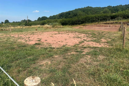
From the eastern side of the A465 the property is accessed via Coedmore Lane, positioned on the northern side of the lane after the railway bridge with gated access direct into the property. Adjacent to the gateway on the lane is a useful parking bay. The property comprises a regular shaped level field enclosure of pasture paddock. Close to the gateway is a hard standing area with the barn. The barn features block and boarded elevations under a monopitched fibre cement roof. There is also an additional small monopitched fully enclosed building adjacent. The barn has planning consent for conversion to a two-bedroom residence and is set within a generous curtilage within a regular sized rectangular paddock providing a perfect setting for a rural family home.
The development will provide a charming modern barn conversion with reception hall, open plan sitting room, kitchen and dining room, laundry and plant store, Jack and Jill cloakroom and two double bedrooms with ensuite bathrooms. Externally, the residential curtilage will offer a parking area to the west of the barn with ample parking and two designated spaces. There will be an outside decking/patio area on the eastern side of the property providing an excellent space for al-fresco dining. The residential curtilage then looks out onto the level paddock with natural water supply from a stream and capped well, appealing to anyone with equestrian or pedigree stock interests.
The property extends in total to approximately 2.18 acres (0.88 hectares).
PLANING INFORMATION
Planning consent has been achieved under Planning Application Reference P253247/F (253247) dated 20th March 2026 for “Conversion of an agricultural barn to a dwelling, extension of the building, change of use of land for associated residential use and ancillary works”. Planning must be commenced within five years of the date of consent.
A copy of the Planning Consent Decision Notice is available from Powells on request, or available for download on Herefordshire Council’s Planning Application Search portal using the above planning application reference.
KEY INFORMATION
Services: No services are directly connected but a mains electricity pole is within the freehold of the property and mains water is close by in Coedmore Lane. There is the possibility of a private water supply in the form of a well on site which has been capped. Private drainage will be to a treatment plant.
Fixtures and fittings: Only those items specifically mentioned in these particulars will be included in the sale.
Tenure: Freehold with vacant possession upon completion.
Local Authority: Herefordshire Council. Telephone .
Wayleaves, Easements and Rights of Way: The property will be sold subject to and with the benefit of all wayleaves, easements and any public and private rights of way that exist, whether or not, they are specifically referred to in these particulars.
Sale Method: The property is offered for sale by Private Treaty.
Viewings: Strictly by appointment with Powells – .
Directions: From the Ross Road at Hereford proceed west onto Belmont Road for 1.11 miles. At the roundabout take the second exit proceeding straight onto the A465 in the direction of Abergavenny. Continue on the A465 for 3 miles then turn left onto Coedmore Lane. Proceed for 0.6 miles crossing over the railway bridge and the gateway to the land will be on your left hand side.
Please note the Post Code will not take you to the exact address.
WHAT3WORDS:
committed.cemented.foiled
Planning Consent: The Planning Consent secured upon the Development Site has been achieved by McLoughlin Planning.
Telephone |
Technical Design and Architectural Work: Technical Design and Architectural Work has been undertaken by Coombes Everitt Architects Limited.
Telephone |
Map Location
Property details
- Tenure
- Ask Agent
- Council Tax Band
- Ask Agent
- Date Posted
- 2026-06-22
Price history
| Date | Change | Price |
|---|---|---|
| 12 Sep 2026 | Reduced 20% (−£50,050) | £199,950 |
| Until 12 Sep 2026 | Asking price | £250,000 |
Market Value Analysis
Compared with 3 Conversion Land listings in West Midlands (1+ acres).
Utilities & Restrictions
Utilities
- Electricity
- Ask Agent
- Water
- Ask Agent
- Heating
- Ask Agent
- Broadband
- Ask Agent
- Sewerage
- Ask Agent
Rights & Restrictions
- Public Rights of Way
- Ask Agent
- Private Rights of Way
- Ask Agent
- Listed Property
- Ask Agent
- Restrictions
- Ask Agent
Listed status, conservation areas and planning constraints for this location are in the full report.
Property Features
- Accessibility
- Ask Agent
- Parking
- Parking Available
- Garden
- Garden
Beyond the particulars: planning activity, flood history, heritage and ground risks, checked for this exact spot.
Connectivity
Broadband
Fastest speed available at this postcode
1 Mbps
Under 10 Mbps here
Suitable for
- Basic browsing & email
Fixed wireless access may also be an option here.
Mobile signal
Predicted 4G and 5G signal; indoor signal depends on building materials.
Ofcom Connected Nations postcode-level predictions. Speeds and signal are modelled, not measured, and vary between addresses and providers.
Signal is the easy part. Planning activity, flood history and protected designations here are in the full report.
Nearest Schools
Primary
- Clehonger CofE Primary School1.6 milesOfsted: Requires improvement *
- Ages
- 5 to 11
- Pupils
- 86
- Type
- Voluntary controlled school
- Faith
- Church of England
- Kingstone and Thruxton Primary School2.8 milesNo Ofsted rating
- Ages
- 3 to 11
- Pupils
- 202
- Type
- Academy converter
- The Steiner Academy Hereford2.8 milesOfsted: Good
- Ages
- 3 to 16
- Pupils
- 345
- Type
- Academy sponsor led
- Marlbrook Primary School3 milesOfsted: Good
- Ages
- 3 to 11
- Pupils
- 578
- Type
- Academy converter
- Our Lady's RC Primary School3.3 milesOfsted report card · Jun 2026
- Ages
- 4 to 11
- Pupils
- 181
- Type
- Voluntary aided school
- Faith
- Roman Catholic
Secondary
- The Hereford Church of England Academy2.8 milesOfsted: Requires improvement
- Ages
- 11 to 16
- Pupils
- 647
- Type
- Academy sponsor led
- Faith
- Christian
- The Steiner Academy Hereford2.8 milesOfsted: Good
- Ages
- 3 to 16
- Pupils
- 345
- Type
- Academy sponsor led
- Kingstone High School2.8 milesNo Ofsted rating
- Ages
- 11 to 16
- Pupils
- 568
- Type
- Academy converter
- Whitecross Hereford3.9 milesOfsted: Good
- Ages
- 11 to 16
- Pupils
- 942
- Type
- Academy converter
- Aylestone School5 milesOfsted: Requires improvement
- Ages
- 11 to 16
- Pupils
- 443
- Type
- Community school
* Latest graded judgement covers quality of education only; no overall grade was issued under the 2024-25 inspection framework.
Distances are straight-line from the advertised location. Source: the national school registers (DfE, Welsh Government, Scottish Government) and Ofsted.
Schools are just the start: sold prices nearby, planning activity and any flood history are in the full report.
Amenities
Supermarket
GP surgery
Pharmacy
Hospital
Green space
Straight-line distances from the advertised location. Sources: NHS records, Geolytix supermarket locations, OS Open Greenspace and the national trails registers.
The area stacks up? Now check the location itself: planning nearby, protected designations and past flooding.
Getting Around
Nearest station
Nearest bus stop
Typical drive times
Straight-line distances from the advertised location; drive times are typical free-flow times over OpenStreetMap road data, so allow more at peak. Public transport locations from DfT NaPTAN.
Easy to reach matters. So do planning activity, flood history and ground risks: all in the full report.
Flood Risk
Environment Agency open data, checked around the advertised map pin for the listed acreage. Long-term risk counts flood defences; the planning map's flood zones do not. Provided by LandSale, not the listing agent, and not part of the agent's particulars. Risk varies across a holding, so verify before committing.
Rivers and the sea
Planning map: Flood Zone 1.
Surface water
These bandings are the summary. Where this location sits on the flood maps, plus planning activity, heritage and ground risks, is in the full report.
Important notice: Information, maps and tags on this page are drawn from the advertising agent's marketing materials or generated automatically. LandSale has not verified them. Relying on these details is at your own risk, always carry out independent checks before committing to a purchase.
LandSale full disclaimer
Marketing information only - not formal particulars. The details on this website are provided for general guidance and do not constitute an offer or contract. Neither LandSale nor the advertising estate/land agent accepts responsibility for any inaccuracy.
1. Source of information
- Listing content: Core description, asking price, tenure, measurements, photographs and planning history originate from the marketing materials of the advertising estate or land agent. LandSale does not author this content and cannot guarantee its accuracy.
- Automated tags & categorisation: Property type, land-use class, acreage bands and similar labels may be applied by machine-learning models. They are intended as a helpful guide only and may not reflect the property's legal status or permitted use.
- Third-party & enriched data layers: Maps, boundary outlines, planning designations, soil reports, broadband coverage and other environmental or location-based insights are licensed from external suppliers. Such data are supplied “as is", may be incomplete or out of date and are subject to change without notice.
2. Verification required
Prospective purchasers must verify critical matters, including but not limited to planning permission, title boundaries, public rights of way, environmental constraints, acreage, services, access and VAT status, through their own inspections, specialist surveys, legal advisers and the selling agent before relying on the information or entering into any contract.
3. No warranty or liability
LandSale gives no warranty, express or implied, as to the accuracy, completeness or fitness for any particular purpose of the information displayed. LandSale shall not be liable for any loss, damage, cost or expense arising directly or indirectly from any use of or reliance on such information, save where liability may not be excluded by law.
4. Updates & feedback
If you believe any detail on this listing is inaccurate, please let us know. We will investigate and, where appropriate, update the listing or notify the agent.
© LandSale | Version 1.3 - August 2026
Listing agent
Powells, Monmouth
Singleton Court Business Park, Wonastow Road, Monmouth, NP25 5JA
Contact Powells, Monmouth
Singleton Court Business Park, Wonastow Road, Monmouth, NP25 5JA
View agent profileSimilar properties for sale
- Price
- Offers Over£135,000
The Mews Plot, Graftonbury, Hereford, HR2, Grafton, Herefordshire, County of HR2 England
Added on 29/01/2026Building Plot
- Price
- Offers in Region of£150,000
Grafton, Hereford, Grafton, Herefordshire, County of HR2 England
Added on 29/01/2026Self Build Plot Added on 29/01/2026Building Plot
- Price
- Guide Price£140,000
Hoarwithy, Hereford, Hentland, Herefordshire, County of HR2 England
Added on 19/08/2026Building Plot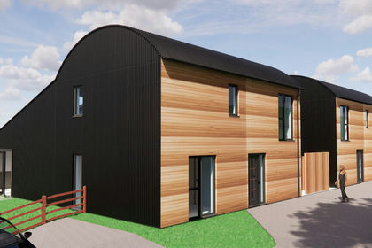
- Price
- Guide Price£195,000
- Size
- 0.4 acres
Added on 15/04/2026Barn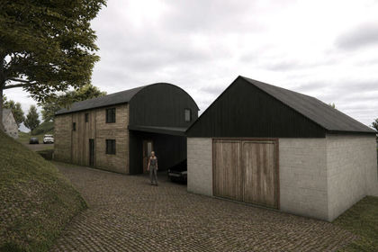
- Price
- Guide Price£160,000
- Size
- 0.25 acres
Added on 08/09/2026Conversion Land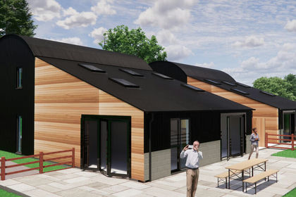
- Price
- Guide Price£225,000
- Size
- 1.5 acres
Added on 10/09/2026Development Land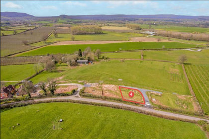 Added on 03/04/2026Building Plot
 Added on 14/07/2026Building Plot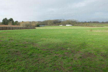
- Price
- Guide Price£160,000
Land Adjoining The Cottage, Newtown Cross, Yarkhill, Herefordshire, County of HR8 England
Added on 20/02/2026Building Plot