The Grange, Whittingham, Alnwick
- Land size
- 2.02 acres
- Bedrooms
- 8
- Bathrooms
- 4
Key Features
- Spacious architecture with entrance hall, 3 reception rooms, 6 bedrooms, 2 bath/shower rooms (one ensuite), kitchen/breakfast room, garden room, boot room/laundry, downstairs wc, attic store. Approx 3
- Self contained cottage with 2 bedrooms (both with ensuite bath/shower facilities), kitchen, sitting/dining room, downstairs wc/shower room. Approx 1,315sq ft.
- Extensive parking and double garage/workshop/garden store.
- Private garden with ha-ha and unique woodland walks.
- Peaceful rural setting.
- EPC ratings E.
- In all about 2.02 acres.
- For sale as a whole.
Description
A distinguished Victorian family house with exceptional unobstructed views and blissful woodland; set in fabulous Northumbrian countryside, providing generous and versatile family accommodation, including a self-contained cottage, with excellent road and rail links to Newcastle and London.
Whittingham 1 mile, Alnwick 9 miles, Alnmouth Railway Station 13 miles, Newcastle 30 miles, Newcastle Airport 35 miles (distances approximate)
Situation And History - The Grange has an idyllic setting, just under a mile northwest of the picturesque village of Whittingham in the heart of rural Northumberland. The village is characterised by its stone-built houses and strong sense of community. The house has a peaceful and private setting and lies close to The Northumberland National Park and The Cheviot Hills. It has lovely views to the south over farmland to Thrunton Wood and Simonside Hills beyond.
The historic market town of Alnwick, noted for Alnwick Castle (seat of The Dukes of Northumberland and famed for its links to “Harry Potter”), and its gardens, lies c.9 miles to the east of The Grange. It provides a good selection of local shops and services including schooling and leisure facilities. Newcastle provides all that would be expected of a provincial capital. Whittingham has its own village school, parish church and village hall whilst, the nearby village of Glanton (c.3 miles) has a community run village shop and post office.
The mainline railway station at Alnmouth (c.13 miles to the east) has regular main line services to Newcastle upon Tyne (30 minutes), Edinburgh (1 hour) and London (3 hours 35 minutes); all average journey times. The A697 gives good road access north to The Scottish Borders and beyond, and south to Newcastle and the national motorway network via the A1 at Morpeth (c. 20 miles – also with a good range of shops and services). There are regular international and domestic flights to and from Newcastle Airport.
This part of Northumberland is particularly well known for its beautiful countryside, dramatic landscapes, vibrant wildlife, rich history, dark skies and strong agricultural, equestrian and sporting traditions. The Grange is an ideal base for those who enjoy cycling, salmon fishing (most notably on The North Tyne), walking, game shooting, rugby and golf (Northumberland has several exciting courses along its dramatic Heritage Coastline).
us for the Borders
Description - The Grange is a handsome Victorian stone built attached family home dating from c.1870; it once formed part of the dower house to The Eslington Estate. It is set in its own grounds of approximately 2.02 acres and includes a self-contained two-bedroom annex (Bluebell Cottage). The house retains a wealth of original architectural features synonymous with the era and is traditionally laid out. On three floors, the accommodation is light, spacious and elegantly proportioned, with period features including high ceilings, stone flagged flooring, decorative tiling, sash windows, feature fireplaces, panelling and well-preserved joinery.
The principal reception rooms are particularly appealing, providing both formal and informal living spaces which suit modern family life whilst retaining their charm. The smaller of these rooms is currently used a home office. There is a large kitchen/breakfast room, where the adjoining garden room provides important extra space. As with all country houses the large boot room/laundry is a real asset and a “must have”. The principal bedroom accommodation is on the first floor, where the main bedroom has an ensuite bathroom; otherwise, there are three bedrooms and a family bathroom. In the attic are two more bedrooms and a storeroom.
Bluebell Cottage is a spacious, well-appointed, two-storey, self-contained flat with its own access. It has a big sitting/dining room with exposed beams and a large open fire, comfortably accommodating six people and a modern kitchen. Upstairs both double bedrooms have ensuite facilities. It provides excellent versatility, suitable for guest accommodation, multigenerational living or potential income generation, subject to any necessary consents. If required, it could be incorporated back into the main body of the house. In recent years Bluebell Cottage has generated an annual income of c. £18,000 per annum.
A gravel drive leads through stone pillars to a gravel sweep at the front door, where a ha-ha provides protection from neighbouring farmland. The driveway is owned, with a right of access over the first section of the drive granted to the neighbouring property. The timber garage block is set apart from the house and provides useful storage for garden implements etc and workshop space. It has its own electricity supply and an outside tap.
As well as a huge lawn, throughout the garden there is a wonderful display of spring flowers. In addition, there are mature trees, flowering shrubs and well-stocked herbaceous borders. Alongside the driveway is a mature woodland, full of wildflowers with carpets of bluebells and cut pathways for lovely morning dog walks or evening meanders with children, which provides a good supply of firewood for the hot tub and woodburning stoves, and a wonderful space for children to play.
Map Location
Property details
- Tenure
- Freehold
- Council Tax Band
- G
- Date Posted
- 2026-06-24
Market Value Analysis
Compared with 204 Homes with Land listings in North East England (1+ acres).
Energy Performance Certificate
Energy Efficiency Rating
Based on UK Energy Performance Certificate standards (EU Directive 2002/91/EC)
Running costs are one side. Planning activity, flood history and ground risks for this location are in the full report.
Utilities & Restrictions
Utilities
- Electricity
- Mains
- Water
- Private Supply
- Heating
- Oil Heating
- Broadband
- Cable Internet
- Sewerage
- Septic Tank / Private
Rights & Restrictions
- Public Rights of Way
- Ask Agent
- Private Rights of Way
- Yes
- Listed Property
- Ask Agent
- Restrictions
- Yes
Listed status, conservation areas and planning constraints for this location are in the full report.
Property Features
- Accessibility
- Ask Agent
- Parking
- Parking Available
- Garden
- Garden
Beyond the particulars: planning activity, flood history, heritage and ground risks, checked for this exact spot.
Connectivity
Broadband
Fastest speed available at this postcode
26 Mbps
Standard (10-30 Mbps)
Suitable for
- Web & social
- Music streaming
- Standard video calls
Mobile signal
Predicted 4G and 5G signal; indoor signal depends on building materials.
Ofcom Connected Nations postcode-level predictions. Speeds and signal are modelled, not measured, and vary between addresses and providers.
Signal is the easy part. Planning activity, flood history and protected designations here are in the full report.
Nearest Schools
Primary
- Whittingham Church of England Primary School0.9 milesNo Ofsted rating
- Ages
- 2 to 11
- Pupils
- 81
- Type
- Voluntary controlled school
- Faith
- Church of England
- Branton Primary School and Nursery2.1 milesNo Ofsted rating
- Ages
- 2 to 11
- Pupils
- 39
- Type
- Academy converter
- Thropton Village First School6.8 milesNo Ofsted rating
- Ages
- 3 to 9
- Pupils
- 36
- Type
- Academy converter
- Rothbury First School6.9 milesOfsted: Good *
- Ages
- 3 to 9
- Pupils
- 94
- Type
- Community school
- Ncea Harry Hotspur Church of England Primary School7.8 milesOfsted: Good
- Ages
- 2 to 11
- Pupils
- 104
- Type
- Academy converter
- Faith
- Church of England
Secondary
- Dr Thomlinson Church of England Middle School7.4 milesNo Ofsted rating
- Ages
- 9 to 13
- Pupils
- 184
- Type
- Academy converter
- Faith
- Church of England
- The Duchess's Community High School8.5 milesOfsted: Requires improvement
- Ages
- 11 to 18
- Pupils
- 1,276
- Type
- Academy converter
- James Calvert Spence College14 milesOfsted: Good
- Ages
- 11 to 19
- Pupils
- 567
- Type
- Community school
- The King Edward VI School18 milesOfsted: Good *
- Ages
- 13 to 18
- Pupils
- 1,426
- Type
- Academy converter
- Morpeth Chantry Middle School19 milesOfsted report card · Mar 2026
- Ages
- 9 to 13
- Pupils
- 525
- Type
- Academy converter
* Latest graded judgement covers quality of education only; no overall grade was issued under the 2024-25 inspection framework.
Distances are straight-line from the advertised location. Source: the national school registers (DfE, Welsh Government, Scottish Government) and Ofsted.
Schools are just the start: sold prices nearby, planning activity and any flood history are in the full report.
Amenities
Supermarket
GP surgery
Pharmacy
Hospital
Straight-line distances from the advertised location. Sources: NHS records, Geolytix supermarket locations, OS Open Greenspace and the national trails registers.
The area stacks up? Now check the location itself: planning nearby, protected designations and past flooding.
Getting Around
Nearest station
Nearest bus stop
Typical drive times
Straight-line distances from the advertised location; drive times are typical free-flow times over OpenStreetMap road data, so allow more at peak. Public transport locations from DfT NaPTAN.
Easy to reach matters. So do planning activity, flood history and ground risks: all in the full report.
Flood Risk
Environment Agency open data, checked around the advertised map pin for the listed acreage. Long-term risk counts flood defences; the planning map's flood zones do not. The map pin for this listing marks the postcode area rather than the exact location, so these readings describe the surrounding area. Provided by LandSale, not the listing agent, and not part of the agent's particulars. Risk varies across a holding, so verify before committing.
Rivers and the sea
Planning map: Flood Zone 1.
Surface water
Not at the pin: mapped about 10 metres away.
These bandings are the summary. Where this location sits on the flood maps, plus planning activity, heritage and ground risks, is in the full report.
Important notice: Information, maps and tags on this page are drawn from the advertising agent's marketing materials or generated automatically. LandSale has not verified them. Relying on these details is at your own risk, always carry out independent checks before committing to a purchase.
LandSale full disclaimer
Marketing information only - not formal particulars. The details on this website are provided for general guidance and do not constitute an offer or contract. Neither LandSale nor the advertising estate/land agent accepts responsibility for any inaccuracy.
1. Source of information
- Listing content: Core description, asking price, tenure, measurements, photographs and planning history originate from the marketing materials of the advertising estate or land agent. LandSale does not author this content and cannot guarantee its accuracy.
- Automated tags & categorisation: Property type, land-use class, acreage bands and similar labels may be applied by machine-learning models. They are intended as a helpful guide only and may not reflect the property's legal status or permitted use.
- Third-party & enriched data layers: Maps, boundary outlines, planning designations, soil reports, broadband coverage and other environmental or location-based insights are licensed from external suppliers. Such data are supplied “as is", may be incomplete or out of date and are subject to change without notice.
2. Verification required
Prospective purchasers must verify critical matters, including but not limited to planning permission, title boundaries, public rights of way, environmental constraints, acreage, services, access and VAT status, through their own inspections, specialist surveys, legal advisers and the selling agent before relying on the information or entering into any contract.
3. No warranty or liability
LandSale gives no warranty, express or implied, as to the accuracy, completeness or fitness for any particular purpose of the information displayed. LandSale shall not be liable for any loss, damage, cost or expense arising directly or indirectly from any use of or reliance on such information, save where liability may not be excluded by law.
4. Updates & feedback
If you believe any detail on this listing is inaccurate, please let us know. We will investigate and, where appropriate, update the listing or notify the agent.
© LandSale | Version 1.3 - August 2026

Listing agent
GSC Grays, Farm Agency
5-6 Bailey Court, Colburn Business Park, Catterick Garrison, DL9 4QL
Contact GSC Grays, Farm Agency
5-6 Bailey Court, Colburn Business Park, Catterick Garrison, DL9 4QL
View agent profileSimilar properties for sale
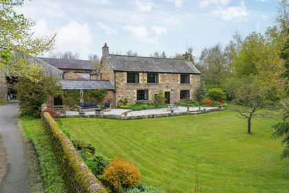
- Price
- Offers Over£985,000
- Size
- 10 acres
Middleton, Morpeth, NE61, Wallington Demesne, Northumberland NE61 England
Added on 10/05/2026Country Home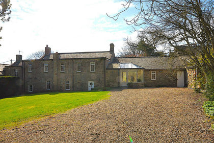
- Price
- £750,000
- Size
- 1 acres
Carr House Great Bavington, Newcastle Upon Tyne NE19, Bavington, Northumberland NE19 England
Added on 28/04/2026Country Home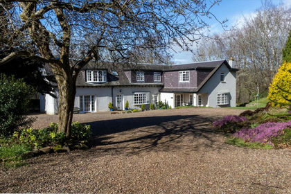
- Price
- Offers in Region of£699,000
- Size
- 5.5 acres
Added on 07/03/2026Estate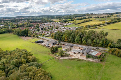
- Price
- Guide Price£1,100,000
- Size
- 46.58 acres
Hollin Hill Farm, Rowlands Gill, Blaydon and Consett, Gateshead NE39 England
Added on 29/01/2026Equestrian property