South Farm, Slaley, Hexham, Northumberland, NE47
Key Features
- Exciting development opportunity
- Full planning permission for five residential dwellings
- Popular village location
- Adjoining paddocks available by separate negotiation
Description
South Farm presents a rare opportunity to create an exceptional collection of five sustainable farmstead conversions in the heart of the highly sought-after village of Slaley, near Hexham. Positioned on the southern edge of the village, the development enjoys breathtaking panoramic views across the valley towards Slaley Forest, combining rural tranquillity with the convenience of village living.
South Farm offers the perfect balance of accessibility and privacy, ideally located within walking distance of the village shop, primary school, local public house and community hall.
Set back from the main road, the development benefits from an enhanced sense of exclusivity and prestige while retaining its traditional agricultural character.
The scheme is accessed via two separate entrances. The existing farm access will provide a shared driveway for 'Dutch Barn' and the The Granary, an impressive Grade II lited building which adjoins South Farm Farmhouse. A new secondary access to the east of the existing entrance will serve Field Barn, East View Barn and West View Barn. Depending on the method of sale, a right of way may be retained over part of this access to facilitate access to the adjoining paddocks, as identified by the brown hatched area on the sale plan.
FIELD BARN
(PLANNING REFERENCE 26/00851/FUL)
Field Barn has planning permission to create an outstanding detached three-bedroom residence. Beautifully positioned to the rear of the steading, it commands uninterrupted panoraminc views across the valley from east to west. The thoughtfully designed conversion provides spacious split-level accommodation arranged over two floors, maximising both the barn’s unique character and its spectacular setting. Wraparound gardens, a double garage and a private driveway extending from the steading further enhance the property’s appeal.
EAST VIEW BARN AND WEST VIEW BARN (PLANNING REFERENCE 25/03860/FUL)
East View and West View will be created from the existing steel portal-framed agricultural buildings, resulting in two generously proportioned, linked-detached four-bedroom homes. The contemporary layouts have been carefully designed to make the most of the exceptional countryside views, with principal living spaces and gardens positioned to enjoy the stunning south-facing aspect. These impressive homes offer spacious family accommodation while embracing the character and setting of the original farmstead.
DUTCH BARN
(PLANNING REFERENCE 25/02854/FUL)
Situated on the western side of the steading, Dutch Barn incorporates both the traditional Dutch barn structure and adjoining stone byre. Accessed via the original shared driveway with The Granary, the conversion will create a striking detached three-bedroom home with attractive south and west-facing gardens. The design preserves the agricultural heritage of the buildings while delivering a distinctive and contemporary countryside home in an exceptional setting.
THE GRANARY
(PLANNING REFERENCE 25/01128/FUL)
Standing proudly at the head of the steading, The Granary is Grade II listed and forms one of the development’s most distinctive buildings. Planning permission has been granted for its conversion into an elegant three-bedroom semi-detached residence. Featuring a handsome sandstone façade and traditional stone roof, The Granary will offer an outstanding blend of historic character and modern living. The gardens are predominantly located to the front of the property, extending alongside the shared driveway to create an attractive and welcoming outdoor space.
South Farm offers an exceptional opportunity to acquire and develop a collection of unique homes in one of Northumberland’s most desirable villages. Combining outstanding architecture, heritage buildings and spectacular countryside views, the development promises a rare blend of rural charm, sustainability and contemporary living.
Additional paddocks are available by separate negotiation.
South Farm enjoys an enviable position within the picturesque village of Slaley. Within easy walking distance are the village shop, highly regarded primary school, community hall, parish church and a selection of traditional public houses. Nearby, Slaley Hall Hotel, Golf & Spa Resort offers championship golf courses, luxurious spa facilities and excellent dining.
The historic market town of Hexham lies approximately 8 miles away and provides an extensive range of shopping, leisure and professional services, together with highly regarded schools and a railway station offering regular services to Newcastle upon Tyne and Carlisle. The A69 provides excellent road links across the region, with Newcastle city centre and Newcastle International Airport both readily accessible.
PLANNING PERMISSION
Documents are available to view via Northumberland County Council planning portal. Reference numbers: 25/02854/FUL 26/00851/FUL 25/01128/FUL 25/03860/FUL
SERVICES
Electricity, water, and drainage connections are understood to be available in the vicinity of the site. Prospective purchasers should satisfy themselves as to the availability, location, capacity and suitability of all services and the cost of any necessary connections.
VIEWINGS
Viewing is strictly by appointment. Arrangements can be made by contacting YoungsRPS, Hexham.
REFERRALS
In accordance with the Estate Agents’ (Provision of Information) Regulations 1991 and the Consumer Protection from Unfair Trading Regulations 2008, we are obliged to inform you that this Company may offer the following services to sellers and purchasers from which we may earn a related referral fee from on completion, in particular the referral of: Mortgages and related products our commission from a broker would be £100.00 incl VAT for Mortgages and £50 inc VAT for Insurances, however this amount can be proportionally clawed back by the lender should the mortgage and/or related product(s) be cancelled early.
WAYLEAVES, EASEMENTS AND RIGHTS OF WAY
The property is being sold subject to all existing wayleaves, easements and rights of way, whether or not specified within the sales particulars. Note 1: The foot path shown on the site plan, has already been redirected to travel down the eastern boundary of the southern field. It will then head up the new eastern driveway to the road. Note 2: Depending on the sale of the additional paddocks, a right of way may be retained over part of this access, as identified by the brown hatched area on the sale plan Note 3: Southview will retain a full right of access over the area hatched in blue.
Map Location
Property details
- Tenure
- Freehold
- Council Tax Band
- TBC
- Date Posted
- 2026-08-05
Utilities & Restrictions
Utilities
- Electricity
- Ask Agent
- Water
- Ask Agent
- Heating
- Ask Agent
- Broadband
- Ask Agent
- Sewerage
- Ask Agent
Rights & Restrictions
- Public Rights of Way
- Ask Agent
- Private Rights of Way
- Ask Agent
- Listed Property
- Ask Agent
- Restrictions
- Ask Agent
Listed status, conservation areas and planning constraints for this location are in the full report.
Property Features
- Accessibility
- Ask Agent
- Parking
- Parking Available
- Garden
- Garden
Beyond the particulars: planning activity, flood history, heritage and ground risks, checked for this exact spot.
Connectivity
Broadband
Fastest speed available at this postcode
1.8 Gbps
Superfast
Suitable for
- 4K streaming on every screen
- Full-time home working
- Online gaming & big downloads
Mobile signal
Predicted 4G and 5G signal; indoor signal depends on building materials.
Ofcom Connected Nations postcode-level predictions. Speeds and signal are modelled, not measured, and vary between addresses and providers.
Signal is the easy part. Planning activity, flood history and protected designations here are in the full report.
Nearest Schools
Primary
- Slaley First School252 metresNo Ofsted rating
- Ages
- 3 to 9
- Pupils
- 40
- Type
- Community school
- Whitley Chapel Church of England First School3.2 milesOfsted: Good *
- Ages
- 3 to 9
- Pupils
- 28
- Type
- Voluntary aided school
- Faith
- Church of England
- Broomhaugh (VA) Church of England First School3.3 milesOfsted: Good
- Ages
- 5 to 9
- Pupils
- 64
- Type
- Voluntary aided school
- Faith
- Church of England
- Hexham First School4.3 milesNo Ofsted rating
- Ages
- 3 to 9
- Pupils
- 68
- Type
- Community school
- Corbridge (VA) Church of England First School4.5 milesOfsted: Good
- Ages
- 3 to 9
- Pupils
- 143
- Type
- Voluntary aided school
- Faith
- Church of England
Secondary
- Corbridge Middle School4.5 milesOfsted report card · Feb 2026
- Ages
- 9 to 13
- Pupils
- 367
- Type
- Community school
- Hexham Middle School4.6 milesNo Ofsted rating
- Ages
- 9 to 13
- Pupils
- 619
- Type
- Academy converter
- St Joseph's Catholic Middle School, Hexham5 milesNo Ofsted rating
- Ages
- 9 to 13
- Pupils
- 168
- Type
- Academy converter
- Faith
- Roman Catholic
- Queen Elizabeth High School5.1 milesOfsted: Good
- Ages
- 13 to 18
- Pupils
- 1,299
- Type
- Academy converter
- Ovingham Middle School7.3 milesNo Ofsted rating
- Ages
- 9 to 13
- Pupils
- 344
- Type
- Academy converter
* Latest graded judgement covers quality of education only; no overall grade was issued under the 2024-25 inspection framework.
Distances are straight-line from the advertised location. Source: the national school registers (DfE, Welsh Government, Scottish Government) and Ofsted.
Schools are just the start: sold prices nearby, planning activity and any flood history are in the full report.
Amenities
Supermarket
GP surgery
Pharmacy
Hospital
Straight-line distances from the advertised location. Sources: NHS records, Geolytix supermarket locations, OS Open Greenspace and the national trails registers.
The area stacks up? Now check the location itself: planning nearby, protected designations and past flooding.
Getting Around
Nearest station
Nearest bus stop
Typical drive times
Straight-line distances from the advertised location; drive times are typical free-flow times over OpenStreetMap road data, so allow more at peak. Public transport locations from DfT NaPTAN.
Easy to reach matters. So do planning activity, flood history and ground risks: all in the full report.
Flood Risk
Environment Agency open data, checked around the advertised map pin for the listed acreage. Long-term risk counts flood defences; the planning map's flood zones do not. Provided by LandSale, not the listing agent, and not part of the agent's particulars. Risk varies across a holding, so verify before committing.
Rivers and the sea
Planning map: Flood Zone 1.
Surface water
Not at the pin: mapped about 10 metres away.
These bandings are the summary. Where this location sits on the flood maps, plus planning activity, heritage and ground risks, is in the full report.
Important notice: Information, maps and tags on this page are drawn from the advertising agent's marketing materials or generated automatically. LandSale has not verified them. Relying on these details is at your own risk, always carry out independent checks before committing to a purchase.
LandSale full disclaimer
Marketing information only - not formal particulars. The details on this website are provided for general guidance and do not constitute an offer or contract. Neither LandSale nor the advertising estate/land agent accepts responsibility for any inaccuracy.
1. Source of information
- Listing content: Core description, asking price, tenure, measurements, photographs and planning history originate from the marketing materials of the advertising estate or land agent. LandSale does not author this content and cannot guarantee its accuracy.
- Automated tags & categorisation: Property type, land-use class, acreage bands and similar labels may be applied by machine-learning models. They are intended as a helpful guide only and may not reflect the property's legal status or permitted use.
- Third-party & enriched data layers: Maps, boundary outlines, planning designations, soil reports, broadband coverage and other environmental or location-based insights are licensed from external suppliers. Such data are supplied “as is", may be incomplete or out of date and are subject to change without notice.
2. Verification required
Prospective purchasers must verify critical matters, including but not limited to planning permission, title boundaries, public rights of way, environmental constraints, acreage, services, access and VAT status, through their own inspections, specialist surveys, legal advisers and the selling agent before relying on the information or entering into any contract.
3. No warranty or liability
LandSale gives no warranty, express or implied, as to the accuracy, completeness or fitness for any particular purpose of the information displayed. LandSale shall not be liable for any loss, damage, cost or expense arising directly or indirectly from any use of or reliance on such information, save where liability may not be excluded by law.
4. Updates & feedback
If you believe any detail on this listing is inaccurate, please let us know. We will investigate and, where appropriate, update the listing or notify the agent.
© LandSale | Version 1.3 - August 2026
Listing agent
youngsRPS, Hexham
Priestpopple Hexham NE46 1PS
Similar properties for sale
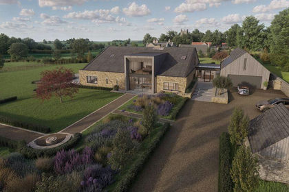
- Price
- Offers Over£850,000
- Size
- 11 acres
East Barns, Newton, Stocksfield, Northumberland, Bywell, Northumberland NE43 England
Added on 03/06/2026Development Land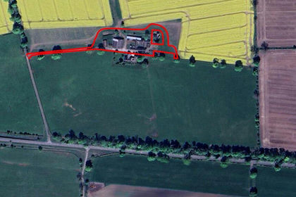
- Price
- From£900,000
South Clarewood Barns, Corbridge, Northumberland, NE45, Whittington, Northumberland NE45 England
Added on 11/03/2026Development Land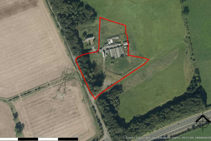
- Price
- Offers in Region of£800,000
- Size
- 4.17 acres
Added on 17/07/2026Development Land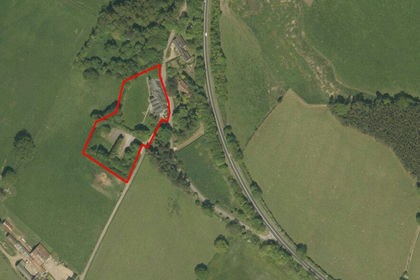
- Price
- Guide Price£750,000
- Size
- 1.8 acres
Land At Helme Park Hotel, Tow Law, Bishop Auckland, DL13, Wolsingham, County Durham DL13 England
Added on 29/01/2026Redevelopment Land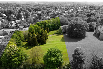
- Price
- Guide Price£700,000
Plot 2, Fernhill, Crossgate Moor, Durham, DH1, Durham, County Durham DH1 England
Added on 07/09/2026Building Plot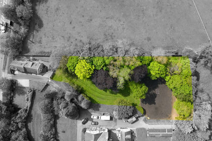
- Price
- Guide Price£700,000
Plot 1, Fernhill, Crossgate Moor, Durham, DH1, Durham, County Durham DH1 England
Added on 07/09/2026Self Build Plot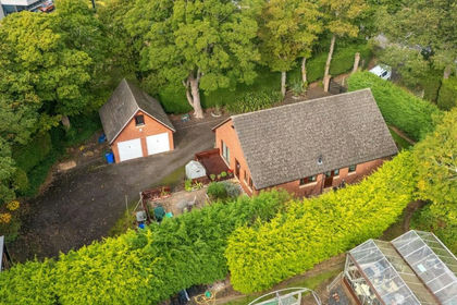
- Price
- Guide Price£685,000
- Size
- 0.97 acres
Land At Orchard Garden, Cramlington, NE23, Cramlington, Northumberland NE23 England
Added on 29/01/2026Development Land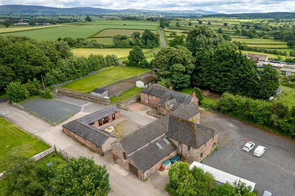
- Price
- £750,000
- Size
- 0.5 acres
Orchard Cottage, Wetheral Shields, Wetheral, Carlisle, CA4, Wetheral, Cumberland CA4 England
Added on 04/07/2026Development Land
- Price
- POA
- Size
- 1.73 acres
Added on 29/01/2026Development Land
- Price
- Guide Price£999,999
- Size
- 8.9 acres
Building Plot, Woodlands House, Close Beck, Wynyard, TS22, Wynyard, Hartlepool TS22 England
Added on 29/01/2026Building Plot