Waterfall Farm, Thurleigh on approx 10 acres.
- Land size
- 10 acres
- Bedrooms
- 4
- Bathrooms
- 2
Key Features
- Direct access to the bridleway network without joining the road
- Seven stables and tack room, with a 40m x 20m manège on a drained sand and rubber surface and drive-in, drive-out access
- Approximately ten acres: five paddocks and a separate four-acre field, all served by water and electricity
- Grade II listed farmhouse of 1,972 sq ft, with origins dating to approximately 1630 and a Georgian frontage of approximately 1830
- Four bedrooms with en suite shower room to the principal bedroom, plus a study
- 3,571 sq ft of outbuildings including a refurbished 36 ft barn, 32 ft workshop and detached home o ce
- Electric gated entrance with CCTV and hardstanding parking for well over twenty vehicles
Description
Waterfall Farm has been in the same family for twenty-three years. In that time the land has been divided into five paddocks and a four-acre field, the manège laid, the barn refurbished, and three separate gardens made and remade. What comes to the market is not a property with equestrian potential. It is a working yard that has already been finished, by people who used it daily. The house has origins dating to approximately 1630, with a Georgian frontage added around 1830, and extends to 1,972 sqft. Around it sit 3,571 sq ft of outbuildings, taking the total to 5,543 sq ft, across approximately ten acres with seven stables and a 40m x 20m manège. The feature that will decide it for the right buyer is simpler than any of those. There is direct access to the bridleway network without ever joining the road. Miles of North Bedfordshire countryside open up straight from the yard.
Ground Floor
The 1830 frontage holds two well-proportioned reception rooms, each a generous 13'2 square, both with sash windows overlooking the stables. The sitting room has a wood burner. The dining room, alongside it, is arranged for more formal entertaining. At the centre of the house is the kitchen and breakfast room, extending to over 17 ft, with room for casual dining alongside everyday cooking. Original beams, period windows and an AGA nook carry the age of the building without apology. A door leads directly out to the patio and garden, with a separate utility room o the inner hall. Beyond sits a snug, well suited to reading or quiet evenings, and then the garden room, a bright space with French doors onto the grounds. Skylights and exposed beams tie it back to the older fabric of the house. A ground floor WC completes this level.
First Floor
Stairs rise from the inner hall to a landing serving four bedrooms, a family bathroom and a study. The principal bedroom is a double with an en suite shower room, fitted with a rainfall head. Bedroom two, at 15 ft, is the largest room in the house, with original boards and views over the stables. Both sit within the Georgian front. Bedrooms three and four occupy the oldest part of the house, with exposed beams and garden outlooks. The two rooms interconnect, with bedroom four reached through bedroom three, an arrangement that suits a nursery beside a parent's room,a children's pair, or a bedroom with a playroom or dressing room alongside it. Bedroom three is a comfortable double at over 14 ft. A small study o the landing serves well as a dressing room or a quiet desk, with the detached o ce in the yard handling anything more substantial. The family bathroom serves the remaining rooms.
Outbuildings
At 3,571 sq ft, the outbuildings are the reason a certain kind of buyer will travel to see this. The stable yard provides seven stables and a dedicated tack room, arranged in an L around the yard for practical daily use, with a separate store on the yard for feed and equipment close to hand. A 32 ft workshop o ers secure undercover parking, workshop use or substantial storage, with further rooms attached. A detached o ce sits apart from the house, giving genuine separation between work and family life. The timber-clad barn, refurbished in 2008, extends to nearly 36 ft by almost 17 ft. It is the most adaptable building on the site: hay and machinery storage, winter shelter, or a workshop of real scale. A summer house, a field shelter, and a well-appointed garden store with its own electricity and water supply complete the range.
Land and Outdoor Living
Approximately ten acres surround the house, comprising five paddocks and a separate four-acre field. Every one is served by water and electricity, which removes the daily labour that defines most yards of this size and makes year-round rotation straightforward. The 40m x 20m manège has a drained sand and rubber surface and a drive-in, drive- out entrance, so a lorry or trailer can be brought in and turned without reversing. A field shelter serves the land beyond. Three separate gardens have been created and improved over the years, each holding sun for most of the day and each o ering a di erent place to sit. Established borders, mature fruit trees and climbing roses soften the front of the house. An electric gate opens onto extensive gravelled hardstanding with parking for well over twenty vehicles. CCTV covers the yard and approach.
Location
Thurleigh is a working village surrounded by open North Bedfordshire countryside, with a social club at its centre and a network of footpaths and bridleways running through the fields around it. Sharnbrook, five minutes by car, covers everyday needs: Co-op, post o ce, pharmacy and doctors' surgery, with The Swan with Two Nicks, The Mill and The Fordham Arms for eating out, Sharnbrook Deli Café during the day, and The Spice Tree for Indian. Families have catchment access to Thurleigh Lower School and Sharnbrook Academy, with Bedford School and Bedford Modern School within comfortable reach. Bedford station runs direct mainline services to London St Pancras. Bedford, Riseley and Rushden Lakes are all inside thirty minutes.
Disclaimer
All descriptions, images and marketing materials are for general guidance only and highlight the lifestyle and features a property may offer. They do not form part of any contract or warranty. Whilst every effort is made to ensure accuracy, neither James Kendall & Co. nor the seller accepts responsibility for any errors. Buyers should verify all details through their own inspections, searches and legal advisers before proceeding.
We are legally required to conduct anti-money laundering checks on all buyers and sellers. These checks are carried out by Lifetime Legal, who will contact you once you've instructed us to sell or had an offer accepted. The cost is £65 (incl. VAT), covering all data retrieval and monitoring required. This non-refundable fee must be paid directly to Lifetime Legal before we publish your property (vendors) or issue a memorandum of sale (buyers). We receive part of this fee for facilitating the service.
Map Location
Property details
- Tenure
- Freehold
- Council Tax Band
- G
- Date Posted
- 2026-08-08
Market Value Analysis
Compared with 11 Equestrian listings in East Anglia (10+ acres).
Utilities & Restrictions
Utilities
- Electricity
- Mains
- Water
- Mains
- Heating
- Oil Heating, Gas Central Heating
- Broadband
- Standard Copper (ADSL)
- Sewerage
- Septic Tank / Private
Rights & Restrictions
- Public Rights of Way
- Ask Agent
- Private Rights of Way
- Ask Agent
- Listed Property
- Yes
- Restrictions
- Ask Agent
Listed status, conservation areas and planning constraints for this location are in the full report.
Property Features
- Accessibility
- Ask Agent
- Parking
- Parking Available
- Garden
- Garden
Beyond the particulars: planning activity, flood history, heritage and ground risks, checked for this exact spot.
Connectivity
Broadband
Fastest speed available at this postcode
80 Mbps
Superfast
Suitable for
- HD streaming
- Video calls
- Web & social
Mobile signal
Predicted 4G and 5G signal; indoor signal depends on building materials.
Ofcom Connected Nations postcode-level predictions. Speeds and signal are modelled, not measured, and vary between addresses and providers.
Signal is the easy part. Planning activity, flood history and protected designations here are in the full report.
Nearest Schools
Primary
- Thurleigh Primary School1 mileOfsted: Good
- Ages
- 3 to 11
- Pupils
- 92
- Type
- Foundation school
- Milton Ernest CofE Primary School2 milesNo Ofsted rating
- Ages
- 4 to 11
- Pupils
- 67
- Type
- Voluntary controlled school
- Faith
- Church of England
- Ravensden CofE Primary Academy2.4 milesOfsted: Good
- Ages
- 2 to 11
- Pupils
- 51
- Type
- Academy sponsor led
- Faith
- Church of England
- Ursula Taylor Church of England School3 milesOfsted: Outstanding *
- Ages
- 4 to 11
- Pupils
- 350
- Type
- Academy converter
- Faith
- Church of England
- Scott Primary School & Nursery3.1 milesNo Ofsted rating
- Ages
- 3 to 11
- Pupils
- 469
- Type
- Community school
Secondary
- St Thomas More Catholic School2.7 milesOfsted: Good
- Ages
- 11 to 18
- Pupils
- 893
- Type
- Academy converter
- Faith
- Roman Catholic
- Mark Rutherford School3.2 milesOfsted report card · Nov 2025
- Ages
- 11 to 18
- Pupils
- 1,150
- Type
- Academy converter
- Lincroft Academy3.2 milesOfsted: Good *
- Ages
- 11 to 16
- Pupils
- 923
- Type
- Academy converter
- Castle Newnham School3.9 milesNo Ofsted rating
- Ages
- 11 to 16
- Pupils
- 744
- Type
- Academy converter
- Goldington Academy4 milesOfsted report card · May 2026
- Ages
- 11 to 16
- Pupils
- 958
- Type
- Academy converter
* Latest graded judgement covers quality of education only; no overall grade was issued under the 2024-25 inspection framework.
Distances are straight-line from the advertised location. Source: the national school registers (DfE, Welsh Government, Scottish Government) and Ofsted.
Schools are just the start: sold prices nearby, planning activity and any flood history are in the full report.
Amenities
Supermarket
GP surgery
Pharmacy
Hospital
Straight-line distances from the advertised location. Sources: NHS records, Geolytix supermarket locations, OS Open Greenspace and the national trails registers.
The area stacks up? Now check the location itself: planning nearby, protected designations and past flooding.
Getting Around
Nearest station
Nearest bus stop
Typical drive times
Straight-line distances from the advertised location; drive times are typical free-flow times over OpenStreetMap road data, so allow more at peak. Public transport locations from DfT NaPTAN.
Easy to reach matters. So do planning activity, flood history and ground risks: all in the full report.
Flood Risk
Environment Agency open data, checked around the advertised map pin for the listed acreage. Long-term risk counts flood defences; the planning map's flood zones do not. Provided by LandSale, not the listing agent, and not part of the agent's particulars. Risk varies across a holding, so verify before committing.
Rivers and the sea
Planning map: Flood Zone 1.
Surface water
Not at the pin: mapped about 10 metres away.
These bandings are the summary. Where this location sits on the flood maps, plus planning activity, heritage and ground risks, is in the full report.
Important notice: Information, maps and tags on this page are drawn from the advertising agent's marketing materials or generated automatically. LandSale has not verified them. Relying on these details is at your own risk, always carry out independent checks before committing to a purchase.
LandSale full disclaimer
Marketing information only - not formal particulars. The details on this website are provided for general guidance and do not constitute an offer or contract. Neither LandSale nor the advertising estate/land agent accepts responsibility for any inaccuracy.
1. Source of information
- Listing content: Core description, asking price, tenure, measurements, photographs and planning history originate from the marketing materials of the advertising estate or land agent. LandSale does not author this content and cannot guarantee its accuracy.
- Automated tags & categorisation: Property type, land-use class, acreage bands and similar labels may be applied by machine-learning models. They are intended as a helpful guide only and may not reflect the property's legal status or permitted use.
- Third-party & enriched data layers: Maps, boundary outlines, planning designations, soil reports, broadband coverage and other environmental or location-based insights are licensed from external suppliers. Such data are supplied “as is", may be incomplete or out of date and are subject to change without notice.
2. Verification required
Prospective purchasers must verify critical matters, including but not limited to planning permission, title boundaries, public rights of way, environmental constraints, acreage, services, access and VAT status, through their own inspections, specialist surveys, legal advisers and the selling agent before relying on the information or entering into any contract.
3. No warranty or liability
LandSale gives no warranty, express or implied, as to the accuracy, completeness or fitness for any particular purpose of the information displayed. LandSale shall not be liable for any loss, damage, cost or expense arising directly or indirectly from any use of or reliance on such information, save where liability may not be excluded by law.
4. Updates & feedback
If you believe any detail on this listing is inaccurate, please let us know. We will investigate and, where appropriate, update the listing or notify the agent.
© LandSale | Version 1.3 - August 2026
Listing agent
James Kendall, Bedford
1A Garricks Court Gold Furlong Marston Moretaine MK43 0XR
Contact James Kendall, Bedford
1A Garricks Court Gold Furlong Marston Moretaine MK43 0XR
View agent profileSimilar properties for sale
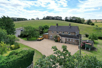
- Price
- Guide Price£1,650,000
- Size
- 73.55 acres
Little Catworth, Huntingdon, Cambridgeshire, PE28, Catworth, Cambridgeshire PE28 England
Added on 01/07/2026Farmhouse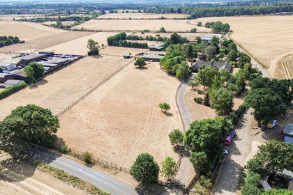
- Price
- Guide Price£1,500,000
- Size
- 6.35 acres
Mill Lane, Everton, SG19, Potton, Central Bedfordshire SG19 England
Added on 02/09/2026House with Land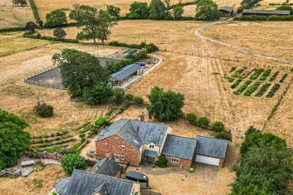
- Price
- £1,250,000
- Size
- 5 acres
Norlinton Close, Orlingbury, Northamptonshire, NN14, Orlingbury, North Northamptonshire NN14 England
Added on 07/09/2026Equestrian property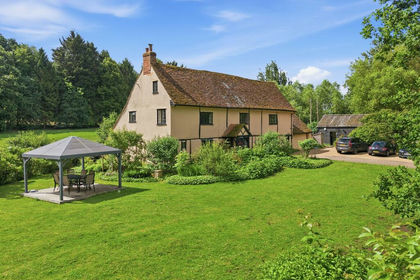
- Price
- Guide Price£1,250,000
- Size
- 5.4 acres
Bedford Road, Holwell Bury, SG5, Stondon, Central Bedfordshire SG5 England
Added on 22/06/2026House with Land
- Price
- Guide Price£1,425,000
- Size
- 9.8 acres
Thicket Road, Houghton, Huntingdon, PE28, Huntingdon, Cambridgeshire PE28 England
Added on 25/04/2026House with Land
- Price
- £1,750,000
- Size
- 10.5 acres
Church Lane, Weston, Hitchin, Hertfordshire, SG4, Weston, Hertfordshire SG4 England
Added on 05/08/2026House with Land
- Price
- £1,800,000
- Size
- 33.11 acres
Added on 01/04/2026Development Land
- Price
- £1,400,000
- Size
- 10 acres
Soulbury Road, Stewkley, Buckinghamshire, Stewkley, Buckinghamshire LU7 England
Added on 18/09/2026House with Land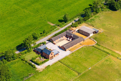
- Price
- Guide Price£1,850,000
- Size
- 15 acres
Dean Road, Stewkley, Leighton Buzzard, Buckinghamshire, LU7, Stewkley, Buckinghamshire LU7 England
Added on 29/01/2026Equestrian property
- Price
- £1,700,000
- Size
- 21 acres
Leckhampstead, Buckingham, Buckinghamshire, MK18, Leckhampstead, Buckinghamshire MK18 England
Added on 15/08/2026Equestrian property