Meadowfield Stables, Marsh Green, Telford
- Land size
- 6.21 acres
Key Features
- 3 stable blocks (10 stables in total)
- 40m X 20m outdoor arena with lighting
- Chalet with livery use
- Open barns
- Dog Kennels
- Two field shelters
- Hard standing area 4.90m x 1.60m
- In all about 6.21 acre
Description
A SUPERBLY LOCATED EQUESTRIAN PREMISES, WITH STABLING, ARENA AND DEVELOPMENT POTENTIAL SET AMONGST 6.21 ACRES OF LAND
Description - Meadowfield Stables is a purpose-built equestrian property, currently operating as a successful and well-established livery yard. Offering an excellent range of facilities, the property is ideally suited to professional equestrian enterprises, private competition yards or those seeking a high-quality home for their own horses.
At the heart of the yard is a floodlit 40m x 20m all-weather arena, finished with a silica sand and rubber surface to provide excellent all year round riding conditions. The secure yard is enclosed by a combination of mature hedging and stock fencing, creating a private and well-protected environment.
The grazing land has been thoughtfully arranged with a central track system and paddocks positioned on either side, each benefiting from independent water supplies. The paddocks are currently subdivided using electric fencing, allowing for flexible grazing management and rotational pasture use.
Additional facilities include a heated non-residential chalet with power and water connected, offering a useful business space to aid with the day-to-day running of the yard. A substantial hardstanding area, previously used for dog kennels, also benefits from electricity and water, presenting potential for a variety of alternative uses (subject to any necessary consents).
Further improvements include a summer house, a range of additional storage sheds providing ample space for equipment and machinery, together with a shipping container that has been fitted out as an office and tack room.
Overall, Meadowfield Stables offers a comprehensive and well-planned equestrian facility, combining practical infrastructure with excellent grazing and riding amenities to create an outstanding opportunity for commercial, training or private equestrian use.
Location - Equestrian enthusiasts are particularly well catered for, with numerous riding routes, and competition venues including (Kingswood, Rodbaston and Radfords) throughout the surrounding countryside. The rural nature of the area provides excellent hacking opportunities, whilst several established equestrian centres and riding facilities can be found within easy driving distance of the property, reinforcing Shropshire's reputation as one of the country's most desirable counties for horse owners and country lifestyle buyers.
Meadowfield Stables enjoys an accessible rural location with excellent rail links nearby. Wellington railway station is approximately 3 miles away (around a 10-minute drive) and provides regular direct services to Shrewsbury, Telford Central, Wolverhampton and Birmingham New Street, together with onward connections to destinations across the UK. Shrewsbury railway station, approximately 8 miles away, is a major regional rail hub offering direct services to Birmingham, Cardiff, Manchester, Chester and the Welsh coast, making the property well placed for both commuting and longer-distance travel while retaining the tranquillity of its countryside setting.
Meadowfield Stables combines a delightful countryside setting with excellent transport links, quality schooling, leisure facilities and access to some of Shropshire's finest attractions.
Approx Distances In Miles: - Shrewsbury 10.5m | Telford 8.4m | M54 Junction 7 16.6m | Wolvehampton 28m | Birmingham 42.8m | Manchester 71 m
Directions - Postcode: TF6 6NE
What3words: paddocks.miss.scars
Leave Shrewsbury on the B5062, following signs for Roden and High Ercall.
Continue on the B5062 through Roden, staying on this road towards High Ercall.
At the junction with the B5063, turn right towards Longdon-upon-Tern / Allscott.
After approximately 1 mile, turn left onto The Avenue (signposted towards Rodington).
Continue along The Avenue for about ¾ mile.
Meadow Field Stables is located on the left-hand side. If you're using the postcode TF6 6NE, the entrance is on this lane just before the road bends.
Property Information - TENURE: Freehold
EPC: N/A
SERVICES: Mains electricity, private tank drainage, Bore Hole. The stable block has power.
LOCAL AUTHORITY: Telford and Wrekin
COUNCIL TAX BAND: N/A
Agents Notes - •The aerial shots and plans are for identification only and not to be relied upon
Map Location
Property details
- Tenure
- Freehold
- Council Tax Band
- Ask Agent
- Date Posted
- 2026-08-19
Market Value Analysis
Compared with 39 Equestrian listings in West Midlands (5+ acres).
Utilities & Restrictions
Utilities
- Electricity
- Mains
- Water
- Private Supply
- Heating
- Ask Agent
- Broadband
- Ask Agent
- Sewerage
- Septic Tank / Private
Rights & Restrictions
- Public Rights of Way
- Ask Agent
- Private Rights of Way
- Ask Agent
- Listed Property
- Ask Agent
- Restrictions
- Ask Agent
Listed status, conservation areas and planning constraints for this location are in the full report.
Property Features
- Accessibility
- Ask Agent
- Parking
- Off-Street Parking
- Garden
- Garden
Beyond the particulars: planning activity, flood history, heritage and ground risks, checked for this exact spot.
Connectivity
Broadband
Fastest speed available at this postcode
17 Mbps
Standard (10-30 Mbps)
Suitable for
- Web & social
- Music streaming
- Standard video calls
Fixed wireless access may also be an option here.
Mobile signal
Predicted 4G and 5G signal; indoor signal depends on building materials.
Ofcom Connected Nations postcode-level predictions. Speeds and signal are modelled, not measured, and vary between addresses and providers.
Signal is the easy part. Planning activity, flood history and protected designations here are in the full report.
Nearest Schools
Primary
- Allscott Meads Primary Academy1 mileNo Ofsted rating
- Ages
- 3 to 11
- Pupils
- 104
- Type
- Free schools
- St Peter's Bratton Church of England Academy1.8 milesOfsted: Requires improvement
- Ages
- 5 to 11
- Pupils
- 397
- Type
- Academy converter
- Faith
- Church of England
- High Ercall Primary School2.1 milesNo Ofsted rating
- Ages
- 4 to 11
- Pupils
- 145
- Type
- Foundation school
- Dothill Primary School2.5 milesNo Ofsted rating
- Ages
- 5 to 11
- Pupils
- 342
- Type
- Foundation school
- St Patrick's Catholic Primary School2.7 milesNo Ofsted rating
- Ages
- 3 to 11
- Pupils
- 227
- Type
- Academy converter
- Faith
- Roman Catholic
Secondary
- Charlton School2.9 milesOfsted report card · Apr 2026
- Ages
- 11 to 16
- Pupils
- 1,218
- Type
- Academy sponsor led
- Ercall Wood Academy3.5 milesOfsted: Good *
- Ages
- 11 to 16
- Pupils
- 971
- Type
- Academy converter
- Hadley Learning Community - Secondary Phase4.5 milesNo Ofsted rating
- Ages
- 11 to 16
- Pupils
- 1,237
- Type
- Academy converter
- New Road Academy5.7 milesOfsted: Requires improvement
- Ages
- 11 to 16
- Pupils
- 1,073
- Type
- Academy sponsor led
- Belvidere School5.9 milesOfsted: Requires improvement *
- Ages
- 11 to 16
- Pupils
- 830
- Type
- Academy converter
* Latest graded judgement covers quality of education only; no overall grade was issued under the 2024-25 inspection framework.
Distances are straight-line from the advertised location. Source: the national school registers (DfE, Welsh Government, Scottish Government) and Ofsted.
Schools are just the start: sold prices nearby, planning activity and any flood history are in the full report.
Amenities
Supermarket
GP surgery
Pharmacy
Hospital
Straight-line distances from the advertised location. Sources: NHS records, Geolytix supermarket locations, OS Open Greenspace and the national trails registers.
The area stacks up? Now check the location itself: planning nearby, protected designations and past flooding.
Getting Around
Nearest station
Nearest bus stop
Typical drive times
Straight-line distances from the advertised location; drive times are typical free-flow times over OpenStreetMap road data, so allow more at peak. Public transport locations from DfT NaPTAN.
Easy to reach matters. So do planning activity, flood history and ground risks: all in the full report.
Flood Risk
Environment Agency open data, checked around the advertised map pin for the listed acreage. Long-term risk counts flood defences; the planning map's flood zones do not. The map pin for this listing is approximate, so these readings describe the surrounding area. Provided by LandSale, not the listing agent, and not part of the agent's particulars. Risk varies across a holding, so verify before committing.
Rivers and the sea
Planning map: Flood Zone 1.
Surface water
Not at the pin: mapped about 70 metres away.
These bandings are the summary. Where this location sits on the flood maps, plus planning activity, heritage and ground risks, is in the full report.
Important notice: Information, maps and tags on this page are drawn from the advertising agent's marketing materials or generated automatically. LandSale has not verified them. Relying on these details is at your own risk, always carry out independent checks before committing to a purchase.
LandSale full disclaimer
Marketing information only - not formal particulars. The details on this website are provided for general guidance and do not constitute an offer or contract. Neither LandSale nor the advertising estate/land agent accepts responsibility for any inaccuracy.
1. Source of information
- Listing content: Core description, asking price, tenure, measurements, photographs and planning history originate from the marketing materials of the advertising estate or land agent. LandSale does not author this content and cannot guarantee its accuracy.
- Automated tags & categorisation: Property type, land-use class, acreage bands and similar labels may be applied by machine-learning models. They are intended as a helpful guide only and may not reflect the property's legal status or permitted use.
- Third-party & enriched data layers: Maps, boundary outlines, planning designations, soil reports, broadband coverage and other environmental or location-based insights are licensed from external suppliers. Such data are supplied “as is", may be incomplete or out of date and are subject to change without notice.
2. Verification required
Prospective purchasers must verify critical matters, including but not limited to planning permission, title boundaries, public rights of way, environmental constraints, acreage, services, access and VAT status, through their own inspections, specialist surveys, legal advisers and the selling agent before relying on the information or entering into any contract.
3. No warranty or liability
LandSale gives no warranty, express or implied, as to the accuracy, completeness or fitness for any particular purpose of the information displayed. LandSale shall not be liable for any loss, damage, cost or expense arising directly or indirectly from any use of or reliance on such information, save where liability may not be excluded by law.
4. Updates & feedback
If you believe any detail on this listing is inaccurate, please let us know. We will investigate and, where appropriate, update the listing or notify the agent.
© LandSale | Version 1.3 - August 2026
Listing agent
Larch Property, Preston On Severn
Franks Barn, Preston On Severn, Uffington, SY4 4TB
Contact Larch Property, Preston On Severn
Franks Barn, Preston On Severn, Uffington, SY4 4TB
View agent profileSimilar properties for sale
- Price
- £375,000
- Size
- 10.9 acres
Kynnersley Drive, Lilleshall, Newport, Lilleshall, Telford and Wrekin TF10 England
Added on 20/07/2026Vacant Land
- Price
- Offers in Excess of£460,800
- Size
- 38.4 acres
Added on 28/08/2026Arable Land
- Price
- Guide Price£400,000
- Size
- 50 acres
Ditton Priors, Bridgnorth, Shropshire, Ditton Priors, Shropshire WV16 England
Added on 08/08/2026Pasture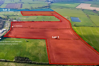
- Price
- Guide Price£400,000
- Size
- 42.7 acres
Ebstree Road, Trysull, Wolverhampton, WV5, Trysull and Seisdon, Staffordshire WV5 England
Added on 04/04/2026Arable Land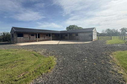
- Price
- Guide Price£495,000
- Size
- 6.5 acres
The Barnyard, Kings Marsh, Churton, Chester, Farndon, Cheshire West and Chester CH3 England
Added on 14/06/2026Equestrian property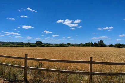
- Price
- Guide Price£350,000
- Size
- 12.85 acres
Land and Building off Woodhouses Lane, Burntwood, Burntwood, Staffordshire WS7 England
Added on 20/08/2026Agricultural Land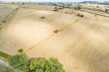
- Price
- Guide Price£350,000
- Size
- 42.4 acres
Glyn Ceiriog, Llangollen, Llansantffraid Glyn Ceiriog, Wrexham LL20 Wales
Added on 21/09/2026Agricultural Land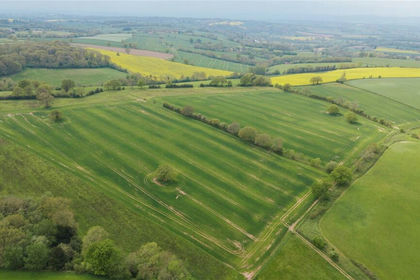
- Price
- £560,000
- Size
- 56.44 acres
Lot 5, Parsonage Farm, Kyre, Tenbury Wells, Worcestershire, Kyre, Worcestershire WR15 England
Added on 16/05/2026Farm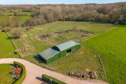
- Price
- Offers in Excess of£450,000
- Size
- 3 acres
Tanwood Lane, Chaddesley Corbett, Kidderminster, Chaddesley Corbett, Worcestershire DY10 England
Added on 11/07/2026Conversion Land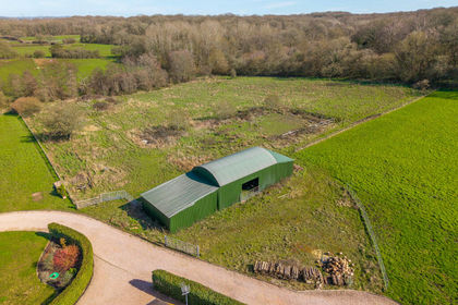
- Price
- Offers in Excess of£450,000
- Size
- 3 acres
Tanwood Lane, Chaddesley Corbett DY10, Chaddesley Corbett, Worcestershire DY10 England
Added on 18/07/2026Conversion Land