The East Wing, Coodham
- Bedrooms
- 4
- Bathrooms
- 4
Key Features
- Occupies a wing of the Grade A listed Coodham mansion, part of an estate with links to the founding of Prestwick Golf Club
- Three bedrooms in the main house, each with its own en-suite, including a master suite with dressing room
- Open plan kitchen, lounge and dining space with a particularly good outlook over the estate lake
- A vast second floor family room, over 29 feet by 26, with its own cloakroom
- Private garden with electric gates and an electric vehicle charging point already fitted
- Separate outbuildings including a garage, a standalone office annexe with shower room, and a stone bar building
Description
Most homes don't come with a claim on the invention of the Open Championship. This one does. The East Wing occupies a wing of the original Coodham mansion, a house whose family produced one of the founding members of Prestwick Golf Club, later served as a religious retreat, then stood derelict before being saved by restoration dividing it into a select number of individual homes. What emerged from that restoration is three full storeys of the original Grade A listed building, given over entirely to one family, with the scale and feel of a grand country house without the upkeep that could be expected from such a home.
Coodham
The house that Margaret Fairlie built here in 1826 was ambitious from the start. Her son, James Ogilvy Fairlie, went on to become a founding member of Prestwick Golf Club and a driving force behind the first Open Championship, so there is a decent claim that modern golf owes something to this address. William Houldsworth later took the house on and expanded it further. The restoration and conversion of the house in more modern times has secured the future for Coodham House and leaves us with the impressive properties we see today.
Ground Floor
Three bedrooms, each with its own en-suite, occupy this level, arranged off a central hallway with the master suite additionally served by a dressing room. The principal bedroom runs to over 22 feet in length. A utility room completes the practical end of the floor, and a private enclosed patio, close to 550 sq ft of it, opens off the accommodation to the side. A further store room sits just beyond the house itself, accessed externally rather than from within.
First Floor
The main living space of the house, and it is a striking one. Kitchen, lounge and dining area run together as a single open plan room stretching to over 22 feet across the kitchen alone, with the dining area continuing the full depth of the house beyond. It is from here, too, that the lake reveals itself, a particularly good outlook over the water that sets the rooms facing this aspect apart.
Second Floor
A single vast family room, over 29 feet by 26, occupies almost the majority of the top floor, served by its own cloakroom. It is the kind of space that resists a single use being suitable for a cinema room, playroom, second sitting room, whatever the household needs it to be at the time.
Outside
The gardens are private, laid over paving, stone chips and composite decking, with a driveway secured behind electric gates. An electric vehicle charging point has already been fitted. The wider grounds surrounding the house are shared with the other Coodham residences and maintained by a factor on behalf of the owners.
Additional Buildings
Beyond the house itself, The East Wing comes with a genuinely useful collection of outbuildings. A single garage with electric door sits alongside a converted office/annexe, complete with its own shower room and French doors onto the garden, equally ideal for anyone working from home or for guests, and standing entirely as its own separate building. A detached stone building, currently fitted out as a bar, and an attached store complete the set and feeling a part of the original estate fabric.
Planning
Coodham House was developed under planning permission granted in the early to mid 2000s, covering the house itself and a wider development across the estate to include a range of new build properties which were not completed at the time. It is understood that a development of eco homes on the wider estate has been discussed. Further information is available from the agent upon request.
Exclusions
It should be noted that a number of items are excluded from the sale but may be available by separate negotiation. Further details are available on request.
Particulars prepared and photography taken August 2026.
Map Location
Property details
- Tenure
- Freehold
- Council Tax Band
- Ask Agent
- Date Posted
- 2026-08-22
Energy Performance Certificate
Energy Efficiency Rating
Based on UK Energy Performance Certificate standards (EU Directive 2002/91/EC)
Running costs are one side. Planning activity, flood history and ground risks for this location are in the full report.
Utilities & Restrictions
Utilities
- Electricity
- Mains
- Water
- Mains
- Heating
- Gas Heating, Double Glazing
- Broadband
- Ask Agent
- Sewerage
- Mains
Rights & Restrictions
- Public Rights of Way
- Ask Agent
- Private Rights of Way
- Ask Agent
- Listed Property
- Ask Agent
- Restrictions
- Ask Agent
Listed status, conservation areas and planning constraints for this location are in the full report.
Property Features
- Accessibility
- Ask Agent
- Parking
- Garage, Driveway
- Garden
- Garden
Beyond the particulars: planning activity, flood history, heritage and ground risks, checked for this exact spot.
Connectivity
Broadband
Fastest speed available at this postcode
1.8 Gbps
Gigabit full fibre · available to 90% of premises
Suitable for
- 4K streaming on every screen
- Full-time home working
- Online gaming & big downloads
Mobile signal
Predicted 4G and 5G signal; indoor signal depends on building materials.
Ofcom Connected Nations postcode-level predictions. Speeds and signal are modelled, not measured, and vary between addresses and providers.
Signal is the easy part. Planning activity, flood history and protected designations here are in the full report.
Nearest Schools
Primary
- Symington Primary School1 mile
- Pupils
- 163
- Type
- Non-denominational
- Dundonald Primary School2.3 miles
- Pupils
- 168
- Type
- Non-denominational
- Shortlees Primary School2.5 miles
- Pupils
- 354
- Type
- Non-denominational
- Gargieston Primary School2.9 miles
- Pupils
- 419
- Type
- Non-denominational
- Whatriggs Primary School3.2 miles
- Pupils
- 481
- Type
- Non-denominational
Secondary
- Grange Academy3.4 miles
- Pupils
- 1,229
- Type
- Non-denominational
- Marr College4 miles
- Pupils
- 1,122
- Type
- Non-denominational
- St Joseph's Academy4.5 miles
- Pupils
- 651
- Type
- Roman Catholic
- Prestwick Academy4.7 miles
- Pupils
- 1,186
- Type
- Non-denominational
- Kilmarnock Academy4.7 miles
- Pupils
- 1,264
- Type
- Non-denominational
Distances are straight-line from the advertised location. Source: the national school registers (DfE, Welsh Government, Scottish Government) and Ofsted.
Schools are just the start: planning activity, heritage and any flood history here are in the full report.
Amenities
Supermarket
GP surgery
Pharmacy
Straight-line distances from the advertised location. Sources: NHS records, Geolytix supermarket locations, OS Open Greenspace and the national trails registers.
The area stacks up? Now check the location itself: planning nearby, protected designations and past flooding.
Getting Around
Nearest station
Nearest bus stop
Typical drive times
Straight-line distances from the advertised location; drive times are typical free-flow times over OpenStreetMap road data, so allow more at peak. Public transport locations from DfT NaPTAN.
Easy to reach matters. So do planning activity, flood history and ground risks: all in the full report.
Flood Risk
SEPA open data, checked around the advertised map pin for the listed acreage. Provided by LandSale, not the listing agent, and not part of the agent's particulars. Risk varies across a holding, so verify before committing.
Rivers and the sea
Surface water
These bandings are the summary. Where this location sits on the flood maps, plus planning activity, heritage and ground risks, is in the full report.
Important notice: Information, maps and tags on this page are drawn from the advertising agent's marketing materials or generated automatically. LandSale has not verified them. Relying on these details is at your own risk, always carry out independent checks before committing to a purchase.
LandSale full disclaimer
Marketing information only - not formal particulars. The details on this website are provided for general guidance and do not constitute an offer or contract. Neither LandSale nor the advertising estate/land agent accepts responsibility for any inaccuracy.
1. Source of information
- Listing content: Core description, asking price, tenure, measurements, photographs and planning history originate from the marketing materials of the advertising estate or land agent. LandSale does not author this content and cannot guarantee its accuracy.
- Automated tags & categorisation: Property type, land-use class, acreage bands and similar labels may be applied by machine-learning models. They are intended as a helpful guide only and may not reflect the property's legal status or permitted use.
- Third-party & enriched data layers: Maps, boundary outlines, planning designations, soil reports, broadband coverage and other environmental or location-based insights are licensed from external suppliers. Such data are supplied “as is", may be incomplete or out of date and are subject to change without notice.
2. Verification required
Prospective purchasers must verify critical matters, including but not limited to planning permission, title boundaries, public rights of way, environmental constraints, acreage, services, access and VAT status, through their own inspections, specialist surveys, legal advisers and the selling agent before relying on the information or entering into any contract.
3. No warranty or liability
LandSale gives no warranty, express or implied, as to the accuracy, completeness or fitness for any particular purpose of the information displayed. LandSale shall not be liable for any loss, damage, cost or expense arising directly or indirectly from any use of or reliance on such information, save where liability may not be excluded by law.
4. Updates & feedback
If you believe any detail on this listing is inaccurate, please let us know. We will investigate and, where appropriate, update the listing or notify the agent.
© LandSale | Version 1.3 - August 2026
Listing agent
Goose & Co Property, Troon
Auchenkyle Lodge, Southwood Road, Troon, KA10 7EL
View agent profileSimilar properties for sale
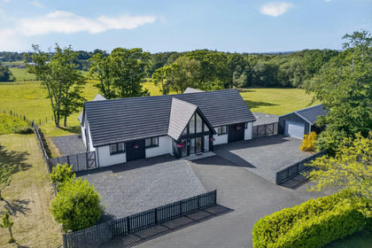
- Price
- Offers Over£595,000
- Size
- 3 acres
Colden Heights, Barquhey Farm, Sundrum, KA6, Ayr, Carrick and Cumnock, South Ayrshire KA6 Scotland
Added on 31/05/2026Country Home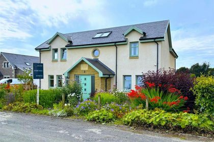
- Price
- Offers Over£599,000
- Size
- 3.2 acres
Added on 11/06/2026House with Land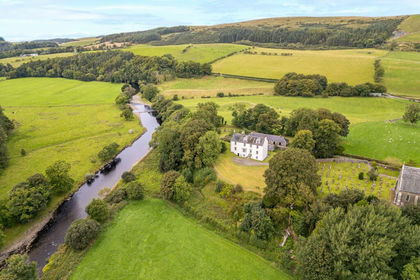
- Price
- Offers Over£685,000
- Size
- 4 acres
Added on 07/09/2026Country Home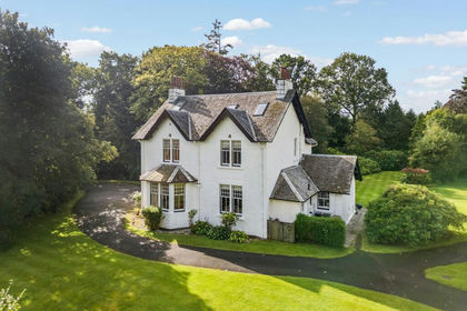
- Price
- Offers Over£875,000
- Size
- 1.32 acres
Tullycross, Croftamie, Glasgow, G63, Stirling and Strathallan, Stirling G63 Scotland
Added on 07/09/2026Country Home