Redmarley, Gloucester, Gloucestershire, GL19
- Land size
- 2 acres
- Bedrooms
- 5
Key Features
- Grade II Listed Substantial Farmhouse
- Traditional 3 Store Mill
- Approximately 2 Acres of Ground
- Idyllic Rural Location
- In Need of Renovation
- No Chain
Description
For sale by public auction on Thursday 22nd October 2026 at 3pm with a guide price of £500,000-£600,000. An extremely rare opportunity to purchase a hidden rural gem project which consists of a Grade II Listed substantial 5 bedroom period house with many original features, in need of renovation. Along with modern and traditional outbuilding including a 3 storey mill with original race and 2 steel framed agricultural barns, all of which are ripe for conversion subject to obtaining the necessary consents. The property sits within approximately 2 acres of ground which backs onto the River Leadon. No chain
ENTRANCE
Part glazed timber entrance door to:
ENTRANCE HALL
Herringbone red tiled floor, stairs off, access to cellar, timber door to rear of property.
SITTING ROOM
Bay window with original shutters, feature fireplace with wood burner inset, timber floorboards, radiator.
DINING ROOM
Bay window with original shutters, open fireplace, built-in cupboards, two radiators.
KITCHEN
Fitted wall and base units incorporating stainless steel sink, oil-fired Rayburn, tiled floor.
PANTRY
Original shelving, built-in meat safe, red tiled floor.
UTILITY ROOM
Belfast sink, oil-fired boiler, space and plumbing for appliances, W.C., hand wash basin, radiator.
STORE
Oil tank, access to water well.
FIRST FLOOR
LANDING
Access to loft.
BEDROOM ONE
Radiator, wooden floorboards.
BEDROOM TWO
Victorian fireplace, radiator, wooden floorboards.
BEDROOM THREE
Radiator, wooden floorboards.
BEDROOM FOUR
Fireplace, radiator, wooden floorboards.
BEDROOM FIVE
Wooden floorboards.
BATHROOM
W.C., hand wash basin, bath, radiator, access to airing cupboard.
OUTSIDE
A vehicular right of way leads to the secluded grounds of the property. A private driveway continues into a courtyard to the rear, where there is access to the former cart shed, together with a two-storey former detached stable block measuring approximately 7.5m x 11m, retaining many original features. Also situated to the end of the building is the former outside W.C. Further outbuildings include: Long Barn 25m x 6.3m, a two-storey stone-built traditional farm building. Four-bay steel framed agricultural barn 18m x 7.8m. Three-storey former mill building with former hop kilns.Multi-level three-bay steel framed barn formerly used for cattle housing and storage, measuring approximately 14m x 13m. The property extends to approximately 2 acres of grounds and adjoins the River Leadon and with a former mill race within its boundary.
RIGHTS OF WAY
There is a footpath through the property and the current owner will retain a right of way for access to the adjoining farmland.
VIEWINGS
Strictly by appointment with the sole agents Pughs. Tel. Out of office hours James Pugh The barns are entered entirely at the viewer's own risk.
SERVICES
We understand from the Vendors that the property benefits from mains water, electric and private drainage.
FOR SALE BY PUBLIC AUCTION
To be offered for sale by public auction, subject to conditions of sale and unless previously sold, At Hazle Meadows Auction Centre, Ross Road, Ledbury, Herefordshire, HR8 2LP on Thursday 22nd October 2026 at 3pm.
ONLINE BIDDING
The auction will be live and online, if you wish to register to bid online please contact the office. All online bidders must be registered by 5pm on Tuesday 20th October 2026.
AUCTION GUIDE PRICE £500,000-£600,000
Please note an Auction Guide Price is an indication by the Agent of the likely sale price and is not the same as a Reserve Price. The Reserve Price is the lowest price at which the vendor will consider a sale and is within or below the Guide Price. Both figures are subject to change.
AUCTION PACK
A link to the auction pack will be made available nearer the date of sale. Any queries of a legal nature, please direct to the vendors solicitor, preferably via your own conveyancer.
VENDOR SOLICITOR
Star Legal 102-103 Church Street Tewkesbury GL20 5ABActing Brendan Lawler brendan.
COUNCIL TAX
Band F (Forest of Dean District Council )
TENURE
We understand from the Vendors that the property is freehold and offered with vacant possession upon completion.
ANTI MONEY LAUNDERING REGULATIONS
To comply with anti money laundering regulations, prospective purchasers will be asked to produce identification documentation at the time of making an offer. We ask for your cooperation in order that there is no delay in agreeing the sale.
Map Location
Property details
- Tenure
- Freehold
- Council Tax Band
- TBC
- Date Posted
- 2026-08-24
Market Value Analysis
Compared with 1,667 Homes with Land listings in South West England (1+ acres).
Utilities & Restrictions
Utilities
- Electricity
- Ask Agent
- Water
- Ask Agent
- Heating
- Ask Agent
- Broadband
- Ask Agent
- Sewerage
- Ask Agent
Rights & Restrictions
- Public Rights of Way
- Ask Agent
- Private Rights of Way
- Ask Agent
- Listed Property
- Ask Agent
- Restrictions
- Ask Agent
Listed status, conservation areas and planning constraints for this location are in the full report.
Property Features
- Accessibility
- Ask Agent
- Parking
- Parking Available
- Garden
- Garden
Beyond the particulars: planning activity, flood history, heritage and ground risks, checked for this exact spot.
Connectivity
Broadband
Fastest speed available at this postcode
1 Mbps
Under 10 Mbps here
Suitable for
- Basic browsing & email
Mobile signal
Predicted 4G and 5G signal; indoor signal depends on building materials.
Ofcom Connected Nations postcode-level predictions. Speeds and signal are modelled, not measured, and vary between addresses and providers.
Signal is the easy part. Planning activity, flood history and protected designations here are in the full report.
Nearest Schools
Primary
- Pauntley Church of England Primary School970 metresOfsted: Good
- Ages
- 4 to 11
- Pupils
- 25
- Type
- Voluntary controlled school
- Faith
- Church of England
- Redmarley Church of England Primary School1.3 milesOfsted: Good
- Ages
- 3 to 11
- Pupils
- 97
- Type
- Academy converter
- Faith
- Church of England
- Ann Cam Church of England Primary School2.5 milesOfsted: Good
- Ages
- 2 to 11
- Pupils
- 126
- Type
- Academy converter
- Faith
- Church of England
- Picklenash Junior School2.6 milesOfsted: Requires improvement *
- Ages
- 7 to 11
- Pupils
- 157
- Type
- Foundation school
- Glebe Infants' School2.6 milesOfsted: Good
- Ages
- 4 to 7
- Pupils
- 132
- Type
- Foundation school
Secondary
- Newent Community School and Sixth Form Centre3 milesNo Ofsted rating
- Ages
- 11 to 18
- Pupils
- 976
- Type
- Academy converter
- John Masefield High School4.7 milesNo Ofsted rating
- Ages
- 11 to 18
- Pupils
- 849
- Type
- Academy converter
- Dene Magna and Sixth Form8.6 milesOfsted: Good *
- Ages
- 11 to 18
- Pupils
- 1,020
- Type
- Academy converter
- John Kyrle High School and Sixth Form Centre Academy8.7 milesOfsted: Good *
- Ages
- 11 to 18
- Pupils
- 1,274
- Type
- Academy converter
- Denmark Road High School9.2 milesOfsted report card · Feb 2026
- Ages
- 11 to 18
- Pupils
- 1,024
- Type
- Academy converter
- Gender
- Girls
* Latest graded judgement covers quality of education only; no overall grade was issued under the 2024-25 inspection framework.
Distances are straight-line from the advertised location. Source: the national school registers (DfE, Welsh Government, Scottish Government) and Ofsted.
Schools are just the start: sold prices nearby, planning activity and any flood history are in the full report.
Amenities
Supermarket
GP surgery
Pharmacy
Hospital
Straight-line distances from the advertised location. Sources: NHS records, Geolytix supermarket locations, OS Open Greenspace and the national trails registers.
The area stacks up? Now check the location itself: planning nearby, protected designations and past flooding.
Getting Around
Nearest station
Nearest bus stop
Typical drive times
Straight-line distances from the advertised location; drive times are typical free-flow times over OpenStreetMap road data, so allow more at peak. Public transport locations from DfT NaPTAN.
Easy to reach matters. So do planning activity, flood history and ground risks: all in the full report.
Flood Risk
Environment Agency open data, checked around the advertised map pin for the listed acreage. Long-term risk counts flood defences; the planning map's flood zones do not. Provided by LandSale, not the listing agent, and not part of the agent's particulars. Risk varies across a holding, so verify before committing.
Rivers and the sea
Planning map: Flood Zone 1.
Surface water
These bandings are the summary. Where this location sits on the flood maps, plus planning activity, heritage and ground risks, is in the full report.
Important notice: Information, maps and tags on this page are drawn from the advertising agent's marketing materials or generated automatically. LandSale has not verified them. Relying on these details is at your own risk, always carry out independent checks before committing to a purchase.
LandSale full disclaimer
Marketing information only - not formal particulars. The details on this website are provided for general guidance and do not constitute an offer or contract. Neither LandSale nor the advertising estate/land agent accepts responsibility for any inaccuracy.
1. Source of information
- Listing content: Core description, asking price, tenure, measurements, photographs and planning history originate from the marketing materials of the advertising estate or land agent. LandSale does not author this content and cannot guarantee its accuracy.
- Automated tags & categorisation: Property type, land-use class, acreage bands and similar labels may be applied by machine-learning models. They are intended as a helpful guide only and may not reflect the property's legal status or permitted use.
- Third-party & enriched data layers: Maps, boundary outlines, planning designations, soil reports, broadband coverage and other environmental or location-based insights are licensed from external suppliers. Such data are supplied “as is", may be incomplete or out of date and are subject to change without notice.
2. Verification required
Prospective purchasers must verify critical matters, including but not limited to planning permission, title boundaries, public rights of way, environmental constraints, acreage, services, access and VAT status, through their own inspections, specialist surveys, legal advisers and the selling agent before relying on the information or entering into any contract.
3. No warranty or liability
LandSale gives no warranty, express or implied, as to the accuracy, completeness or fitness for any particular purpose of the information displayed. LandSale shall not be liable for any loss, damage, cost or expense arising directly or indirectly from any use of or reliance on such information, save where liability may not be excluded by law.
4. Updates & feedback
If you believe any detail on this listing is inaccurate, please let us know. We will investigate and, where appropriate, update the listing or notify the agent.
© LandSale | Version 1.3 - August 2026

Listing agent
Pughs, Ledbury
Hazle Meadows Auction Centre Ross Road Ledbury HR8 2LP
Similar properties for sale
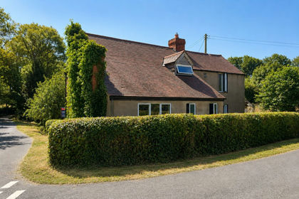
- Price
- £499,995
- Size
- 2.09 acres
Added on 25/05/2026House with Land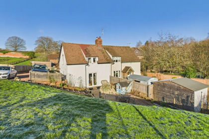
- Price
- £400,000
- Size
- 1 acres
Phocle Green, Ross-on-Wye, HR9, Upton Bishop, Herefordshire, County of HR9 England
Added on 29/01/2026Cottage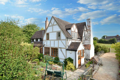
- Price
- £600,000
- Size
- 3.5 acres
Rock Street, Chaceley, Gloucestershire, Chaceley, Gloucestershire GL19 England
Added on 25/05/2026Cottage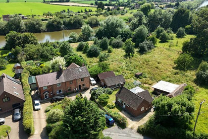
- Price
- £500,000
- Size
- 1.25 acres
Minsterworth, Gloucester, Gloucestershire, GL2, Minsterworth, Gloucestershire GL2 England
Added on 28/06/2026House with Land
- Price
- Guide Price£490,000
- Size
- 21.19 acres
Meend Farm, Turners Tump, Ruardean, GL17, Ruardean, Gloucestershire GL17 England
Added on 26/08/2026Smallholding
- Price
- £585,000
- Size
- 1 acres
The Patches, Ruardean Woodside, Ruardean, GL17, Drybrook, Gloucestershire GL17 England
Added on 25/05/2026House with Land
- Price
- Guide Price£625,000
- Size
- 2 acres
Watery Lane, Yarkhill HR1, Yarkhill, Herefordshire, County of HR1 England
Added on 23/09/2026House with Land
- Price
- £500,000
- Size
- 1.5 acres
Added on 25/08/2026House with Land
- Price
- £585,000
- Size
- 3 acres
Peterstow, Ross-on-Wye, Herefordshire, HR9, Peterstow, Herefordshire, County of HR9 England
Added on 20/08/2026House with Land
- Price
- Offers in Region of£400,000
- Size
- 1.44 acres
Stiffords Bridge, Cradley, Malvern, Cradley and Storridge, Herefordshire, County of WR13 England
Added on 29/01/2026House with Land