Coldridge, Crediton, EX17
- Land size
- 8 acres
- Bedrooms
- 4
- Bathrooms
- 3
Key Features
- Just under eight acres of gardens & land
- Substantial detached barn conversion of approx. 2,300 sqft
- Excellent equestrian or smallholding potential
- Private approach along its own lane
- Large adjoining field with far-reaching rural views
- Four bedrooms including two en-suites
- Two large reception rooms with five-bedroom flexibility
- Recently redecorated
- Gardens, pond & ample private parking
- No onward chain
Description
If you're looking for a substantial home with proper space around you, Fursdon Barn has a lot to offer. Tucked away in the Mid Devon countryside close to Coldridge, the property is approached along its own lane and sits within just under eight acres of gardens and land, with a large field immediately behind the house and some fabulous views across the surrounding countryside. At approximately 2,300 sqft, there's plenty of house to go with the land too, making this an appealing proposition for families, equestrian buyers, those with smallholding ambitions or simply anyone wanting more space and privacy around them. It's a wonderfully rural setting without being buried at the end of miles of narrow lanes, with the B3220 within easy reach and Crediton, Lapford and the surrounding villages all accessible. Recently redecorated throughout and with some new carpets fitted, the house feels fresh and ready for its next owners.
Inside, the barn has the sort of generous, traditional layout that works particularly well for country life. The kitchen sits at the heart of things alongside a good-sized utility room, while two large reception rooms give everyone plenty of space to spread out. For most buyers, we'd imagine keeping both as living spaces, but the layout is flexible enough for one to become a fifth bedroom if needed, perhaps for guests, multi-generational living or anyone wanting ground-floor accommodation. There are four further bedrooms, two with their own en-suite shower rooms, together with the family bathroom. It's an uncomplicated and adaptable layout with plenty of space as family needs change, and the recent redecoration means there's no immediate list of jobs to tackle. Instead, there's scope for a new owner to settle in and gradually put their own stamp on the house and grounds.
Outside is where Fursdon Barn really comes into its own. The gardens immediately around the house provide private space to sit out and enjoy the setting, with a pond adding further interest, while there's ample parking for numerous vehicles. Beyond is the large adjoining field which forms the majority of the holding and takes the overall acreage to just under eight acres. For equestrian buyers in particular, the amount of land provides an excellent starting point, with scope to create a setup to suit individual requirements, subject to any necessary permissions. Equally, it could work for livestock, a smallholding or simply the luxury of having your own piece of Devon countryside. Add in the wide rural views, private approach, approximately 2,300 sqft of accommodation and no onward chain, and Fursdon Barn offers a combination of house, land and potential that's increasingly difficult to find.
Please see the floorplan for room sizes.
Current Council Tax: Band TBC - Mid Devon
Utilities: Mains electric, water, telephone & broadband
Broadband within this postcode: Starlink option / full fibre ready to be connected
Drainage: Private
Heating: Oil fired central heating
Construction: Standard
Listed: No
Conservation Area: No
Tenure: Freehold
Buyers' Compliance Fee Notice: Please note that a compliance check fee of £25 (inc. VAT) per person is payable once your offer is accepted. This non-refundable fee covers essential ID verification and anti-money laundering checks, as required by law.
Agents’ Notes:
Boundaries, Access & Parking:
Boundary positions, access rights and parking arrangements have been provided by the seller, and any land plans shown are for identification purposes only. We have not seen the title deeds or other legal documents, and buyers should confirm exact details and ownership responsibilities with their conveyancer.
Broadband & Mobile Coverage:
Broadband speeds and mobile signal vary by provider and location, and service availability can change over time. Buyers can check current availability and predicted speeds at or via the Ofcom coverage checker.
Digital Photo Enhancement/Virtual Staging:
Some images in this brochure may have been digitally enhanced or virtually staged, for example by adding lighting effects, blue skies, twilight ambience, furniture or décor, to help illustrate how the property could look. These images are only illustrative and do not show the current fixtures, fittings or condition. Always rely on your viewing for an accurate understanding of the property.
Private Drainage:
We’re informed by the seller that the property has a private drainage system, which they advise is in working order. Buyers should satisfy themselves regarding its type, condition and regulatory compliance with their conveyancer.
Heating Type (Non-Mains):
We’re informed by the seller that the property is heated via oil boiler. Buyers should confirm servicing arrangements and running costs.
Chain Status / Vacant Property:
We’re informed by the seller that the property is intended to be sold with vacant possession. This information was correct at the time of listing but may change prior to sale.
Planning & Building Regulations:
We’re informed by the seller that the conversion was completed 15 years ago with planning permission and recent works to the property including heating and electrics have been certified. An indemnity can be supplied for any outstanding certification from the time of build as the property has been empty since conversion. Buyers should satisfy themselves regarding the necessary consents and compliance before purchase, and seek advice from their conveyancer and/or lender.
COLDRIDGE sits atop a hill affording magnificent views across the mid-Devon countryside while its church provides a distinct marker in the landscape due to its elevated position. An active village hall community provides parishioners with a variety of entertainment while the nearby villages of Lapford and Winkleigh give access to a range of local shops and services. The bustling market town of Crediton lies 11 miles westward with its supermarkets and range of independent shops and eateries.
DIRECTIONS
Use EX17 6BE or the what3words is ///upstarts.nooks.hubcaps
From the A377 at Morchard Road, take the B3320 toward Winkleigh. After approx. 2 miles, turn right into an unsigned road (at Blackditch Cross) and after approx. 100m, take the lane to the left, proceed to the end and you’ll reach the property.
EPC Rating: C
Garden
Just under 8 acres of gardens and land
Map Location
Property details
- Tenure
- Freehold
- Council Tax Band
- Ask Agent
- Date Posted
- 2026-09-22
Market Value Analysis
Compared with 494 Homes with Land listings in South West England (5+ acres).
Energy Performance Certificate
Energy Efficiency Rating
Based on UK Energy Performance Certificate standards (EU Directive 2002/91/EC)
Running costs are one side. Planning activity, flood history and ground risks for this location are in the full report.
Utilities & Restrictions
Utilities
- Electricity
- Ask Agent
- Water
- Ask Agent
- Heating
- Oil Heating
- Broadband
- Ask Agent
- Sewerage
- Ask Agent
Rights & Restrictions
- Public Rights of Way
- Ask Agent
- Private Rights of Way
- Ask Agent
- Listed Property
- Ask Agent
- Restrictions
- Ask Agent
Listed status, conservation areas and planning constraints for this location are in the full report.
Property Features
- Accessibility
- Ask Agent
- Parking
- Parking Available
- Garden
- Private Garden
Beyond the particulars: planning activity, flood history, heritage and ground risks, checked for this exact spot.
Connectivity
Broadband
Fastest speed available at this postcode
1.8 Gbps
Gigabit full fibre · available to 29% of premises
Suitable for
- 4K streaming on every screen
- Full-time home working
- Online gaming & big downloads
Fixed wireless access may also be an option here.
Mobile signal
Predicted 4G and 5G signal; indoor signal depends on building materials.
Ofcom Connected Nations postcode-level predictions. Speeds and signal are modelled, not measured, and vary between addresses and providers.
Signal is the easy part. Planning activity, flood history and protected designations here are in the full report.
Nearest Schools
Primary
- St Thomas of Canterbury CofE Primary School1.7 milesOfsted report card · Jun 2026
- Ages
- 2 to 11
- Pupils
- 51
- Type
- Academy converter
- Faith
- Anglican/Church of England
- Bow Community Primary School3.3 milesOfsted: Good *
- Ages
- 4 to 11
- Pupils
- 133
- Type
- Community school
- Morchard Bishop Church of England Primary School3.7 milesNo Ofsted rating
- Ages
- 2 to 11
- Pupils
- 101
- Type
- Academy converter
- Faith
- Church of England
- Copplestone Primary School4.3 milesOfsted: Good
- Ages
- 4 to 11
- Pupils
- 138
- Type
- Foundation school
- North Tawton Community Primary School and Nursery4.3 milesNo Ofsted rating
- Ages
- 2 to 11
- Pupils
- 160
- Type
- Academy converter
Secondary
- Chulmleigh Community College5.3 milesNo Ofsted rating
- Ages
- 11 to 16
- Pupils
- 735
- Type
- Academy converter
- Queen Elizabeth's7.9 milesOfsted report card · May 2026
- Ages
- 11 to 18
- Pupils
- 1,096
- Type
- Academy converter
- Okehampton College11 milesOfsted report card · Jan 2026
- Ages
- 11 to 18
- Pupils
- 1,066
- Type
- Academy converter
- South Molton Community College12 milesOfsted: Good *
- Ages
- 11 to 16
- Pupils
- 656
- Type
- Foundation school
- Thomas Hall School14 milesOfsted: Requires improvement
- Ages
- 4 to 16
- Pupils
- 438
- Type
- Free schools
* Latest graded judgement covers quality of education only; no overall grade was issued under the 2024-25 inspection framework.
Distances are straight-line from the advertised location. Source: the national school registers (DfE, Welsh Government, Scottish Government) and Ofsted.
Schools are just the start: sold prices nearby, planning activity and any flood history are in the full report.
Amenities
Supermarket
GP surgery
Pharmacy
Hospital
Green space
Straight-line distances from the advertised location. Sources: NHS records, Geolytix supermarket locations, OS Open Greenspace and the national trails registers.
The area stacks up? Now check the location itself: planning nearby, protected designations and past flooding.
Getting Around
Nearest station
Nearest bus stop
Typical drive times
Straight-line distances from the advertised location; drive times are typical free-flow times over OpenStreetMap road data, so allow more at peak. Public transport locations from DfT NaPTAN.
Easy to reach matters. So do planning activity, flood history and ground risks: all in the full report.
Flood Risk
Environment Agency open data, checked around the advertised map pin for the listed acreage. Long-term risk counts flood defences; the planning map's flood zones do not. Provided by LandSale, not the listing agent, and not part of the agent's particulars. Risk varies across a holding, so verify before committing.
Rivers and the sea
Planning map: Flood Zone 1.
Surface water
These bandings are the summary. Where this location sits on the flood maps, plus planning activity, heritage and ground risks, is in the full report.
Important notice: Information, maps and tags on this page are drawn from the advertising agent's marketing materials or generated automatically. LandSale has not verified them. Relying on these details is at your own risk, always carry out independent checks before committing to a purchase.
LandSale full disclaimer
Marketing information only - not formal particulars. The details on this website are provided for general guidance and do not constitute an offer or contract. Neither LandSale nor the advertising estate/land agent accepts responsibility for any inaccuracy.
1. Source of information
- Listing content: Core description, asking price, tenure, measurements, photographs and planning history originate from the marketing materials of the advertising estate or land agent. LandSale does not author this content and cannot guarantee its accuracy.
- Automated tags & categorisation: Property type, land-use class, acreage bands and similar labels may be applied by machine-learning models. They are intended as a helpful guide only and may not reflect the property's legal status or permitted use.
- Third-party & enriched data layers: Maps, boundary outlines, planning designations, soil reports, broadband coverage and other environmental or location-based insights are licensed from external suppliers. Such data are supplied “as is", may be incomplete or out of date and are subject to change without notice.
2. Verification required
Prospective purchasers must verify critical matters, including but not limited to planning permission, title boundaries, public rights of way, environmental constraints, acreage, services, access and VAT status, through their own inspections, specialist surveys, legal advisers and the selling agent before relying on the information or entering into any contract.
3. No warranty or liability
LandSale gives no warranty, express or implied, as to the accuracy, completeness or fitness for any particular purpose of the information displayed. LandSale shall not be liable for any loss, damage, cost or expense arising directly or indirectly from any use of or reliance on such information, save where liability may not be excluded by law.
4. Updates & feedback
If you believe any detail on this listing is inaccurate, please let us know. We will investigate and, where appropriate, update the listing or notify the agent.
© LandSale | Version 1.3 - August 2026
Listing agent
Helmores, Crediton
111-112 High Street, Crediton, Devon, EX17 3LF
Similar properties for sale
- Price
- Guide Price£925,000
- Size
- 10.74 acres
Morchard Bishop, Crediton, EX17, Morchard Bishop, Devon EX17 England
Added on 28/04/2026Farm
- Price
- Guide Price£800,000
- Size
- 13 acres
Added on 28/01/2026Golf Course
- Price
- Guide Price£895,000
- Size
- 4.96 acres
Added on 03/07/2026Farmhouse
- Price
- £725,000
- Size
- 7.65 acres
Wellsprings Lane, Sampford Courtenay, Okehampton, Sampford Courtenay, Devon EX20 England
Added on 22/07/2026House with Land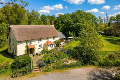
- Price
- Guide Price£675,000
- Size
- 4.4 acres
Added on 01/05/2026Cottage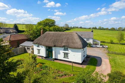
- Price
- Guide Price£700,000
- Size
- 10 acres
Sampford Courtenay, Okehampton, EX20, Sampford Courtenay, Devon EX20 England
Added on 10/05/2026Barn Conversion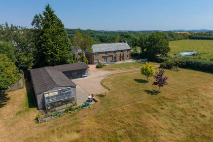
- Price
- Guide Price£895,000
- Size
- 8 acres
Black Dog, Crediton, EX17, Woolfardisworthy, Devon EX17 England
Added on 20/07/2026House with Land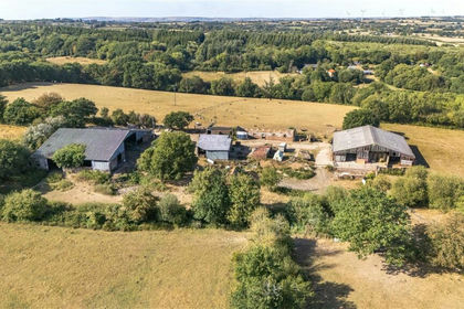
- Price
- Guide Price£950,000
- Size
- 90.38 acres
Grendon Lane, Witheridge, Tiverton, Devon, EX16, Witheridge, Devon EX16 England
Added on 10/09/2026Farm
- Price
- Guide Price£670,000
- Size
- 9.5 acres
Tedburn St. Mary, Exeter, Tedburn St. Mary, Devon EX6 England
Added on 28/07/2026House with Land
- Price
- Guide Price£695,000
- Size
- 7.2 acres
Roborough, Winkleigh, Devon, EX19, Roborough, Devon EX19 England
Added on 13/08/2026Smallholding