Northwich Road, Lower Stretton, Warrington
- Land size
- 9.22 acres
- Bedrooms
- 6
- Bathrooms
- 3
Key Features
- Substantial 6 bedroom Grade II Listed family home set within approximately 9.22 acres
- Considerable scope for business, investment and future development opportunities
- In addition to main house there is a two-storey, two-bedroom cottage
- Detached two-storey barn with past planning consent for two dwellings
- Extensive grounds with Tennis court, 2 large camping fields
- Dog park, large pond and yard area.
- Outbuildings include a triple garage/workshop and attached unit
- Main residence offers substantial and versatile accommodation arranged over three floors.
- EPC F
- Council Tax Main House G - Cottage F
Description
Stretton House represents a rare and exciting opportunity to acquire a substantial Grade II Listed family home set within approximately 9.22 acres, offering considerable scope for business, investment and future development opportunities, subject to obtaining all necessary planning consents. Adjoining the main residence is a two-storey, two-bedroom cottage having a lounge and dining kitchen, currently let and benefiting from its own private garden and parking. In addition, there is a detached two-storey barn, which previously had planning permission for conversion into two separate dwellings, although this consent has since lapsed. The extensive grounds provide considerable versatility and currently include a tennis court, two large camping fields, one of which is served by separate male and female WC facilities and shower facilities. There is also a dog park, large pond and yard area, together with a substantial shed which is currently let. Further outbuildings include a triple garage/workshop with an adjoining unit comprising a kitchen, bedroom and shower room. Please note that this unit does not currently benefit from planning permission for use as ancillary accommodation. The property also provides extensive off-road parking and private lawned gardens serving the main house. The Grade II Listed main residence offers substantial and versatile accommodation arranged over three floors. The ground floor comprises four reception rooms, a breakfast kitchen, pantry, utility room and WC, providing excellent living and entertaining space. To the first floor are four bedrooms, including a principal bedroom with en suite bathroom, together with a three-piece family bathroom. A useful office area/landing provides additional flexible space for those working from home. The second floor offers two further double bedrooms and a shared shower room, bringing the main house to a total of six bedrooms.
LOCATION
Enjoying an attractive semi-rural Cheshire setting, Lower Stretton combines village living with excellent accessibility. The nearby M56 and A49 providing convenient commuter connections, while Warrington, Appleton and Grappenhall offer a wide range of shops, restaurants and everyday amenities. Families are well served by a choice of schools in the surrounding area, with nearby countryside and Walton Hall and Gardens adding to the area's lifestyle appeal.
ACCOMMODATION
ENTRANCE HALL / DINING ROOM
A beautiful entrance hall with stone flagged floor, open fireplace, radiator, currently used as the dining room.
KITCHEN
Large spacious kitchen, built-in ovens with gas hob, family dining table and pantry off the kitchen providing space for additional appliances.
LIVING ROOM
A cosy living room with open fireplace, carpet flooring, radiators and dual aspect windows.
FAMILY ROOM
Large family room, with timber floor, open fireplace, original beams and sash windows to the side.
BEDROOM / RECEPTION ROOM
French doors leading onto the garden, currently used as a bedroom, good size fourth reception room with carpet floor and radiator.
REAR PORCH / UTILITY
Stone floor, W.C. off the porch leading into utility area with plumbing and space for appliances.
FIRST FLOOR LANDING
Large space used as an office currently with sash window and radiator.
BEDROOM 1
Carpet flooring, sash windows, fitted wardrobes, and radiator.
BEDROOM 2
Wooden floor, sash windows and radiator.
BATHROOM
Bath with handheld shower, wash basin and toilet.
BEDROOM 3
Master bedroom complete with en-suite, walk-in wardrobes, three windows and radiator.
BEDROOM 4
Feature fireplace, sash windows, built in wardrobes, radiator.
SECOND FLOOR LANDING
Window to the rear.
BEDROOM 5
Carpet floor, single window, exposed brick wall, beams and radiator.
BATHROOM
Jack and Jill bathroom serves bedrooms 5 and 6. Walk-in shower, wash basin and WC.
BEDROOM 6
Carpet floor, single window, exposed brick wall, beams and radiator.
GARDEN
Stretton House Cottage has a private lawned garden, and a gravel driveway. Stretton House features an enclosed private lawned garden to the front of the property.
OUTBUILDINGS
These include a three-bay triple garage / workshop, with a double door at the front and electric roller door to the side. A separate unit currently used as an annex attached to the garage / workshop comprised of a living / kitchen area, bedroom with en-suite. Additional facilities comprise of a two-storey barn which previously had planning granted for two residential dwellings (Planning ref 2022/40759).
LAND
Extending to approximately 9.22 acres, comprising of gardens, outbuildings, dog park and two large fields and tennis court. The fields currently operate as a campsite featuring a newly installed 10,000 litre water tank to serve separate his and hers toilet and shower facilities. The site also comprises of 12 electric points. Access to the campsite operates on a one-way in and out system with access gained directly off Northwich Road. The campsite operates under a camping license issued by Freedom Camping Club. The dog park was granted planning in 2022 (Planning ref 2022/41093). The site comprises of approximately 0.84 acres featuring dog agility and a wooden shelter. The land is serviced by water.
SERVICES
Cottage mains electric, heating from gas bottles and private drainage. Stretton House, mains electric, oil central heating, private drainage.
COUNCIL TAX
Stretton House Band G - Stretton House Cottage Band F
EPC F
APPROVED PLANNING
2025/00616/DISCON - Discharge of conditions 4 (visibility splays) ,5 (external roofing and facing material), 6(Schedule for Replacement Timber), & 8 (septic tank details) on application 2022/40759 – Condition part discharged / part not discharged
2022/40759 – Conversion of Grade II listed barn into two dwellings – lapsed
2022/41093 – Retention of a dog exercise area including a shelter and use of existing tennis court for recreational tennis court hire – Approved
DIRECTIONS
Sat Nav – WA4 4PF
What3words - ///charmingly.removers.legroom
AML REGULATIONS
In line with UK anti-money laundering legislation, we are legally required to carry out checks on all purchasers. While the Rostons Group remains responsible for ensuring these checks and any ongoing monitoring are completed correctly, the initial anti-money laundering checks are carried out
on our behalf by Movebutler. Once you have had an offer accepted on a property you wish to buy, you will receive an email from Movebutler containing a secure link to complete the required checks. The cost of these checks is £30 (incl. VAT) per buyer. This fee covers the cost of obtaining the necessary data, along with any manual checks or monitoring that may be required. Payment is made directly to Movebutler and must be completed before we can issue a memorandum of sale. Please note that this fee is non-refundable.
VIEWINGS
Please contact Rostons Village & Country Homes on . All viewings must be made in advance.
PUBLIC RIGHTS OF WAY, WAYLEAVES & EASEMENTS
The property is sold subject to all rights of way, wayleaves and easements whether or not they are defined in this brochure.
SALE PLAN & PARTICULARS
The sale plan is based on the Ordnance Survey sheet. Prospective purchasers should check the contract documents. The purchasers shall raise no objection or query in respect of any variation between the physical boundaries and the Ordnance Survey sheet plan. The plans are strictly for identification purposes only.
DISCLAIMER
Rostons Ltd for themselves and the vendors of the property, give notice that these particulars, do not constitute any part of an offer or contract, that all statements contained in these particulars as to the property are made without responsibility and are not to be relied upon as statements or representations of fact and that they do not make or give any representation or warranty whatsoever in relation to this property. An intending purchaser must satisfy themselves by inspection or otherwise as to the correctness of each of the statements contained within these particulars. The Agent has not tested any apparatus, equipment, fixture, fittings or services and cannot verify that they are in working order or fit for their purpose. The buyer is advised to obtain verification from their Solicitor or Surveyor.
Map Location
Property details
- Tenure
- Freehold
- Council Tax Band
- G
- Date Posted
- 2026-09-22
Market Value Analysis
Compared with 244 Homes with Land listings in North West England (5+ acres).
Utilities & Restrictions
Utilities
- Electricity
- Mains
- Water
- Mains
- Heating
- Oil Heating
- Broadband
- Ask Agent
- Sewerage
- Septic Tank / Private
Rights & Restrictions
- Public Rights of Way
- Ask Agent
- Private Rights of Way
- Ask Agent
- Listed Property
- Yes
- Restrictions
- Ask Agent
Listed status, conservation areas and planning constraints for this location are in the full report.
Property Features
- Accessibility
- Ask Agent
- Parking
- Off-Street Parking
- Garden
- Garden
Beyond the particulars: planning activity, flood history, heritage and ground risks, checked for this exact spot.
Connectivity
Broadband
Fastest speed available at this postcode
10 Gbps
Gigabit full fibre · available to 93% of premises
Suitable for
- 4K streaming on every screen
- Full-time home working
- Online gaming & big downloads
Mobile signal
Predicted 4G and 5G signal; indoor signal depends on building materials.
Ofcom Connected Nations postcode-level predictions. Speeds and signal are modelled, not measured, and vary between addresses and providers.
Signal is the easy part. Planning activity, flood history and protected designations here are in the full report.
Nearest Schools
Primary
- Stretton St Matthew's CofE Primary School0.8 milesOfsted: Outstanding *
- Ages
- 4 to 11
- Pupils
- 209
- Type
- Academy converter
- Faith
- Church of England
- Whitley Village School1.1 milesOfsted: Good *
- Ages
- 4 to 11
- Pupils
- 77
- Type
- Academy converter
- Appleton Thorn Primary School1.7 milesOfsted: Good *
- Ages
- 4 to 11
- Pupils
- 198
- Type
- Academy converter
- Antrobus St Mark's CofE Primary School1.7 milesOfsted report card · Mar 2026
- Ages
- 3 to 11
- Pupils
- 96
- Type
- Voluntary aided school
- Faith
- Church of England
- Grappenhall Heys Community Primary School2.2 milesOfsted: Outstanding *
- Ages
- 3 to 11
- Pupils
- 396
- Type
- Community school
Secondary
- Bridgewater High School2.3 milesOfsted: Good
- Ages
- 11 to 16
- Pupils
- 1,683
- Type
- Academy converter
- Sir Thomas Boteler Church of England High School3.5 milesOfsted report card · Feb 2026
- Ages
- 11 to 16
- Pupils
- 879
- Type
- Academy sponsor led
- Faith
- Church of England
- Sandymoor Ormiston Academy3.7 milesOfsted: Good
- Ages
- 11 to 18
- Pupils
- 631
- Type
- Free schools
- Cardinal Newman Catholic High School4.1 milesOfsted: Good
- Ages
- 11 to 16
- Pupils
- 808
- Type
- Voluntary aided school
- Faith
- Roman Catholic
- Ormiston Bolingbroke Academy4.4 milesOfsted report card · Jan 2026
- Ages
- 11 to 19
- Pupils
- 754
- Type
- Academy sponsor led
* Latest graded judgement covers quality of education only; no overall grade was issued under the 2024-25 inspection framework.
Distances are straight-line from the advertised location. Source: the national school registers (DfE, Welsh Government, Scottish Government) and Ofsted.
Schools are just the start: sold prices nearby, planning activity and any flood history are in the full report.
Amenities
Supermarket
GP surgery
Pharmacy
Hospital
Straight-line distances from the advertised location. Sources: NHS records, Geolytix supermarket locations, OS Open Greenspace and the national trails registers.
The area stacks up? Now check the location itself: planning nearby, protected designations and past flooding.
Getting Around
Nearest station
Nearest bus stop
Typical drive times
Straight-line distances from the advertised location; drive times are typical free-flow times over OpenStreetMap road data, so allow more at peak. Public transport locations from DfT NaPTAN.
Easy to reach matters. So do planning activity, flood history and ground risks: all in the full report.
Flood Risk
Environment Agency open data, checked around the advertised map pin for the listed acreage. Long-term risk counts flood defences; the planning map's flood zones do not. Provided by LandSale, not the listing agent, and not part of the agent's particulars. Risk varies across a holding, so verify before committing.
Rivers and the sea
Planning map: Flood Zone 1.
Surface water
Not at the pin: mapped about 60 metres away.
These bandings are the summary. Where this location sits on the flood maps, plus planning activity, heritage and ground risks, is in the full report.
Important notice: Information, maps and tags on this page are drawn from the advertising agent's marketing materials or generated automatically. LandSale has not verified them. Relying on these details is at your own risk, always carry out independent checks before committing to a purchase.
LandSale full disclaimer
Marketing information only - not formal particulars. The details on this website are provided for general guidance and do not constitute an offer or contract. Neither LandSale nor the advertising estate/land agent accepts responsibility for any inaccuracy.
1. Source of information
- Listing content: Core description, asking price, tenure, measurements, photographs and planning history originate from the marketing materials of the advertising estate or land agent. LandSale does not author this content and cannot guarantee its accuracy.
- Automated tags & categorisation: Property type, land-use class, acreage bands and similar labels may be applied by machine-learning models. They are intended as a helpful guide only and may not reflect the property's legal status or permitted use.
- Third-party & enriched data layers: Maps, boundary outlines, planning designations, soil reports, broadband coverage and other environmental or location-based insights are licensed from external suppliers. Such data are supplied “as is", may be incomplete or out of date and are subject to change without notice.
2. Verification required
Prospective purchasers must verify critical matters, including but not limited to planning permission, title boundaries, public rights of way, environmental constraints, acreage, services, access and VAT status, through their own inspections, specialist surveys, legal advisers and the selling agent before relying on the information or entering into any contract.
3. No warranty or liability
LandSale gives no warranty, express or implied, as to the accuracy, completeness or fitness for any particular purpose of the information displayed. LandSale shall not be liable for any loss, damage, cost or expense arising directly or indirectly from any use of or reliance on such information, save where liability may not be excluded by law.
4. Updates & feedback
If you believe any detail on this listing is inaccurate, please let us know. We will investigate and, where appropriate, update the listing or notify the agent.
© LandSale | Version 1.3 - August 2026

Listing agent
Rostons, Hatton Heath
West View House Whitchurch Road, Hatton Heath, CH3 9AU
Call agent
01829773000Contact Rostons, Hatton Heath
West View House Whitchurch Road, Hatton Heath, CH3 9AU
Call agent
01829773000Similar properties for sale
- Price
- Offers in Excess of£1,500,000
- Size
- 16 acres
Massey Brook Lane, Lymm, WA13, Lymm, Warrington WA13 England
Added on 08/08/2026Smallholding
- Price
- Guide Price£1,550,000
- Size
- 11 acres
Hobbs Hill Lane, High Legh, WA16, High Legh, Cheshire East WA16 England
Added on 08/07/2026Farmhouse- Price
- Offers in Excess of£1,500,000
- Size
- 16 acres
Massey Brook Lane, Lymm, WA13, Lymm, Warrington WA13 England
Added on 05/08/2026Smallholding
- Price
- Offers in Excess of£1,000,000
- Size
- 7.5 acres
Thorn Tree Farm, Ainsworth Lane, Crowton, Northwich, Crowton, Cheshire West and Chester CW8 England
Added on 11/09/2026Development Land
- Price
- Offers Over£1,250,000
- Size
- 4 acres
Plumley, Knutsford, Cheshire, Plumley, Cheshire East WA16 England
Added on 19/08/2026House with Land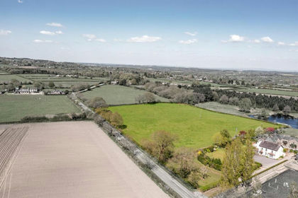
- Price
- £1,260,000
- Size
- 6.61 acres
Forest Gate Farm, Delamere Road, Norley, Kingsley, Cheshire West and Chester WA6 England
Added on 07/09/2026House with Land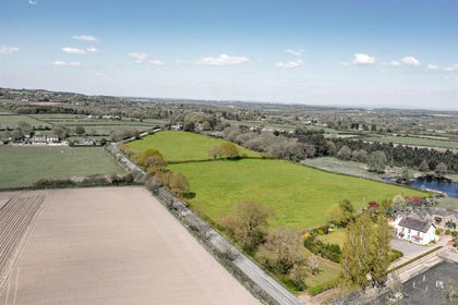
- Price
- Guide Price£1,395,000
- Size
- 14.39 acres
Forest Gate Farm, Delamere Road, Norley, Norley, Cheshire West and Chester WA6 England
Added on 25/04/2026Country Home
- Price
- Offers in Region of£1,250,000
- Size
- 7.8 acres
Chester Road, Oakmere, Delamere and Oakmere, Cheshire West and Chester CW8 England
Added on 29/01/2026House with Land
- Price
- £1,375,000
- Size
- 8 acres
Wash Lane, Allostock, Allostock, Cheshire West and Chester WA16 England
Added on 24/06/2026House with Land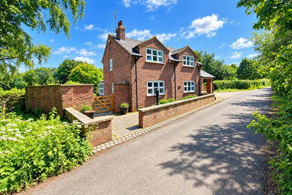
- Price
- Offers in Excess of£1,500,000
- Size
- 6.49 acres
School Lane, Ollerton, Knutsford, Cheshire, WA16, Ollerton, Cheshire East WA16 England
Added on 11/09/2026House with Land