Kingsley Avenue, Ilfracombe, Devon
- Land size
- 2.81 acres
- Bedrooms
- 8
- Bathrooms
- 7
Key Features
- Eight Bedrooms
- Impressive Victorian Residence
- Self Contained Annexe
- Stunning Indoor Swimming Pool
- Six Person Hot Tub
- Beautiful Established Grounds
- Countryside & Sea Views
- Exceptional Lifestyle Opportunity
- Excellent Income Potential
Description
Set at the end of a private driveway within approximately 2.81 acres of beautifully established gardens, woodland and pasture, The Grange is an impressive detached Victorian residence offering exceptional space, character and versatility on the outskirts of Ilfracombe.
Dating from the 1890s with later additions, the main house provides over 6,450 sq ft of accommodation arranged across three floors. A grand entrance hall leads to two generous reception rooms, currently arranged as a lounge and dining room, together with a conservatory, orangery and substantial kitchen/breakfast room. Further accommodation includes a utility room, boot room and a ground floor bedroom suite designed for accessible living.
Across the main house and annexe there are six bedrooms to the main house and a further 2 bedrooms to the annex, providing outstanding flexibility for larger families, those looking for multi-generational living or buyers wanting space for visiting family and friends.
A particular feature is the impressive indoor leisure complex, incorporating a heated 40ft swimming pool, electrically operated cover, six-person hot tub and changing facilities, with direct access to a private garden terrace and built-in barbecue.
The detached annexe is a significant advantage. The ground floor provides a substantial games room and garage/workshop, while the first floor offers a self-contained two-bedroom apartment with living room, kitchen, bathroom and private garden. This makes The Grange ideally suited to dual occupancy, dependent relatives, older children or extended family, while also providing the potential to generate a supplementary income if desired.
Outside, the secluded grounds include sweeping lawns, ponds, mature woodland, pasture, terraces and pathways, with attractive countryside and sea views. There is also generous parking and turning space for several vehicles.
Currently used as self-catering holiday accommodation, The Grange lends itself exceptionally well to becoming a substantial private family residence.
Bicclescombe Park lies at the end of the drive, with Ilfracombe’s harbour, amenities and the beaches of Woolacombe, Croyde and Saunton all within easy reach.
Ilfracombe is a characterful Victorian seaside town offering a good range of everyday amenities, including independent shops, supermarkets, schools, a cinema, healthcare facilities and a variety of cafés, bars and restaurants. The picturesque harbour remains a focal point of the town, home to the iconic Verity statue, along with a selection of galleries and eateries. The town also benefits from a modern watersports centre and the well-regarded Ilfracombe Aquarium.
A range of local events and seasonal festivals take place throughout the year, many centred around the harbour and seafront, including performances at the Landmark Theatre. The surrounding North Devon coastline is renowned for its natural beauty, with nearby Hele Bay offering a more sheltered beach, while the award-winning beaches at Woolacombe, Croyde and Putsborough are all within easy reach by car.
The regional centre of Barnstaple is approximately 20 minutes away, providing a wider selection of national retailers, leisure facilities and transport connections, including rail links to Exeter and beyond.
Directions
From our Ilfracombe office on the High Street, head towards Northfield Road and follow the A361. At the roundabout, take the first exit onto Church Street, continuing onto St Brannock’s Road. After approximately 0.6 miles, turn left into Kingsley Avenue. Follow Kingsley Avenue, then turn left to remain on the road. Continue towards the end, where the private entrance to The Grange will be found on the left.
The Grange is approached via a private driveway and sits within approximately 2.81 acres of secluded, established grounds. Sweeping lawns, mature woodland, pasture, ponds, terraces and pathways create a wonderfully private setting, with attractive countryside and sea views. The gardens enjoy a sunny aspect and offer plenty of space for entertaining, recreation and family life. A generous parking and turning area provides ample space for several vehicles, alongside the garage and workshop.
Agents Notes
Freehold, Title Number DN202860, UPRN . Traditional brick and stone construction, set within approximately 2.81 acres. The property benefits from off road parking and gas central heating, with gas also providing domestic hot water. The Council Tax assessment is currently deleted and business rates may apply. Recorded flood risk is very low. EPC TBC. An updated assessment is awaited. Water supply, drainage, broadband, mobile coverage and any rights or restrictions remain to be confirmed. Buyers should ask their solicitor to verify the authorised use and title provisions.
Map Location
Property details
- Tenure
- Freehold
- Council Tax Band
- TBC
- Date Posted
- 2026-09-22
Market Value Analysis
Compared with 1,667 Homes with Land listings in South West England (1+ acres).
Utilities & Restrictions
Utilities
- Electricity
- Ask Agent
- Water
- Ask Agent
- Heating
- Ask Agent
- Broadband
- Ask Agent
- Sewerage
- Ask Agent
Rights & Restrictions
- Public Rights of Way
- Ask Agent
- Private Rights of Way
- Ask Agent
- Listed Property
- Ask Agent
- Restrictions
- Ask Agent
Listed status, conservation areas and planning constraints for this location are in the full report.
Property Features
- Accessibility
- Ask Agent
- Parking
- Parking Available
- Garden
- Garden
Beyond the particulars: planning activity, flood history, heritage and ground risks, checked for this exact spot.
Connectivity
Broadband
Fastest speed available at this postcode
1.8 Gbps
Gigabit full fibre
Suitable for
- 4K streaming on every screen
- Full-time home working
- Online gaming & big downloads
Mobile signal
Predicted 4G and 5G signal; indoor signal depends on building materials.
Ofcom Connected Nations postcode-level predictions. Speeds and signal are modelled, not measured, and vary between addresses and providers.
Signal is the easy part. Planning activity, flood history and protected designations here are in the full report.
Nearest Schools
Primary
- Ilfracombe Infant and Nursery School831 metresOfsted: Requires improvement *
- Ages
- 2 to 7
- Pupils
- 207
- Type
- Community school
- Ilfracombe Church of England Junior School0.6 milesOfsted: Good *
- Ages
- 7 to 11
- Pupils
- 326
- Type
- Voluntary controlled school
- Faith
- Church of England
- Berrynarbor Church of England Primary School2.5 milesOfsted: Good
- Ages
- 4 to 11
- Pupils
- 69
- Type
- Academy converter
- Faith
- Church of England
- West Down School2.7 milesOfsted: Good
- Ages
- 2 to 11
- Pupils
- 95
- Type
- Academy converter
- Combe Martin Primary School3.7 milesOfsted: Requires improvement *
- Ages
- 2 to 11
- Pupils
- 137
- Type
- Academy converter
Secondary
- The Ilfracombe Church of England Academy907 metresOfsted report card · Jan 2026
- Ages
- 11 to 18
- Pupils
- 1,016
- Type
- Academy sponsor led
- Faith
- Church of England
- Braunton Academy6.7 milesNo Ofsted rating
- Ages
- 11 to 16
- Pupils
- 828
- Type
- Academy converter
- Pilton Community College7.8 milesOfsted: Good
- Ages
- 11 to 16
- Pupils
- 1,165
- Type
- Academy converter
- The Park Community School9.3 milesOfsted: Good *
- Ages
- 11 to 16
- Pupils
- 1,408
- Type
- Academy converter
- Bideford College13 milesOfsted report card · May 2026
- Ages
- 11 to 18
- Pupils
- 1,455
- Type
- Academy sponsor led
* Latest graded judgement covers quality of education only; no overall grade was issued under the 2024-25 inspection framework.
Distances are straight-line from the advertised location. Source: the national school registers (DfE, Welsh Government, Scottish Government) and Ofsted.
Schools are just the start: sold prices nearby, planning activity and any flood history are in the full report.
Amenities
Supermarket
GP surgery
Pharmacy
Hospital
Green space
Walking trail
Straight-line distances from the advertised location. Sources: NHS records, Geolytix supermarket locations, OS Open Greenspace and the national trails registers.
The area stacks up? Now check the location itself: planning nearby, protected designations and past flooding.
Getting Around
Nearest station
Nearest bus stop
Typical drive times
Straight-line distances from the advertised location; drive times are typical free-flow times over OpenStreetMap road data, so allow more at peak. Public transport locations from DfT NaPTAN.
Easy to reach matters. So do planning activity, flood history and ground risks: all in the full report.
Flood Risk
Environment Agency open data, checked around the advertised map pin for the listed acreage. Long-term risk counts flood defences; the planning map's flood zones do not. Provided by LandSale, not the listing agent, and not part of the agent's particulars. Risk varies across a holding, so verify before committing.
Rivers and the sea
Planning map: Flood Zone 1.
Surface water
Not at the pin: mapped about 50 metres away.
These bandings are the summary. Where this location sits on the flood maps, plus planning activity, heritage and ground risks, is in the full report.
Important notice: Information, maps and tags on this page are drawn from the advertising agent's marketing materials or generated automatically. LandSale has not verified them. Relying on these details is at your own risk, always carry out independent checks before committing to a purchase.
LandSale full disclaimer
Marketing information only - not formal particulars. The details on this website are provided for general guidance and do not constitute an offer or contract. Neither LandSale nor the advertising estate/land agent accepts responsibility for any inaccuracy.
1. Source of information
- Listing content: Core description, asking price, tenure, measurements, photographs and planning history originate from the marketing materials of the advertising estate or land agent. LandSale does not author this content and cannot guarantee its accuracy.
- Automated tags & categorisation: Property type, land-use class, acreage bands and similar labels may be applied by machine-learning models. They are intended as a helpful guide only and may not reflect the property's legal status or permitted use.
- Third-party & enriched data layers: Maps, boundary outlines, planning designations, soil reports, broadband coverage and other environmental or location-based insights are licensed from external suppliers. Such data are supplied “as is", may be incomplete or out of date and are subject to change without notice.
2. Verification required
Prospective purchasers must verify critical matters, including but not limited to planning permission, title boundaries, public rights of way, environmental constraints, acreage, services, access and VAT status, through their own inspections, specialist surveys, legal advisers and the selling agent before relying on the information or entering into any contract.
3. No warranty or liability
LandSale gives no warranty, express or implied, as to the accuracy, completeness or fitness for any particular purpose of the information displayed. LandSale shall not be liable for any loss, damage, cost or expense arising directly or indirectly from any use of or reliance on such information, save where liability may not be excluded by law.
4. Updates & feedback
If you believe any detail on this listing is inaccurate, please let us know. We will investigate and, where appropriate, update the listing or notify the agent.
© LandSale | Version 1.3 - August 2026
Listing agent
Bond Oxborough Phillips, Ilfracombe
119 High Street, Ilfracombe, EX34 9EY
Similar properties for sale
- Price
- Guide Price£1,375,000
- Size
- 4.5 acres
Added on 28/01/2026House with Land
- Price
- Guide Price£1,300,000
- Size
- 11.6 acres
Sterridge Valley, Berrynarbor, North Devon EX34, Ilfracombe, Devon EX34 England
Added on 06/04/2026House with Land
- Price
- Offers Over£1,250,000
- Size
- 3 acres
Sterridge Valley, Berrynarbor, Ilfracombe, Berrynarbor, Devon EX34 England
Added on 28/05/2026Holiday Let Property
- Price
- Guide Price£1,000,000
- Size
- 1.7 acres
Mortehoe, Woolacombe, Devon, EX34, Ilfracombe, Devon EX34 England
Added on 03/06/2026Cottage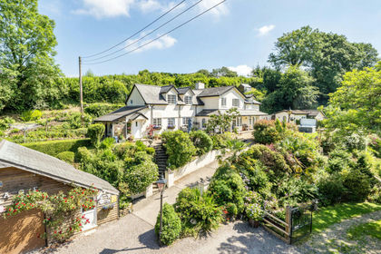
- Price
- Guide Price£1,250,000
- Size
- 3 acres
East Down, Barnstaple, Devon, EX31, East Down, Devon EX31 England
Added on 01/07/2026Country Home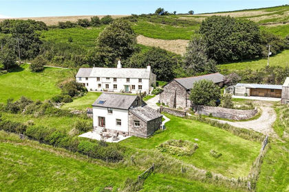
- Price
- Guide Price£1,500,000
- Size
- 56.95 acres
Combe Martin, Ilfracombe, Devon, EX34, Combe Martin, Devon EX34 England
Added on 19/05/2026Farm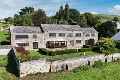
- Price
- Guide Price£1,200,000
- Size
- 1 acres
Added on 18/09/2026Mill Conversion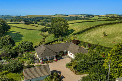
- Price
- Guide Price£1,000,000
- Size
- 3.2 acres
Added on 04/09/2026House with Land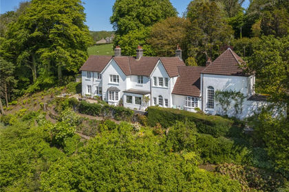
- Price
- Offers in Excess of£1,100,000
- Size
- 2.45 acres
Bratton Fleming, Barnstaple, Devon, EX31, Bratton Fleming, Devon EX31 England
Added on 09/06/2026House with Land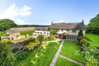
- Price
- Offers in Excess of£1,150,000
- Size
- 5.7 acres
Bratton Fleming, Barnstaple, Devon, EX31, Bratton Fleming, Devon EX31 England
Added on 04/06/2026House with Land