Login, Whitland, SA34
- Land size
- 66 acres
- Bedrooms
- 4
- Bathrooms
- 2
Key Features
- Exceptional country estate extending to approximately 66 acres
- Character 2-bedroom farmhouse with a separate 2-bedroom detached cottage
- A wonderful mix of open pasture, wildflower meadows and mature woodland
- Peaceful River Taf setting with attractive riverside meadows
- Impressive range of traditional barns, stabling, workshops and agricultural buildings
- Magnificent elevated position overlooking its own private wooded valley
- Conveniently located for Narberth, Carmarthen and Haverfordwest
- Highly secluded setting with no immediate neighbours
Description
A truly special country property set within approximately 66 acres of beautiful countryside, with a characterful farmhouse, separate two-bedroom cottage, River Taf frontage and far-reaching views across its own private wooded valley.
Tucked away in a wonderfully secluded position near Login, approximately 6 miles north-west of Narberth, this is a property that offers something increasingly difficult to find — genuine privacy, space and an extraordinary connection with the surrounding countryside. With no near neighbours and approximately 66 acres of land, the setting is wonderfully peaceful, yet the property remains within easy reach of Narberth, Haverfordwest and Carmarthen. The land extends to approximately 45 acres of pasture and meadow together with around 20 acres of mature woodland, with internal tracks leading through the holding towards attractive river meadows adjoining the River Taf. The mature woodland is a particularly attractive feature, with a network of tracks and pathways providing access through the trees and towards the river meadows. In spring, the woodland floor comes alive with carpets of bluebells, wild garlic and wood anemones, while the combination of woodland, meadow and river provides a rich natural habitat for an impressive variety of wildlife. Birdlife is particularly abundant, with red kites, ravens, sparrowhawks, kingfishers, herons, swallows, numerous finches and warblers, together with four different species of tit, regularly seen across the holding. The grounds also attract a variety of butterflies, while otters have been spotted along the river, further highlighting the property's exceptional natural setting. The elevated position provides stunning views across the property's own wooded valley, while the river frontage offers excellent fishing opportunities, with the waters understood to hold salmon, sewin and brown trout. The fishing rights are understood to be held in hand, offering the rare opportunity to enjoy a private stretch of river within the estate and its beautiful natural surroundings.
At the heart of the holding is a charming two-bedroom farmhouse, full of character and traditional features including exposed stonework, beams, original flagstone, quarry-tiled floors and exposed roof timbers. The accommodation includes a kitchen/dining room with Rayburn, separate kitchen area, utility room, cloakroom, large rear conservatory and inviting sitting room with exposed stonework, beamed ceiling and multi-fuel stove. Upstairs are two bedrooms, a family bathroom and useful under-eaves storage, with the main bedroom enjoying double-aspect windows overlooking the surrounding grounds. Separately positioned is Fron Haul Cottage, an attractive detached two-bedroom property providing self-contained accommodation. With a generous living room, conservatory overlooking the valley, kitchen, shower room, ground-floor bedroom and first-floor loft bedroom with exposed A-frames and five Velux windows, the cottage offers excellent flexibility for guests, extended family or potential holiday letting, subject to any necessary consents.
The property is complemented by an impressive range of traditional and useful outbuildings arranged around the yard, including stone barns, a former dairy/workshop, stabling and loose boxes, a Dutch barn, feed store and open-fronted hay and storage building, together with a substantial field shelter. The gardens surrounding the farmhouse are mature and established, with terraced areas, flower and shrub borders, greenhouse and garden workshop. The land itself provides a wonderful mixture of pasture, meadow and woodland, with a borehole supplying some of the animal troughs. Of particular interest, the land has been managed without artificial fertilisers, herbicides or other chemical treatments for more than 12 years, although it is not of organic status. The combination of land, buildings and accommodation makes the property particularly suited to those looking for a private country lifestyle, whether for equestrian use, smallholding, conservation, family occupation or simply enjoying the freedom and space of owning a substantial rural holding.
Location
Despite its secluded setting, the property is well placed for access to the surrounding towns and road network. Login is a small rural community surrounded by rolling countryside, with Narberth approximately 6 miles to the south-east. Narberth offers a popular town centre with independent shops, cafés, restaurants and everyday amenities, together with convenient access to the wider Pembrokeshire countryside and coastline. The A40 is readily accessible, providing connections throughout Pembrokeshire and Carmarthenshire, while Haverfordwest and Carmarthen are both approximately 16 miles away and provide extensive shopping, leisure, educational, healthcare and employment facilities. The wider area is ideally suited to those looking to enjoy the West Wales countryside, with opportunities for walking, fishing, equestrian pursuits and access to the region's beaches and coastal attractions. The property is approached initially via a shared driveway before continuing along a private drive to the house and traditional yard. The property is bisected by a public footpath.
The combination of a character farmhouse, separate two-bedroom cottage, approximately 66 acres of pasture and woodland, River Taf frontage, fishing rights and an extensive range of outbuildings creates a genuinely exciting lifestyle opportunity. Viewing is highly recommended to fully appreciate the privacy, setting, views, scale of the land and the considerable potential this remarkable property has to offer.
Tenure: Freehold
Local Authority: Carmarthenshire County Council
Services: We have been advised mains electricity and mains water are connected, with private drainage. The farmhouse benefits from oil-fired central heating, together with a Rayburn, while the cottage has a separate oil-fired boiler. Telephone and high-speed internet services are provided via Starlink.
Council Tax Band: E
EPC: E
Kitchen/Diner
Kitchen
Living Room
Utility Room
Conservatory
WC
Landing
Bedroom 1
Bedroom 2
Bathroom
Living Room/Diner
Kitchen
Bathroom
Sunroom
Bedroom 1
Bedroom 2
Map Location
Property details
- Tenure
- Freehold
- Council Tax Band
- E
- Date Posted
- 2026-09-23
Market Value Analysis
Compared with 16 Homes with Land listings in Wales (50+ acres).
Utilities & Restrictions
Utilities
- Electricity
- Mains
- Water
- Mains
- Heating
- Oil Heating, Wood Burner
- Broadband
- Ask Agent
- Sewerage
- Ask Agent
Rights & Restrictions
- Public Rights of Way
- Ask Agent
- Private Rights of Way
- Ask Agent
- Listed Property
- Ask Agent
- Restrictions
- Ask Agent
Listed status, conservation areas and planning constraints for this location are in the full report.
Property Features
- Accessibility
- Ask Agent
- Parking
- Parking Available
- Garden
- Private Garden
Beyond the particulars: planning activity, flood history, heritage and ground risks, checked for this exact spot.
Connectivity
Broadband
Fastest speed available at this postcode
4 Mbps
Under 10 Mbps here
Suitable for
- Basic browsing & email
Mobile signal
Predicted 4G and 5G signal; indoor signal depends on building materials.
Ofcom Connected Nations postcode-level predictions. Speeds and signal are modelled, not measured, and vary between addresses and providers.
Signal is the easy part. Planning activity, flood history and protected designations here are in the full report.
Nearest Schools
Primary
- Beca1.9 miles
- Pupils
- 46
- Type
- Infants & Juniors
- Language
- Welsh medium school / provision (including transitional)
- Bro Brynach3.1 miles
- Pupils
- 90
- Type
- Nursery, Infants & Juniors
- Language
- Welsh medium school / provision (including transitional)
- Ysgol Gymunedol Brynconin3.3 miles
- Pupils
- 71
- Type
- Nursery, Infants & Juniors
- Language
- Welsh medium school / provision (including transitional)
- Llys Hywel5.3 miles
- Pupils
- 135
- Type
- Infants & Juniors
- Language
- Dual language school / provision (Welsh and English) (including transitional)
- Ysgol Gymunedol Maenclochog5.6 miles
- Pupils
- 98
- Type
- Infants & Juniors
- Language
- Welsh medium school / provision (including transitional)
Secondary
- Dyffryn Taf5 miles
- Pupils
- 890
- Type
- Secondary (ages 11-19)
- Language
- Dual language school / provision (Welsh and English) (including transitional)
- Ysgol Bro Preseli5.8 miles
- Pupils
- 932
- Type
- Middle (ages 3-19)
- Language
- Welsh medium school / provision (including transitional)
- Ysgol Gyfun Emlyn13 miles
- Pupils
- 502
- Type
- Secondary (ages 11-19)
- Language
- Dual language school / provision (Welsh and English) (including transitional)
- Ysgol Caer Elen13 miles
- Pupils
- 907
- Type
- Middle (ages 3-16)
- Language
- Welsh medium school / provision (including transitional)
- Ysgol Uwchradd Aberteifi14 miles
- Pupils
- 614
- Type
- Secondary (ages 11-19)
- Language
- Welsh medium school / provision (including transitional)
Distances are straight-line from the advertised location. Source: the national school registers (DfE, Welsh Government, Scottish Government) and Ofsted.
Schools are just the start: sold prices nearby, planning activity and any flood history are in the full report.
Amenities
Supermarket
GP surgery
Pharmacy
Straight-line distances from the advertised location. Sources: NHS records, Geolytix supermarket locations, OS Open Greenspace and the national trails registers.
The area stacks up? Now check the location itself: planning nearby, protected designations and past flooding.
Getting Around
Nearest station
Nearest bus stop
Typical drive times
Straight-line distances from the advertised location; drive times are typical free-flow times over OpenStreetMap road data, so allow more at peak. Public transport locations from DfT NaPTAN.
Easy to reach matters. So do planning activity, flood history and ground risks: all in the full report.
Flood Risk
Natural Resources Wales open data, checked around the advertised map pin for the listed acreage. Long-term risk counts flood defences; the planning map's flood zones do not. Provided by LandSale, not the listing agent, and not part of the agent's particulars. Risk varies across a holding, so verify before committing.
Rivers and the sea
Not at the pin: mapped about 180 metres away.
Planning map: Flood Zone 3, about 180 metres away.
Surface water
Not at the pin: mapped about 140 metres away.
These bandings are the summary. Where this location sits on the flood maps, plus planning activity, heritage and ground risks, is in the full report.
Important notice: Information, maps and tags on this page are drawn from the advertising agent's marketing materials or generated automatically. LandSale has not verified them. Relying on these details is at your own risk, always carry out independent checks before committing to a purchase.
LandSale full disclaimer
Marketing information only - not formal particulars. The details on this website are provided for general guidance and do not constitute an offer or contract. Neither LandSale nor the advertising estate/land agent accepts responsibility for any inaccuracy.
1. Source of information
- Listing content: Core description, asking price, tenure, measurements, photographs and planning history originate from the marketing materials of the advertising estate or land agent. LandSale does not author this content and cannot guarantee its accuracy.
- Automated tags & categorisation: Property type, land-use class, acreage bands and similar labels may be applied by machine-learning models. They are intended as a helpful guide only and may not reflect the property's legal status or permitted use.
- Third-party & enriched data layers: Maps, boundary outlines, planning designations, soil reports, broadband coverage and other environmental or location-based insights are licensed from external suppliers. Such data are supplied “as is", may be incomplete or out of date and are subject to change without notice.
2. Verification required
Prospective purchasers must verify critical matters, including but not limited to planning permission, title boundaries, public rights of way, environmental constraints, acreage, services, access and VAT status, through their own inspections, specialist surveys, legal advisers and the selling agent before relying on the information or entering into any contract.
3. No warranty or liability
LandSale gives no warranty, express or implied, as to the accuracy, completeness or fitness for any particular purpose of the information displayed. LandSale shall not be liable for any loss, damage, cost or expense arising directly or indirectly from any use of or reliance on such information, save where liability may not be excluded by law.
4. Updates & feedback
If you believe any detail on this listing is inaccurate, please let us know. We will investigate and, where appropriate, update the listing or notify the agent.
© LandSale | Version 1.3 - August 2026
Listing agent
Blackbear, Pembrokeshire
2b Quay Street, Haverfordwest, SA61 1BG
Similar properties for sale
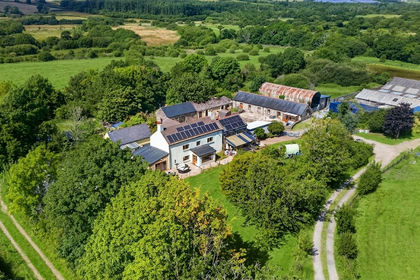
- Price
- Offers in Region of£900,000
- Size
- 48 acres
Added on 04/08/2026Smallholding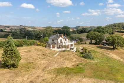
- Price
- Guide Price£1,200,000
- Size
- 74.3 acres
Llangynin, St Clears, SA33, St Clears, Carmarthenshire SA33 Wales
Added on 05/09/2026Smallholding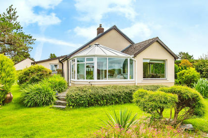
- Price
- Offers in Region of£900,000
- Size
- 47 acres
Tegryn, Llanfyrnach CARDIGAN SA35, Clydau, Pembrokeshire SA35 Wales
Added on 29/01/2026Smallholding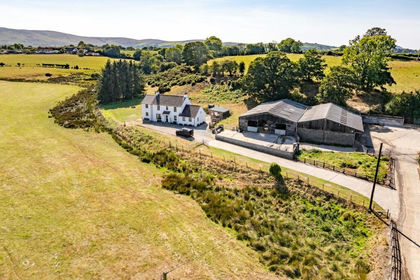
- Price
- £1,000,000
- Size
- 50 acres
Eglwyswrw, Crymych, SA41, Eglwyswrw, Pembrokeshire SA41 Wales
Added on 30/05/2026Farm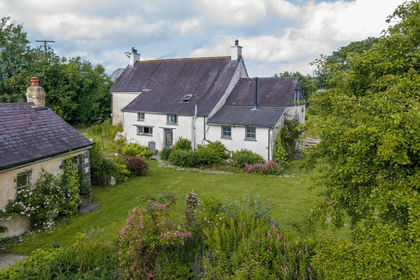
- Price
- £925,000
- Size
- 39 acres
Cilrhedyn, Llanfyrnach, SA35, Llanfyrnach, Pembrokeshire SA35 Wales
Added on 10/07/2026Farmhouse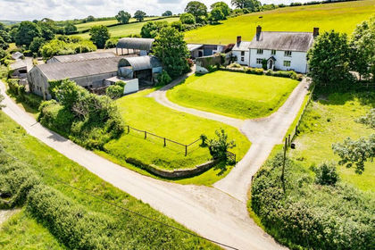
- Price
- £800,000
- Size
- 33.12 acres
Llechryd, Cardigan, SA43, Manordeifi, Pembrokeshire SA43 Wales
Added on 08/08/2026Smallholding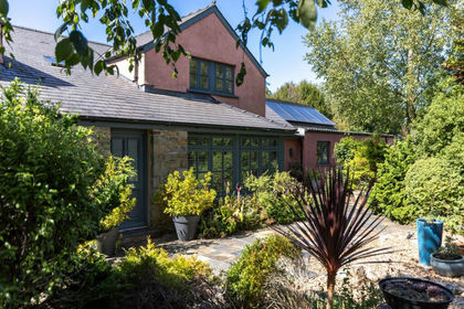
- Price
- Guide Price£1,200,000
- Size
- 35 acres
Llanychaer, Fishguard, SA65, Cwm Gwaun, Pembrokeshire SA65 Wales
Added on 21/08/2026Country Estate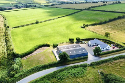
- Price
- £895,000
- Size
- 37.55 acres
Wolfscastle, Haverfordwest, SA62, Wolfscastle, Pembrokeshire SA62 Wales
Added on 29/01/2026Farm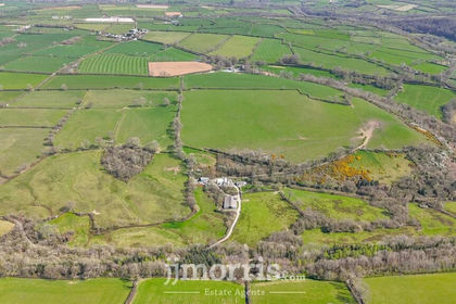
- Price
- £750,000
- Size
- 60 acres
Cwm Cou, Newcastle Emlyn, SA38, Beulah, Ceredigion SA38 Wales
Added on 29/01/2026Farm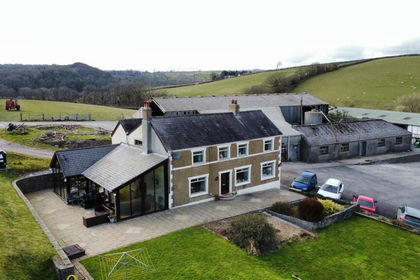
- Price
- Offers in Region of£900,000
- Size
- 52.5 acres
Croesyceiliog, Carmarthen, SA32, Llandyfaelog, Carmarthenshire SA32 Wales
Added on 29/01/2026Farmhouse