Water Lane, Denston, Newmarket
- Land size
- 1.75 acres
- Bedrooms
- 6
- Bathrooms
- 4
Description
“A magnificent centuries-old farmhouse in an idyllic West Suffolk village”
This incredible 16th-century farmhouse, with approximately 1.75 acres of lush private grounds, sits in a picturesque pocket of West Suffolk in the village of Denston. Extending over 6,200 sq ft, the house comprises six bedrooms and a wealth of exceptionally well-preserved Tudor details, including wonderfully wonky beams and elaborate hand-carved woodwork, matching the carving also seen in the adjacent church. A landscaped courtyard, filled with circular rose beds, includes a private swimming pool, while the mature garden provides a verdant backdrop. For local amenities, Wickhambrook is two miles north, while Clare, best known for its antique shops and Country Park, is roughly five miles south.
Setting the Scene
Denston is a designated conservation village for its historic architecture and rural charm. Chantry Farm sits opposite the village green with quintessential views overlooking the famous late 15th-century St. Nicholas Church, known for preserving rare medieval liturgical integrity.
The setting is exemplary of the English countryside, with a rich patchwork of green pastures and dense hedgerows. The house sits just off Water Lane, via a private gravelled driveway that wraps around the house, with parking space for several cars.
The Grand Tour
Built in c.1540, the farmhouse presents a handsome façade of terracotta-hued limewash, traditional mullion windows and a clay-tiled pitched roof.
The front doorway leads to a square hallway and on to the heart of the house, where most rooms emanate period character. The dining room provides a first example, covered from top to bottom with immaculate, hand-hewn exposed beams that contrast with the vibrant, red-painted walls.
The drawing room is arguably the most spledid room in the house, where an exposed brick fireplace draws attention to an imposing, elaborately carved bressummer beam above, and all the openings have solid wood architraves and doors. The room is the most adorned with a medieval Green Man carvings, as well historic linenfold paneling. 9ft ceiling heights are a rarity for homes of this era, emphasising the importance of the house at the time. Adjacent is the sitting room, with similar features, as well as an additional wood burner to the one in the dining room.
Off the dining room, one doorway descends to a characterful study and separate WC, whilst a second doorway leads to the kitchen. The room is painted mushroom grey, with cream-painted cabinets framing a green AGA range cooker. Part of a more recently renovated space, the floor is laid with terracotta tiles, and a cupboard features a walk-in pantry.
Through the kitchen is a second entryway, which leads to the former outbuildings, consisting of a laundry room which opens into a wide boot room with storage for coats and muddy shoes.
Stairs from the entrance hallway lead first to a guest bedroom and ensuite bathroom. Continuing up on to the first floor, a landing connects to three bedrooms. The principal bedroom, which enjoys dual-aspect views over the garden, also has its original carved beams. The room is painted a lovely butter yellow, and an en suite bathroom has a bathtub with an overhead shower. There are two further bedrooms, each with exposed beams, along with a dressing room (that could double as a bedroom, if desired) and a shared bathroom.
The second floor is home to two additional bedrooms, another bathroom, and a second study room, ideal for home-working and guests.
The Great Outdoors
The house backs onto an expansive private garden enclosed by mature trees, including productive fruit trees. At the rear of the house is a beautiful, landscaped terrace, with a walled garden comprising rose beds and flowering perennials, paving the way towards a large swimming pool, bordered to one side by tall hedging. Opposite are a pool house and garden room for storing equipment, and a table has been set up for outdoor dining. The outbuildings also include a garage. There is also a pond within the grounds of the home.
Out and About
Set on the edge of Denston, a picturesque countryside village, Chantry Farm boasts a peaceful setting. The nearby villages of Wickhambrook, and Clare provide local daily amenities, shops, and traditional Suffolk pubs like The Queen's Head at Hawkendon and The Crown at Hartest.
The area is exceptionally well served by schools, with a strong selection of both state and independent institutions across all age groups. Local state primary options include Wickhambrook Primary Academy and Cavendish Church of England Primary School, while secondary education is provided nearby at Castle Manor Academy or the highly regarded King Edward VI School in Bury St Edmunds. For independent schooling, Barnardiston Hall Preparatory School, Fairstead House in Newmarket, and South Lee School in Bury St Edmunds are nearby. Chantry Farm is 20 minutes from both Newmarket and Bury St Edmunds and is only 40 minutes from Cambridge.
The nearest railway station is located at Newmarket, roughly a 20-minute drive away, running regular Greater Anglia services into Cambridge in about 20 minutes as well as direct routes to Ipswich. London is easily accessible with Whittlesford Parkway on the Cambridge line being only 30 minutes away. Alternatively from Cambridge itself, high-speed rail connections run directly into London King's Cross and London Liverpool Street. Bury St Edmunds station is around 20 minutes to the north and has broader connections across East Anglia. For international travel, London Stansted Airport can be easily reached by car in approximately 40 to 45 minutes via the A1307 and M11.
Map Location
Property details
- Tenure
- Freehold
- Council Tax Band
- F
- Date Posted
- 2026-09-23
Market Value Analysis
Compared with 1,159 Homes with Land listings in East Anglia (1+ acres).
Utilities & Restrictions
Utilities
- Electricity
- Mains
- Water
- Mains
- Heating
- Oil Heating
- Broadband
- Fibre (FTTC)
- Sewerage
- Septic Tank / Private
Rights & Restrictions
- Public Rights of Way
- Ask Agent
- Private Rights of Way
- Ask Agent
- Listed Property
- Yes
- Restrictions
- Yes
Listed status, conservation areas and planning constraints for this location are in the full report.
Property Features
- Accessibility
- Ask Agent
- Parking
- Driveway
- Garden
- Garden
Beyond the particulars: planning activity, flood history, heritage and ground risks, checked for this exact spot.
Connectivity
Broadband
Fastest speed available at this postcode
5.5 Gbps
Gigabit full fibre · available to 86% of premises
Suitable for
- 4K streaming on every screen
- Full-time home working
- Online gaming & big downloads
Mobile signal
Predicted 4G and 5G signal; indoor signal depends on building materials.
Ofcom Connected Nations postcode-level predictions. Speeds and signal are modelled, not measured, and vary between addresses and providers.
Signal is the easy part. Planning activity, flood history and protected designations here are in the full report.
Nearest Schools
Primary
- Wickhambrook Primary Academy1.7 milesOfsted: Good *
- Ages
- 4 to 11
- Pupils
- 180
- Type
- Academy converter
- Hundon Community Primary School2.9 milesOfsted: Good
- Ages
- 4 to 11
- Pupils
- 64
- Type
- Community school
- Hartest Church of England Primary School4.5 milesOfsted: Good
- Ages
- 4 to 11
- Pupils
- 42
- Type
- Academy sponsor led
- Faith
- Church of England
- Clare Community Primary School4.6 milesOfsted: Good
- Ages
- 4 to 11
- Pupils
- 199
- Type
- Academy sponsor led
- Cavendish Church of England Primary School4.8 milesOfsted: Inadequate
- Ages
- 4 to 11
- Pupils
- 52
- Type
- Academy sponsor led
- Faith
- Church of England
Secondary
- Stour Valley Community School4.6 milesOfsted: Good
- Ages
- 11 to 16
- Pupils
- 569
- Type
- Free schools
- Samuel Ward Academy6.6 milesOfsted: Good
- Ages
- 11 to 18
- Pupils
- 1,076
- Type
- Academy converter
- Castle Manor Academy7.4 milesNo Ofsted rating
- Ages
- 11 to 16
- Pupils
- 760
- Type
- Academy converter
- King Edward VI CEVC School9.2 milesNo Ofsted rating
- Ages
- 11 to 16
- Pupils
- 1,189
- Type
- Voluntary controlled school
- Faith
- Church of England
- Bury St Edmunds County High School9.4 milesOfsted report card · May 2026
- Ages
- 11 to 16
- Pupils
- 657
- Type
- Academy converter
* Latest graded judgement covers quality of education only; no overall grade was issued under the 2024-25 inspection framework.
Distances are straight-line from the advertised location. Source: the national school registers (DfE, Welsh Government, Scottish Government) and Ofsted.
Schools are just the start: sold prices nearby, planning activity and any flood history are in the full report.
Amenities
Supermarket
GP surgery
Pharmacy
Hospital
Straight-line distances from the advertised location. Sources: NHS records, Geolytix supermarket locations, OS Open Greenspace and the national trails registers.
The area stacks up? Now check the location itself: planning nearby, protected designations and past flooding.
Getting Around
Nearest station
Nearest bus stop
Typical drive times
Straight-line distances from the advertised location; drive times are typical free-flow times over OpenStreetMap road data, so allow more at peak. Public transport locations from DfT NaPTAN.
Easy to reach matters. So do planning activity, flood history and ground risks: all in the full report.
Flood Risk
Environment Agency open data, checked around the advertised map pin for the listed acreage. Long-term risk counts flood defences; the planning map's flood zones do not. Provided by LandSale, not the listing agent, and not part of the agent's particulars. Risk varies across a holding, so verify before committing.
Rivers and the sea
Planning map: Flood Zone 1.
Surface water
Not at the pin: mapped about 30 metres away.
These bandings are the summary. Where this location sits on the flood maps, plus planning activity, heritage and ground risks, is in the full report.
Important notice: Information, maps and tags on this page are drawn from the advertising agent's marketing materials or generated automatically. LandSale has not verified them. Relying on these details is at your own risk, always carry out independent checks before committing to a purchase.
LandSale full disclaimer
Marketing information only - not formal particulars. The details on this website are provided for general guidance and do not constitute an offer or contract. Neither LandSale nor the advertising estate/land agent accepts responsibility for any inaccuracy.
1. Source of information
- Listing content: Core description, asking price, tenure, measurements, photographs and planning history originate from the marketing materials of the advertising estate or land agent. LandSale does not author this content and cannot guarantee its accuracy.
- Automated tags & categorisation: Property type, land-use class, acreage bands and similar labels may be applied by machine-learning models. They are intended as a helpful guide only and may not reflect the property's legal status or permitted use.
- Third-party & enriched data layers: Maps, boundary outlines, planning designations, soil reports, broadband coverage and other environmental or location-based insights are licensed from external suppliers. Such data are supplied “as is", may be incomplete or out of date and are subject to change without notice.
2. Verification required
Prospective purchasers must verify critical matters, including but not limited to planning permission, title boundaries, public rights of way, environmental constraints, acreage, services, access and VAT status, through their own inspections, specialist surveys, legal advisers and the selling agent before relying on the information or entering into any contract.
3. No warranty or liability
LandSale gives no warranty, express or implied, as to the accuracy, completeness or fitness for any particular purpose of the information displayed. LandSale shall not be liable for any loss, damage, cost or expense arising directly or indirectly from any use of or reliance on such information, save where liability may not be excluded by law.
4. Updates & feedback
If you believe any detail on this listing is inaccurate, please let us know. We will investigate and, where appropriate, update the listing or notify the agent.
© LandSale | Version 1.3 - August 2026
Listing agent
Inigo, London
St Alphege Hall Kings Bench Street, London, SE1 0QX
Similar properties for sale
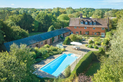
- Price
- Guide Price£1,395,000
- Size
- 1.75 acres
Added on 03/09/2026House with Land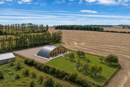
- Price
- Guide Price£1,250,000
- Size
- 1.1 acres
Added on 17/09/2026House with Land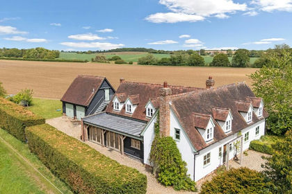
- Price
- Guide Price£1,200,000
- Size
- 1.4 acres
Added on 27/05/2026House with Land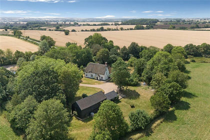
- Price
- Guide Price£1,150,000
- Size
- 8.3 acres
Added on 18/07/2026House with Land
- Price
- Guide Price£1,500,000
- Size
- 1 acres
Chapel Lane, Brockley, Bury St. Edmunds, Brockley, Suffolk IP29 England
Added on 09/04/2026House with Land
- Price
- Guide Price£1,295,000
- Size
- 1.6 acres
Added on 17/06/2026Cottage
- Price
- Guide Price£1,250,000
- Size
- 16.7 acres
Added on 16/04/2026Barn
- Price
- Guide Price£1,150,000
- Size
- 1.15 acres
Stoke By Clare, Sudbury, Suffolk, Stoke-by-Clare, Suffolk CO10 England
Added on 01/09/2026House with Land
- Price
- £1,350,000
- Size
- 8 acres
The Street, Stoke By Clare, Suffolk, Stoke-by-Clare, Suffolk CO10 England
Added on 22/07/2026Equestrian property
- Price
- £1,350,000
- Size
- 8 acres
The Street, Stoke By Clare, Stoke-by-Clare, Suffolk CO10 England
Added on 29/01/2026Equestrian property