Land and Buildings at Mount Pleasant Farm, Winwick
- Land size
- 212.16 acres
Description
Approximately 212.16 acres (85.87 hectares) of Arable Land together with a range of Agricultural Buildings.
SITUATION
The land and buildings at Mount Pleasant Farm are situated to the south of the village of Winwick, Cambridgeshire, with road frontage onto the B660 (Old Weston Road) and Hamerton Road. Winwick is a small village with a village hall and All Saints Church. Great Gidding lies approximately 1½ miles to the north and has a convenience store, village hall, playing field and play park, together with the Fox & Hounds public house.
The property is approximately 7 miles from the popular market town of Oundle, which lies on the banks of the River Nene. Oundle offers a wide variety of places to eat and drink, as well as Oundle School, an array of independent shops and leisure facilities. The cathedral city of Peterborough is situated approximately 15 miles to the north-east of the property, and the market town of Thrapston is approximately 10 miles to the south-west.
The property is well placed for road connections, lying between the A605 to the east, which connects the A1 with the A14 and A45, and the A1(M), which provides access to London and the North. The property is approximately 7 miles from Junction 15 of the A1(M). Peterborough railway station, situated approximately 15 miles away, offers direct services to London King´s Cross in under 50 minutes on the East Coast Main Line, together with direct services to Cambridge, Stansted Airport and Birmingham.
GENERAL
The property comprises a block of predominantly arable land extending to approximately 212.16 acres (85.87 hectares), together with a range of agricultural buildings. It benefits from direct frontage onto the B660 (Old Weston Road) and Hamerton Road, with additional access from Church Lane.
The property is bisected by the B660 (Old Weston Road), with approximately 74.03 acres (29.97 hectares) of arable land lying to the west, and the remaining land and agricultural buildings to the east. The agricultural land extends to approximately 211.02 acres (85.40 hectares), with the remaining 1.14 acres (0.46 hectares) comprising the yard and buildings. The land comprises approximately 208.62 acres (84.43 hectares) of arable land and 2.40 acres (0.97 hectares) of permanent pasture, arranged in sizeable, regularly shaped field parcels. The land occupies a shallow valley, falling gradually towards a brook that runs broadly from east to west.
The land is classified as Grade 3 according to the Agricultural Land Classification maps, and the soil is identified as being loam to clayey loam and clayey loam to silty loam soils with medium to heavy texture.
The property is available for sale as a Whole, or up to three Lots. The lotting of the property is indicative and other sensible lotting options will be considered.
LOT 1 - BUILDINGS AND LAND (COLOURED RED ON PLAN)
Approximately 7.97 acres (3.22 hectares)
Lot 1 comprises a range of traditional Victorian yellow-brick buildings arranged around a courtyard, over which a large steel portal-framed building was subsequently erected, understood to date from the 1970s or 1980s. The buildings extend to approximately 14,350 sq ft in total.
The buildings are currently primarily accessed from Church Lane via a farm track and sit within approximately 1.14 acres (0.46 hectares).
Approximately 6.83 acres (2.76 hectares) of land lie to the west of the buildings and are bounded by mature hedgerows and trees. The land is currently primarily accessed from the B660 (Old Weston Road) via a gated field entrance along its western boundary.
If Lot 1 is sold separately, a right of access will be granted over Lot 1 from the field gate for the benefit of Lot 2.
LOT 2 - ARABLE AND GRASSLAND EAST OF OLD WESTON ROAD (COLOURED BLUE ON PLAN)
Approximately 130.17 acres (52.68 hectares)
In all, approximately 127.77 acres (51.71 hectares) of arable land divided into six good sized field parcels, and approximately 2.40 acres (0.97 hectares) of permanent grassland. The land is bound by a mix of mature hedgerows and trees and a brook dissects the land running from east to west. Lot 2 has extensive road frontage with numerous access points off the B660 (Old Weston Road) and Hamerton Road.
If Lot 2 is sold separately, a right of access will be granted over Lot 1 from the field gate for the benefit of Lot 2.
LOT 3 - ARABLE LAND WEST OF OLD WESTON ROAD (COLOURED GREEN ON PLAN)
Approximately 74.03 acres (29.97 hectares)
Lot 3 comprises approximately 74.03 acres (29.97 hectares) of arable land divided into two sizeable field parcels, bounded by a mix of mature hedgerows and trees. The lot benefits from extensive road frontage and access points onto Old Weston Road, which forms the north-eastern and southeastern boundaries of the land.
GENERAL INFORMATION
Method of Sale
The property is offered for sale by Private Treaty as a Whole or in up to three Lots. The lotting of the property is indicative and other sensible lotting options will be considered.
Tenure and Possession
The yard and buildings are offered for sale with vacant possession on completion. The remainder of the property is offered for sale subject to an existing Farm Business Tenancy. A notice to quit has been served to terminate the tenancy on 28 September 2027, when vacant possession will be available. Further details are available from the Seller´s Agent upon request.
Services
The buildings within Lot 1 are connected to mains water. The supply is currently shared with the neighbouring Farmhouse and Granary and will need to be separated.
The buildings are served by an overhead electricity connection, although the supply is currently disconnected. The Buyer will be responsible for arranging reinstatement of the supply if required.
Environmental Schemes
The majority of the arable land and adjoining hedgerows are currently included in a Sustainable Farming Incentive agreement. The agreement is not transferable and will expire before the Farm Business Tenancy ends.
Planning and Local Authority
The property is located within the administrative boundaries of Huntingdonshire District Council.
Easements, Wayleaves, Covenants and Rights of Way
The property is sold subject to and with the benefit of all existing wayleaves, easements and rights of way, whether public or private, light, sport, drainage, water, electricity supplies and any other rights, obligations, easements and quasi easements, whether specifically mentioned or not.
A public footpath runs through the land from north to south and along the western boundary, and a public bridleway runs along the southern boundary affecting Lot 1 and 2. A further public footpath crosses over Lot 3 from east to west.
An overhead electricity line crosses part of the property within Lot 2, running broadly parallel with Hamerton Road, and across field parcel NG 5140 to Old Weston Road, which we understand is held under an annual wayleave agreement.
An underground gas pipeline crosses field parcel NG 2398 within Lot 2. It is understood that the pipeline was installed in 1997, which we assume is held under a legal easement.
An underground Anglian Water water pipe crosses through Lot 2 from the pumping station on the northern boundary and continues through field NG 7826. It then continues along the eastern boundary of field NG 2859 and diagonally across field NG 4845 within Lot 3. We understand the pipe was installed under the Notice provisions of the Water Industry Act 1991.
If Lot 1 is sold separately from Lot 2, the Buyer of Lot 1 will be required to erect a suitable fence along the boundary between the two lots.
Outgoings
The property is subject to Drainage Charges.
Restrictive Covenant
The steel portal-framed building within Lot 1 is subject to an existing restrictive covenant prohibiting its development for a period of 10 years from 30th July 2026. This only applies to the steel portal-framed building in the centre of the traditional buildings, and does not apply to the traditional buildings or the surrounding land.
There is no Overage Agreement over the property.
Sporting, Timber and Mineral Rights
We understand that the sporting, mineral and timber rights are included within the freehold interest, insofar as they are owned.
Boundaries
The Buyer(s) will be deemed to have inspected the property and satisfied themselves as to the ownership of any boundary, hedge, tree or ditch.
VAT
Should the sale of the property or rights attached to the sale become a chargeable supply for the purpose of VAT, such tax will be paid by the Buyer(s) in addition to the purchase price.
Nearest Postcode and What3Words
The nearest postcode for the property is PE28 5PS. The property can be found more precisely using the What3Words mapping system reference of: ///olive.cackling.corn
Plans, Areas and Schedules
Plans included or attached to these particulars are based upon the Ordnance Survey Maps copyright reserved. All plans are not to scale.
Viewings
All viewings are strictly by appointment only through the Seller´s Agent, Henry H Bletsoe and Son LLP. Please contact Bletsoes on to arrange a viewing of the Property.
Health and Safety
Given the potential hazards of a working farm, we ask you to be as vigilant as possible when making your inspection, for your own personal safety, particularly around farm buildings and machinery. It is asked that you observe any specific signage on the property.
Measurements and Other Information
All measurements are approximate. While we endeavour to make our Sales Particulars accurate and reliable, if there is a point which is of particular importance please do contact the Seller´s Agent, Henry H Bletsoe and Son LLP, who will be pleased to check the information for you, particularly if you are contemplating travelling some distance to view the property.
Anti Money Laundering Regulations
Buyer(s) will be required to provide proof of identity and address to the Seller´s Agent following acceptance of an offer (subject to contract) and prior to Solicitors being instructed.
Map Location
Property details
- Tenure
- Freehold
- Council Tax Band
- Ask Agent
- Date Posted
- 2026-09-24
Market Value Analysis
Compared with 22 Farmland & Pasture listings in East Anglia (100+ acres).
Utilities & Restrictions
Utilities
- Electricity
- Ask Agent
- Water
- Ask Agent
- Heating
- Ask Agent
- Broadband
- Ask Agent
- Sewerage
- Ask Agent
Rights & Restrictions
- Public Rights of Way
- Ask Agent
- Private Rights of Way
- Ask Agent
- Listed Property
- Ask Agent
- Restrictions
- Ask Agent
Listed status, conservation areas and planning constraints for this location are in the full report.
Property Features
- Accessibility
- Ask Agent
- Parking
- Ask Agent
- Garden
- Garden
Beyond the particulars: planning activity, flood history, heritage and ground risks, checked for this exact spot.
Connectivity
Broadband
Fastest speed available at this postcode
76 Mbps
Superfast
Suitable for
- HD streaming
- Video calls
- Web & social
Mobile signal
Predicted 4G and 5G signal; indoor signal depends on building materials.
Ofcom Connected Nations postcode-level predictions. Speeds and signal are modelled, not measured, and vary between addresses and providers.
Signal is the easy part. Planning activity, flood history and protected designations here are in the full report.
Nearest Schools
Primary
- Brington CofE Primary School3.3 milesNo Ofsted rating
- Ages
- 4 to 11
- Pupils
- 94
- Type
- Voluntary controlled school
- Faith
- Church of England
- Sawtry Infants' School4.1 milesOfsted: Good *
- Ages
- 4 to 7
- Pupils
- 211
- Type
- Community school
- Sawtry Junior Academy4.1 milesOfsted: Good
- Ages
- 7 to 11
- Pupils
- 274
- Type
- Academy converter
- Polebrook Church of England Primary School4.7 milesNo Ofsted rating
- Ages
- 5 to 11
- Pupils
- 70
- Type
- Academy converter
- Faith
- Church of England
- Spaldwick Primary School5.1 milesOfsted: Good *
- Ages
- 4 to 11
- Pupils
- 104
- Type
- Academy converter
Secondary
- Sawtry Village Academy4.4 milesNo Ofsted rating
- Ages
- 11 to 18
- Pupils
- 1,101
- Type
- Academy converter
- Prince William School5.8 milesOfsted: Good
- Ages
- 11 to 18
- Pupils
- 1,416
- Type
- Academy sponsor led
- Manor School8.1 milesOfsted: Inadequate
- Ages
- 11 to 19
- Pupils
- 851
- Type
- Academy converter
- Hinchingbrooke School9.3 milesOfsted report card · May 2026
- Ages
- 11 to 18
- Pupils
- 2,173
- Type
- Academy converter
- St Peter's School9.5 milesOfsted report card · May 2026
- Ages
- 11 to 18
- Pupils
- 1,506
- Type
- Academy converter
* Latest graded judgement covers quality of education only; no overall grade was issued under the 2024-25 inspection framework.
Distances are straight-line from the advertised location. Source: the national school registers (DfE, Welsh Government, Scottish Government) and Ofsted.
Schools are just the start: sold prices nearby, planning activity and any flood history are in the full report.
Amenities
Supermarket
GP surgery
Pharmacy
Hospital
Straight-line distances from the advertised location. Sources: NHS records, Geolytix supermarket locations, OS Open Greenspace and the national trails registers.
The area stacks up? Now check the location itself: planning nearby, protected designations and past flooding.
Getting Around
Nearest station
Nearest bus stop
Typical drive times
Straight-line distances from the advertised location; drive times are typical free-flow times over OpenStreetMap road data, so allow more at peak. Public transport locations from DfT NaPTAN.
Easy to reach matters. So do planning activity, flood history and ground risks: all in the full report.
Flood Risk
Environment Agency open data, checked around the advertised map pin for the listed acreage. Long-term risk counts flood defences; the planning map's flood zones do not. Provided by LandSale, not the listing agent, and not part of the agent's particulars. Risk varies across a holding, so verify before committing.
Rivers and the sea
Not at the pin: mapped about 440 metres away.
Planning map: Flood Zone 3, about 360 metres away.
Surface water
Not at the pin: mapped about 30 metres away.
These bandings are the summary. Where this location sits on the flood maps, plus planning activity, heritage and ground risks, is in the full report.
Important notice: Information, maps and tags on this page are drawn from the advertising agent's marketing materials or generated automatically. LandSale has not verified them. Relying on these details is at your own risk, always carry out independent checks before committing to a purchase.
LandSale full disclaimer
Marketing information only - not formal particulars. The details on this website are provided for general guidance and do not constitute an offer or contract. Neither LandSale nor the advertising estate/land agent accepts responsibility for any inaccuracy.
1. Source of information
- Listing content: Core description, asking price, tenure, measurements, photographs and planning history originate from the marketing materials of the advertising estate or land agent. LandSale does not author this content and cannot guarantee its accuracy.
- Automated tags & categorisation: Property type, land-use class, acreage bands and similar labels may be applied by machine-learning models. They are intended as a helpful guide only and may not reflect the property's legal status or permitted use.
- Third-party & enriched data layers: Maps, boundary outlines, planning designations, soil reports, broadband coverage and other environmental or location-based insights are licensed from external suppliers. Such data are supplied “as is", may be incomplete or out of date and are subject to change without notice.
2. Verification required
Prospective purchasers must verify critical matters, including but not limited to planning permission, title boundaries, public rights of way, environmental constraints, acreage, services, access and VAT status, through their own inspections, specialist surveys, legal advisers and the selling agent before relying on the information or entering into any contract.
3. No warranty or liability
LandSale gives no warranty, express or implied, as to the accuracy, completeness or fitness for any particular purpose of the information displayed. LandSale shall not be liable for any loss, damage, cost or expense arising directly or indirectly from any use of or reliance on such information, save where liability may not be excluded by law.
4. Updates & feedback
If you believe any detail on this listing is inaccurate, please let us know. We will investigate and, where appropriate, update the listing or notify the agent.
© LandSale | Version 1.3 - August 2026
Listing agent
Bletsoes, Thrapston
Oakleigh House, High Street, Thrapston, NN14 4LJ
Similar properties for sale
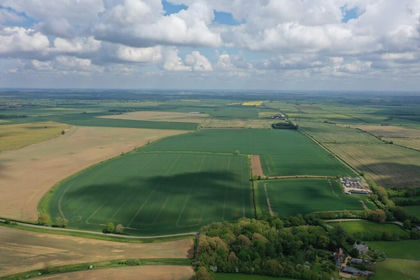
- Price
- Guide Price£1,915,000
- Size
- 210.07 acres
Added on 31/05/2026Farmland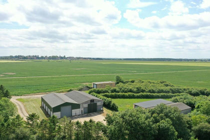
- Price
- Guide Price£1,500,000
- Size
- 135.76 acres
Added on 29/01/2026Farmland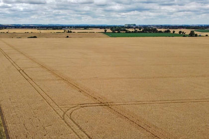
- Price
- Guide Price£1,600,000
- Size
- 152.91 acres
Willington, Bedford, Bedfordshire, Willington, Bedford MK44 England
Added on 15/07/2026Farm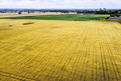
- Price
- Guide Price£2,375,000
- Size
- 220 acres
Willington, Bedford, Bedfordshire, Willington, Bedford MK44 England
Added on 15/07/2026Farm
- Price
- Guide Price£1,378,000
- Size
- 164.07 acres
Cow Croft Field Farm, Marshland St. James, Norfolk PE14 England
Added on 17/05/2026Farmland
- Price
- Guide Price£1,350,000
- Size
- 79.89 acres
Added on 24/09/2026Agricultural Land
- Price
- Guide Price£2,875,000
- Size
- 338.13 acres
Lot 8 - Land Nr Kirtling And Ashley, Kirtling, Cambridgeshire CB8 England
Added on 01/09/2026Farmland
- Price
- Guide Price£1,865,000
- Size
- 150.21 acres
Church Lawford, Rugby, CV23, Church Lawford, Warwickshire CV23 England
Added on 10/05/2026Farm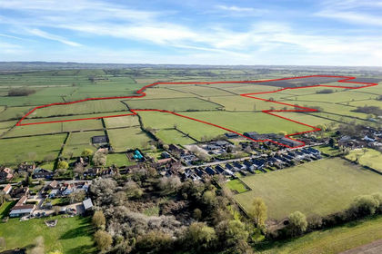
- Price
- Guide Price£2,000,000
- Size
- 213.99 acres
Land and Buildings at Ivy Farm, Kinoulton, Nottinghamshire, Kinoulton, Nottinghamshire NG12 England
Added on 15/03/2026Farmland
- Price
- Guide Price£1,350,000
- Size
- 143.46 acres
Added on 04/09/2026Farmland