Nenthorn, Kelso, Scottish Borders
- Land size
- 12 acres
- Bedrooms
- 6
- Bathrooms
- 5
Description
Burnbrae Holidays, originated in 2000, is a unique, and well established holiday cottage business comprising a characterful 3 bedroom self-catering former mill, three 1 bedroom self-catering cottages and an array of out buildings which offer development potential for further accommodation, all set within circa 12 acres of mature pasture.
Burnbrae Mill the largest of the four properties offers flexible family or group accommodation, with the ground floor incorporating two south facing reception rooms - namely a south facing conservatory with far reaching views and the cosy sitting room with wood burning stove, a well equipped dining kitchen, utility & laundry space, a WC, small office and versatile studio. Historically the studio has been utilised for a number of uses including a classroom, further accommodation with licence permission and even a chiropractor practise offering an additional income stream. Three bedrooms can be found on the first floor, one principal with an ensuite shower room, a double and a single with a further bathroom.
There are three one bedroom cottages, ideal for couples, friends or solo travellers. Each cottage comprises their own fully fitted kitchen, lounge with wood burning stove, beautiful conservatory, double/twin bedroom and bathroom. The cottages offer privacy from other guest whilst still being able to enjoy views over the paddock fields, the Eden Water and Cheviot Hills in the distance. Each cottages has its own private south facing patio and access to the further shared garden area.
Externally, Burnbrae Holidays sits within mature gardens and grounds planted with a selection of shrubbery, trees and flowers attracting a wide assortment of wildlife including a number of birds and a pair of barn owls who have nested for the last 3 years. Further to the external boundary is several large paddock fields which are currently let to the local riding school providing another steady income. Running parallel to the side of these paddocks is the Eden Water and in one of the fields, Mungos Well, a woodland has been planted by the current owners to enhance wildlife habitats and assist wood harvesting for the stoves.
Burnbrae benefits from numerous ancillary outbuildings, including a boat store, a bike store, wood store, car port, boiler house, barn with workshop and byre shed. With relevant planning consents these have the potential to be developed into additional accommodation, an extension from the main Burnbrae Mill or Kelso's very first Bunk House. They do currently offer excellent storage for the cottages and Mill with ample off street parking for all accommodation being a further bonus.
The business prioritises energy efficiency with a large biomass pellet boiler serving the main house and three cottages, along with a row of solar panels and EV car charging. The Biomass boiler has the capacity to heat and provide hot water to additional accommodation if further development takes place.
This is a rare opportunity to acquire a substantial and productive commercial business with 5 star reviews and a 50% return rate. The property’s peaceful position enjoys stunning rural views over the rolling countryside while remaining conveniently placed just a short drive from the centre of Kelso with its array of local amenities and shops, ideal for holiday makers or travellers.
For further holiday cottage details, see below a link to the business website.
Accounts for the business will be made available to seriously interested parties.
EPC Rating - C
Burnbrae Mill Council Tax Band - F
Cottages rateable value - £2,200
Tenure - Freehold
Viewings by appointment via Rettie Borders.
EPC Rating: C
Council Tax Band: F
Map Location
Property details
- Tenure
- Freehold
- Council Tax Band
- F
- Date Posted
- 2026-09-24
Market Value Analysis
Compared with 6 Holiday Lets listings in Scotland (1+ acres).
Energy Performance Certificate
Energy Efficiency Rating
Based on UK Energy Performance Certificate standards (EU Directive 2002/91/EC)
Running costs are one side. Planning activity, flood history and ground risks for this location are in the full report.
Utilities & Restrictions
Utilities
- Electricity
- Ask Agent
- Water
- Ask Agent
- Heating
- Ask Agent
- Broadband
- Ask Agent
- Sewerage
- Ask Agent
Rights & Restrictions
- Public Rights of Way
- Ask Agent
- Private Rights of Way
- Ask Agent
- Listed Property
- Ask Agent
- Restrictions
- Ask Agent
Listed status, conservation areas and planning constraints for this location are in the full report.
Property Features
- Accessibility
- Ask Agent
- Parking
- Parking Available
- Garden
- Garden
Beyond the particulars: planning activity, flood history, heritage and ground risks, checked for this exact spot.
Connectivity
Broadband
Fastest speed available at this postcode
1.8 Gbps
Gigabit full fibre · available to 79% of premises
Suitable for
- 4K streaming on every screen
- Full-time home working
- Online gaming & big downloads
Fixed wireless access may also be an option here.
Mobile signal
Predicted 4G and 5G signal; indoor signal depends on building materials.
Ofcom Connected Nations postcode-level predictions. Speeds and signal are modelled, not measured, and vary between addresses and providers.
Signal is the easy part. Planning activity, flood history and protected designations here are in the full report.
Nearest Schools
Primary
- Edenside Primary School3.2 miles
- Pupils
- 258
- Type
- Non-denominational
- Broomlands Primary School3.2 miles
- Pupils
- 249
- Type
- Non-denominational
- Ednam Primary School3.3 miles
- Pupils
- 43
- Type
- Non-denominational
- Gordon Primary School4.4 miles
- Pupils
- 48
- Type
- Non-denominational
- Sprouston Primary School4.5 miles
- Pupils
- 13
- Type
- Non-denominational
Secondary
- Kelso High School2.8 miles
- Pupils
- 592
- Type
- Non-denominational
- Earlston High School6.3 miles
- Pupils
- 1,090
- Type
- Non-denominational
- Jedburgh Grammar School10 miles
- Pupils
- 381
- Type
- Non-denominational
- Berwickshire High School12 miles
- Pupils
- 574
- Type
- Non-denominational
- Galashiels Academy12 miles
- Pupils
- 874
- Type
- Non-denominational
Distances are straight-line from the advertised location. Source: the national school registers (DfE, Welsh Government, Scottish Government) and Ofsted.
Schools are just the start: planning activity, heritage and any flood history here are in the full report.
Amenities
Supermarket
GP surgery
Pharmacy
Straight-line distances from the advertised location. Sources: NHS records, Geolytix supermarket locations, OS Open Greenspace and the national trails registers.
The area stacks up? Now check the location itself: planning nearby, protected designations and past flooding.
Getting Around
Nearest station
Nearest bus stop
Typical drive times
Straight-line distances from the advertised location; drive times are typical free-flow times over OpenStreetMap road data, so allow more at peak. Public transport locations from DfT NaPTAN.
Easy to reach matters. So do planning activity, flood history and ground risks: all in the full report.
Flood Risk
SEPA open data, checked around the advertised map pin for the listed acreage. Provided by LandSale, not the listing agent, and not part of the agent's particulars. Risk varies across a holding, so verify before committing.
Rivers and the sea
Not at the pin: mapped about 50 metres away.
Surface water
Not at the pin: mapped about 10 metres away.
These bandings are the summary. Where this location sits on the flood maps, plus planning activity, heritage and ground risks, is in the full report.
Important notice: Information, maps and tags on this page are drawn from the advertising agent's marketing materials or generated automatically. LandSale has not verified them. Relying on these details is at your own risk, always carry out independent checks before committing to a purchase.
LandSale full disclaimer
Marketing information only - not formal particulars. The details on this website are provided for general guidance and do not constitute an offer or contract. Neither LandSale nor the advertising estate/land agent accepts responsibility for any inaccuracy.
1. Source of information
- Listing content: Core description, asking price, tenure, measurements, photographs and planning history originate from the marketing materials of the advertising estate or land agent. LandSale does not author this content and cannot guarantee its accuracy.
- Automated tags & categorisation: Property type, land-use class, acreage bands and similar labels may be applied by machine-learning models. They are intended as a helpful guide only and may not reflect the property's legal status or permitted use.
- Third-party & enriched data layers: Maps, boundary outlines, planning designations, soil reports, broadband coverage and other environmental or location-based insights are licensed from external suppliers. Such data are supplied “as is", may be incomplete or out of date and are subject to change without notice.
2. Verification required
Prospective purchasers must verify critical matters, including but not limited to planning permission, title boundaries, public rights of way, environmental constraints, acreage, services, access and VAT status, through their own inspections, specialist surveys, legal advisers and the selling agent before relying on the information or entering into any contract.
3. No warranty or liability
LandSale gives no warranty, express or implied, as to the accuracy, completeness or fitness for any particular purpose of the information displayed. LandSale shall not be liable for any loss, damage, cost or expense arising directly or indirectly from any use of or reliance on such information, save where liability may not be excluded by law.
4. Updates & feedback
If you believe any detail on this listing is inaccurate, please let us know. We will investigate and, where appropriate, update the listing or notify the agent.
© LandSale | Version 1.3 - August 2026
Listing agent
Rettie, Melrose
1 Abbey Street, Melrose, TD6 9PX
Similar properties for sale
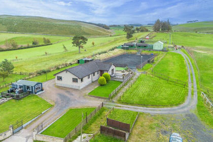
- Price
- Offers in Region of£725,000
- Size
- 10 acres
Ashkirk, Selkirk, Berwickshire, Roxburgh and Selkirk, Scottish Borders TD7 Scotland
Added on 29/01/2026Equestrian property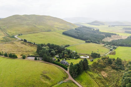
- Price
- Offers Over£625,000
- Size
- 10 acres
Added on 18/09/2026House with Land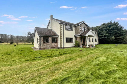
- Price
- £720,000
- Size
- 6 acres
Haugh Head, Wooler, Northumberland, NE71, Wooler, Northumberland NE71 England
Added on 29/01/2026House with Land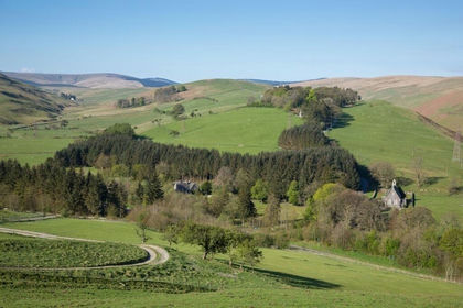
- Price
- Offers Over£895,000
- Size
- 6 acres
Added on 18/04/2026House with Land
- Price
- Offers Over£935,000
- Size
- 6.4 acres
Milton Bridge, Penicuik, Midlothian, Midlothian, Midlothian EH26 Scotland
Added on 04/07/2026House with Land
- Price
- Offers Over£650,000
- Size
- 8 acres
Added on 22/07/2026House with Land
- Price
- Offers Over£850,000
- Size
- 166 acres
Added on 26/08/2026Farmland
- Price
- Offers Over£900,000
- Size
- 263 acres
Added on 26/08/2026Farm