Aston Magna, Moreton-In-Marsh, Gloucestershire, GL56
- Bedrooms
- 5
- Bathrooms
- 3
Description
Architecture & History
Originally a medieval chapel served the community of Aston Magna but after falling into disrepair during the mid 1600’s, it was abandoned. A replacement place of worship, “The Church of St John The Evangelist”, was established in 1843. Commissioned entirely at his own expense by John Thomas Freeman-Mitford, the 2nd Baron Redesdale of Batsford Park. It was something of a ground breaking design of its time, the construction reflecting the style of earlier Norman churches rather than the more customary early Victorian styles.
Eventually, “The Old Church” as it became known was de-consecrated in 1979, gaining listed status in Aug 1983, with its conversion to a residential family home taking place in the early 90's. During this period, it served as a commercial studio space used to build sets for the Dr Who TV series along with other BBC shows.
And now, this unique and imposing building sits very much in the family home category with just over 2800 sq. ft of internal floor area available as well as additional space within the clock tower and a purpose-built triple garage set within the grounds.
The lobbied entrance, with its time worn flagstone floor, is positioned between two gothic arched doors leading to the base of the principal stairwell naturally illuminated courtesy of the huge light well sitting overhead. A guest WC sits to the right of the entrance door as you enter.
Beyond a wooden door lies one of the two generously proportioned reception rooms, retaining exposed stone pillars and crowned by a substantial timber beam. A contemporary wood-burning stove provides a handsome focal point.
From the central hall, solid-wood herringbone parquet flooring, richly patinated with age, continues into the well-proportioned kitchen-diner, which forms the heart of the home. A substantial AGA provides a rustic visual anchor, while the church clock face, mounted on the wall above the worktop, forms another striking feature and serves as a reminder of the building’s ecclesiastical origins. The ample scale of this room creates an inviting environment for gatherings and convivial occasions.
Pass through the kitchen & double doors open to a second and equally well proportioned, light filled reception with wood burning stove.
A second stairwell sits opposite the second reception room, at the base of the clock tower. At ground level, this area is given over to a generous and highly practical utility room. From here, a spiral staircase winds upwards, passing a shower room on the first floor before culminating in a viewing platform at the very top. With panoramic views across the surrounding countryside, it is a natural spot for quiet contemplation, a home office or a reading snug.
A collection of five bedrooms along with three bathrooms (two of which are en-suite) sit either side of the central hallway on the first floor, all of which enjoy the volume afforded by the vaulted ceilings which stretch to the central apex of what would once been the roof interior of the church.
The scale and proportions of this unique space are unlike anything found in a regular home, making it a compelling purchase for those seeking a complete one-of-a-kind family home.
The Old Church sits comfortably in the centre of its own grounds surrounded by formal & landscaped garden areas, sun trapped patio area, part of the original graveyard plus a paddock which lays home to the relatively new triple garage with its boarded loft room used very much as a private hideaway for kids and teenagers. A lengthy gravel drive from the street entrance leads to a parking area which will comfortably hold around five cars.
Local Area & Transport
Despite its rural feel, Aston Magna is well served by amenities: good schools (Chipping Camden School is just 3.5 miles distant), respected healthcare, farmers’ markets, festivals and cultural events. There is an active social scene centred around village halls, local clubs, country shows and seasonal activities. For families and professionals, this mix of quiet surroundings and accessible services makes everyday life comfortable without losing the sense of being “in the country”. Stratford-upon-Avon and Cheltenham are 20 & 40 mins away respectively, by car.
The region is within relatively easy reach of major cities, with good road links connecting to Oxford, Birmingham, Bristol and the M4/M5 corridors. Mainline rail services are plentiful, with Moreton-in-Marsh (only a five minute car ride away) offering regular trains to Oxford (~40 mins) and London Paddington (~90 mins) from the local station, alongside its extensive array of retail outlets, coffee shops and restaurants. With nearby Stratford Upon Avon, Banbury, Kemble and Stroud also offering direct trains to desirable destinations, the Cotswolds are viable for commuting and for maintaining professional and social ties in larger urban centres while enjoying living in a rural setting.
Visitor hot spots and attractions include, Soho House, Daylesford Organic, Stratford-Upon-Avon (Shakespeare's birthplace, the RSC theatre), Snowshill Manor, Chipping Norton & Longborough Opera House.
Just off the A44 at Bourton-on-the-Hill, Bourton Woods offers something a little unusual in the Cotswolds: the chance to walk through a privately owned, working woodland that is also a designated wildlife reserve. Part of the Batsford Estate, the wood is managed both for sustainable timber production and for conservation, giving it a layered character that appeals to walkers, nature lovers and anyone curious about how modern estates balance use and protection of the land. batsfordestate.co
Unlike many large private estates, Bourton Woods actively invites the public. Annual walking permits are available, allowing visitors to explore an extensive network of paths through mixed woodland without the crowds often found in more commercial forests. The result is a quiet, contemplative experience: mature trees, varied understorey and a sense of stepping into a landscape that feels both managed and wild.
Material Information
- Property construction: Traditional Brick
- Heating type: LPG (Liquid Propane Gas) Central Heating
- Utilities: LPG, electricity, water & broadband
- Gas Supply: Liquid Propane Gas supplied to an external tank situated on the property, delivered (and maintained/repaired if needed) by the supplier Flogas.
- Electricity supply: Independently provided by EDF Energy
- Water supply: Mains connected via Thames Water
- Sewerage: Septic tank
- Broadband: [Standard Download speed 3mbps; Upload Speed 0.5mbps. Ultrafast available (d/s & u/s 1000Mbps). Source: Ofcom
- Mobile signal/coverage: Likely external cover on all major networks. Likely very limited to no internal cover on any major networks. Source: Ofcom
- Building safety: None known at time of listing
- Restrictions: Grade II Listed – Listing No 1088639
- Rights and easements: Public right of way to adjoining graveyard.
- Flood risk: Very low risk of any type of flooding. Source: uk
- Planning permission: None known at time of listing. Source: uk
- Accessibility/adaptations: Not suitable for wheelchair users
- Coalfield or mining area: No. Source: The Coal Authority
- Flight path: not directly.
Map Location
Property details
- Tenure
- Freehold
- Council Tax Band
- G
- Date Posted
- 2026-09-25
Energy Performance Certificate
Energy Efficiency Rating
Based on UK Energy Performance Certificate standards (EU Directive 2002/91/EC)
Running costs are one side. Planning activity, flood history and ground risks for this location are in the full report.
Utilities & Restrictions
Utilities
- Electricity
- Mains
- Water
- Ask Agent
- Heating
- Gas Central Heating
- Broadband
- Full Fibre (FTTP)
- Sewerage
- Septic Tank / Private
Rights & Restrictions
- Public Rights of Way
- Ask Agent
- Private Rights of Way
- Ask Agent
- Listed Property
- Yes
- Restrictions
- Yes
Listed status, conservation areas and planning constraints for this location are in the full report.
Property Features
- Accessibility
- No Wheelchair Access
- Parking
- Garage
- Garden
- Private Garden
Beyond the particulars: planning activity, flood history, heritage and ground risks, checked for this exact spot.
Connectivity
Broadband
Fastest speed available at this postcode
1 Gbps
Gigabit full fibre
Suitable for
- 4K streaming on every screen
- Full-time home working
- Online gaming & big downloads
Mobile signal
Predicted 4G and 5G signal; indoor signal depends on building materials.
Ofcom Connected Nations postcode-level predictions. Speeds and signal are modelled, not measured, and vary between addresses and providers.
Signal is the easy part. Planning activity, flood history and protected designations here are in the full report.
Nearest Schools
Primary
- St David's Church of England Primary School2.1 milesOfsted report card · Nov 2025
- Ages
- 4 to 11
- Pupils
- 256
- Type
- Academy converter
- Faith
- Church of England
- Blockley Church of England Primary School2.3 milesOfsted: Good
- Ages
- 5 to 11
- Pupils
- 148
- Type
- Academy converter
- Faith
- Church of England
- St James and Ebrington Church of England Primary School3.6 milesOfsted report card · Mar 2026
- Ages
- 2 to 11
- Pupils
- 149
- Type
- Academy converter
- Faith
- Church of England
- St Catharine's Catholic Primary School3.8 milesOfsted: Good
- Ages
- 5 to 11
- Pupils
- 114
- Type
- Academy converter
- Faith
- Roman Catholic
- Longborough Church of England Primary School4 milesOfsted report card · Jan 2026
- Ages
- 2 to 11
- Pupils
- 36
- Type
- Academy converter
- Faith
- Church of England
Secondary
- Chipping Campden School3.8 milesOfsted: Good *
- Ages
- 11 to 18
- Pupils
- 1,465
- Type
- Academy converter
- Shipston High School4.5 milesOfsted: Good
- Ages
- 11 to 16
- Pupils
- 526
- Type
- Academy converter
- Chipping Norton School9.1 milesOfsted: Good *
- Ages
- 11 to 18
- Pupils
- 1,035
- Type
- Academy converter
- The Cotswold Academy9.2 milesOfsted: Outstanding *
- Ages
- 11 to 18
- Pupils
- 1,564
- Type
- Academy converter
- Blackminster Middle School10 milesOfsted: Requires improvement
- Ages
- 10 to 13
- Pupils
- 217
- Type
- Community school
* Latest graded judgement covers quality of education only; no overall grade was issued under the 2024-25 inspection framework.
Distances are straight-line from the advertised location. Source: the national school registers (DfE, Welsh Government, Scottish Government) and Ofsted.
Schools are just the start: sold prices nearby, planning activity and any flood history are in the full report.
Amenities
Supermarket
GP surgery
Pharmacy
Hospital
Green space
Straight-line distances from the advertised location. Sources: NHS records, Geolytix supermarket locations, OS Open Greenspace and the national trails registers.
The area stacks up? Now check the location itself: planning nearby, protected designations and past flooding.
Getting Around
Nearest station
Nearest bus stop
Typical drive times
Straight-line distances from the advertised location; drive times are typical free-flow times over OpenStreetMap road data, so allow more at peak. Public transport locations from DfT NaPTAN.
Easy to reach matters. So do planning activity, flood history and ground risks: all in the full report.
Flood Risk
Environment Agency open data, checked around the advertised map pin for the listed acreage. Long-term risk counts flood defences; the planning map's flood zones do not. Provided by LandSale, not the listing agent, and not part of the agent's particulars. Risk varies across a holding, so verify before committing.
Rivers and the sea
Planning map: Flood Zone 1.
Surface water
Not at the pin: mapped about 20 metres away.
These bandings are the summary. Where this location sits on the flood maps, plus planning activity, heritage and ground risks, is in the full report.
Important notice: Information, maps and tags on this page are drawn from the advertising agent's marketing materials or generated automatically. LandSale has not verified them. Relying on these details is at your own risk, always carry out independent checks before committing to a purchase.
LandSale full disclaimer
Marketing information only - not formal particulars. The details on this website are provided for general guidance and do not constitute an offer or contract. Neither LandSale nor the advertising estate/land agent accepts responsibility for any inaccuracy.
1. Source of information
- Listing content: Core description, asking price, tenure, measurements, photographs and planning history originate from the marketing materials of the advertising estate or land agent. LandSale does not author this content and cannot guarantee its accuracy.
- Automated tags & categorisation: Property type, land-use class, acreage bands and similar labels may be applied by machine-learning models. They are intended as a helpful guide only and may not reflect the property's legal status or permitted use.
- Third-party & enriched data layers: Maps, boundary outlines, planning designations, soil reports, broadband coverage and other environmental or location-based insights are licensed from external suppliers. Such data are supplied “as is", may be incomplete or out of date and are subject to change without notice.
2. Verification required
Prospective purchasers must verify critical matters, including but not limited to planning permission, title boundaries, public rights of way, environmental constraints, acreage, services, access and VAT status, through their own inspections, specialist surveys, legal advisers and the selling agent before relying on the information or entering into any contract.
3. No warranty or liability
LandSale gives no warranty, express or implied, as to the accuracy, completeness or fitness for any particular purpose of the information displayed. LandSale shall not be liable for any loss, damage, cost or expense arising directly or indirectly from any use of or reliance on such information, save where liability may not be excluded by law.
4. Updates & feedback
If you believe any detail on this listing is inaccurate, please let us know. We will investigate and, where appropriate, update the listing or notify the agent.
© LandSale | Version 1.3 - August 2026
Listing agent
Unique Property Company, Unique Property Company
Unit 17 The Gransden, 39 Gransden Avenue, London E8 3QA
Contact Unique Property Company, Unique Property Company
Unit 17 The Gransden, 39 Gransden Avenue, London E8 3QA
View agent profileSimilar properties for sale
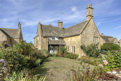
- Price
- Guide Price£950,000
Church Street, Weston-Subedge, Gloucestershire, GL55, Weston Subedge, Gloucestershire GL55 England
Added on 10/09/2026Residential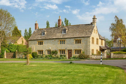
- Price
- Guide Price£1,375,000
- Size
- 1.16 acres
Honington, Shipston-on-Stour, Warwickshire, CV36, Honington, Warwickshire CV36 England
Added on 17/05/2026House with Land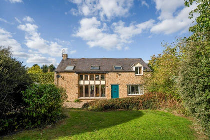
- Price
- Guide Price£950,000
- Size
- 0.59 acres
Stourton, Shipston-on-Stour, Warwickshire, CV36, Stourton, Warwickshire CV36 England
Added on 29/01/2026Barn Conversion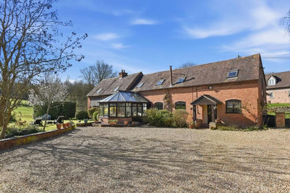
- Price
- Offers in Region of£995,000
- Size
- 0.5 acres
Crimscote, Stratford-upon-Avon, Whitchurch, Warwickshire CV37 England
Added on 22/06/2026Barn Conversion
- Price
- Guide Price£850,000
Stanway Road, Stanton, Gloucestershire, WR12, Stanton, Gloucestershire WR12 England
Added on 24/08/2026Barn Conversion
- Price
- Guide Price£1,175,000
- Size
- 0.2 acres
Wyre Lane, Long Marston, CV37, Long Marston, Warwickshire CV37 England
Added on 29/05/2026Barn Conversion
- Price
- £1,250,000
- Size
- 0.5 acres
Church Street, Bledington, OX7, Bledington, Gloucestershire OX7 England
Added on 28/06/2026Barn Conversion
- Price
- Guide Price£850,000
- Size
- 7 acres
Bretforton Road, Badsey, Evesham, Worcestershire, WR11, Badsey, Worcestershire WR11 England
Added on 13/05/2026Equestrian property
- Price
- £975,000
- Size
- 2.4 acres
Dorsington, Stratford Upon Avon, Warwickshire, CV37, Dorsington, Warwickshire CV37 England
Added on 19/09/2026House with Land
- Price
- £1,000,000
- Size
- 2.16 acres
Manor House, Cleeve Prior Manor, WR11, Cleeve Prior, Worcestershire WR11 England
Added on 24/08/2026House with Land