Land at Wilby, Norfolk
- Land size
- 170.64 acres
Key Features
- Approximately 170.64 acres of arable land, grassland and water meadows
- Attractive ring-fenced holding
- Former farmhouse site and adjoining orchard
- Productive Grade 3 and Grade 4 farmland
- Environmental and natural capital opportunities
- Excellent access to the A11
- Available as a whole or in up to two lots
Description
Lot 1: 10.71 acres (4.33 ha) - Former Farmhouse & Land
Guide Price: £210,000
Lot 2: 159.93 acres (64.72 ha) - Land
Guide Price: £1,040,000
In all, about 170.64 acres (69.06 hectares)
Offers in the region of £1,250,000
The property is offered for sale by Private Treaty as a whole or in up to two lots.
DESCRIPTION
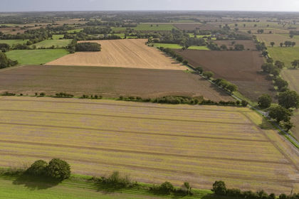
Land at Wilby extends to about 170.64 acres (69.06 hectares) and comprises a ring-fenced block of arable land, permanent grassland and water meadows, interspersed with pockets of established woodland, in a highly accessible yet attractive rural position.
The arable land, extending to approximately 85.48 acres, is laid out in three large, easily worked fields well suited to modern arable machinery, and is farmed by the Vendor's farming partnership within a rotation of winter and spring cereals, winter oilseed , sugar beet, potatoes and peas. The grassland and water meadows, extending to about 71.91 acres, form the northern part of the property and are used for sheep grazing under a seasonal licence granted to a local third party grazier. The land is classified as Grade 3 and Grade 4 by DEFRA and described by the Soil Series of England and Wales as belonging to the Coombe 1 series, being well-drained, calcareous fine silty and clayey soils over chalk, well suited to cereals, ley grassland and permanent pasture.
The site of a former farmhouse and its adjoining orchard lie on the eastern edge of the holding, offering an attractive amenity or redevelopment opportunity within an established and well-screened setting.
Land at Wilby represents a rare opportunity to acquire a versatile Norfolk holding which combines productive arable land with grassland, woodland and water meadow, well suited to continued agricultural use, amenity and environmental enhancement.
LOT 1: FORMER FARMHOUSE & LAND
About 10.71 acres (4.33 ha). Guide Price £210,000.
An attractive parcel of land extending to approximately 10.71 acres (4.33 hectares), occupying a well-screened position on the edge of the historic village of Wilby, with direct access from Wilby Road. It comprises the site of a former farmhouse, an adjoining old orchard and surrounding permanent grassland.
The former farmhouse site and orchard extend to approximately 3.07 acres and offer an opportunity for potential redevelopment, lifestyle of amenity use, subject to obtaining the necessary consents.
The balance of the land comprises permanent grassland classified as Grade 4 by DEFRA, currently grazed by a third-party contractor under a seasonal licence. Further details are available from the Vendor's agents.
Access to Lot 1 is taken from Wilby Road to the east.
What3words: ///glass.escapes.playfully
LOT 2: THE LAND
About 159.93 acres (64.72 ha). Guide Price £1,040,000
Comprising the main block of agricultural land and extending to in all about 159.93 acres, with direct access from Church Road along its southern boundary. The land is arranged in a compact ring-fenced block and includes arable land, grassland and water meadows, woodland, water and internal farm tracks.
The arable land, totalling approximately 85.48 acres, is laid out in three large, easily worked fields well suited to modern arable machinery, and is currently farmed by the Vendor's farming partnership in a rotation of winter and spring cereals, winter oilseed , sugar beet, potatoes and peas. The grassland and water meadows form the northern part of the holding and are currently used for sheep grazing under a seasonal licence granted to a local third party grazier.
The land is classified as Grade 3 and Grade 4 by DEFRA and is of the Coombe 1 soil series — well-drained, calcareous fine silty and clayey soils over chalk — which is well suited to cereals, ley grassland and permanent pasture.
Access to Lot 2 is taken from Church Road along its southern boundary.
What3words: ///summer.conjured.bespoke
CROPPING SCHEDULE
ENVIRONMENTAL & NATURAL CAPITAL
The property offers considerable scope for environmental enhancement alongside conventional farming. The grassland, water meadows and watercourses forming the northern part of the holding represent an increasingly scarce habitat type, and the combination of permanent grassland, established woodland blocks, hedgerows and open water provides a strong foundation for habitat creation and restoration.
Opportunities may include wetland and floodplain meadow restoration, species-rich grassland creation, woodland and hedgerow planting, riparian buffer establishment and wider habitat connectivity, together with the potential to generate Biodiversity Net Gain (BNG) units and other natural capital benefits. Any such scheme would be subject to specialist survey, scheme design and the necessary consents.
The land is subject to a Countryside Stewardship Mid-Tier agreement expiring on 31 December 2028 and two Sustainable Farming Incentive agreements, both terminating on 31 January 2027. Further details are available from the Vendor's agents.
METHOD OF SALE
The property is offered for sale by Private Treaty as a whole or in up to two lots.
TENURE & POSSESSION
The property is offered for sale freehold with vacant possession granted on completion.
The grassland is used for sheep grazing under a seasonal licence granted to a third party contractor, which will not affect vacant possession on completion. Further details are available from the Vendor's agents.
REGISTERED TITLE
The property is registered under Title Numbers NK368828 and NK374341.
RETAINED LAND
Land adjoining the property to its western boundary will be retained by the Vendor and is not included in the sale. The retained land is subject to a promotion agreement with a third party. Further details are available from the Vendor's agents.
INGOING VALUATION & HOLDOVER
Arrangements can be made for the Purchaser to take on the growing crop on payment of an ingoing valuation, or alternatively a holdover on the current cropping can be arranged mutually between the parties.
Where an ingoing valuation is taken, the Purchaser will, in addition to the purchase price, be required to take over and pay for all growing crops, cultivations, fertilisers, sprays and acts of husbandry at a valuation to be agreed between the parties. The valuation will be based on the cost of establishing the crops, including cultivations, seed, fertilisers, sprays and other inputs, plus a reasonable profit or management allowance, all assessed in line with current agricultural industry standards and contractor rates.
Payment will be due immediately upon agreement of the valuation, with interest at 4% above Barclays Bank base rate from exchange of contracts until payment. Should the valuation not be agreed within four weeks of exchange of contracts, the matter will be referred to a single arbitrator appointed by mutual agreement or, in default, by the President of the Royal Institution of Chartered Surveyors.
EARLY ENTRY
Early entry may be available by separate agreement following exchange of contracts, subject to the Vendor's consent, payment of an additional 10% deposit and any additional conditions required at the time.
SPORTING, TIMBER & MINERAL RIGHTS
All sporting, timber and mineral rights are included within the sale in so far as they are owned.
EASEMENTS, WAYLEAVES & RIGHTS OF WAY
The property is sold subject to and with the benefit of all rights including rights of way, whether public or private, light, support, drainage, water and electricity supplies and any other rights and obligations, easements and quasi-easements, restrictive covenants, and all existing and proposed wayleaves for masts, pylons, stays, cables, drains, water, gas and other pipes, whether referred to in these particulars or not.
BOUNDARIES
All boundaries outlined on the attached plans are for identification purposes only. Potential buyers are responsible for confirming the boundaries.
Any mistakes, omissions or inaccuracies will not allow the buyer to cancel the contract or claim compensation.
LOCAL AUTHORITY
Breckland District Council Address:
Elizabeth House, Walpole Loke, Dereham, Norfolk NR19 1EE
Tel:
Website:
VIEWINGS
Strictly by appointment with the selling agents. Interested parties are requested to contact the agents to arrange a viewing.
VAT
Any guide price quoted or discussed is exclusive of VAT. In the event that a sale of the property or any part of it or any right attached to it becomes a chargeable supply for the purposes of VAT, such tax will be payable in addition. All interested parties are advised to seek independent professional advice regarding their VAT position.
ANTI-MONEY LAUNDERING
In accordance with the Money Laundering Regulations 2017, once an offer is accepted, the purchaser(s) must provide any requested information to complete the necessary due diligence as a legal requirement.
HEALTH & SAFETY
Given the potential hazards of a working farm, we ask that you exercise caution when viewing the property. Neither the Vendor nor the selling agents are responsible for the safety of those viewing the property, and accordingly, those viewing the property do so at their own risk.
Map Location
Property details
- Tenure
- Ask Agent
- Council Tax Band
- Ask Agent
- Date Posted
- 2026-09-25
Market Value Analysis
Compared with 22 Farmland & Pasture listings in East Anglia (100+ acres).
Utilities & Restrictions
Utilities
- Electricity
- Ask Agent
- Water
- Ask Agent
- Heating
- Ask Agent
- Broadband
- Ask Agent
- Sewerage
- Ask Agent
Rights & Restrictions
- Public Rights of Way
- Ask Agent
- Private Rights of Way
- Ask Agent
- Listed Property
- Ask Agent
- Restrictions
- Ask Agent
Listed status, conservation areas and planning constraints for this location are in the full report.
Property Features
- Accessibility
- Ask Agent
- Parking
- Ask Agent
- Garden
- Garden
Beyond the particulars: planning activity, flood history, heritage and ground risks, checked for this exact spot.
Connectivity
Broadband
Fastest speed available at this postcode
1.8 Gbps
Gigabit full fibre
Suitable for
- 4K streaming on every screen
- Full-time home working
- Online gaming & big downloads
Mobile signal
Predicted 4G and 5G signal; indoor signal depends on building materials.
Ofcom Connected Nations postcode-level predictions. Speeds and signal are modelled, not measured, and vary between addresses and providers.
Signal is the easy part. Planning activity, flood history and protected designations here are in the full report.
Nearest Schools
Primary
- Old Buckenham Primary School2.6 milesNo Ofsted rating
- Ages
- 2 to 11
- Pupils
- 184
- Type
- Academy sponsor led
- Rosecroft Primary School2.6 milesOfsted: Requires improvement
- Ages
- 3 to 11
- Pupils
- 457
- Type
- Academy converter
- Banham Primary School2.8 milesOfsted: Good *
- Ages
- 4 to 11
- Pupils
- 95
- Type
- Academy converter
- Kenninghall Primary School2.8 milesOfsted report card · Jun 2026
- Ages
- 4 to 11
- Pupils
- 104
- Type
- Academy sponsor led
- East Harling Primary School and Nursery3 milesOfsted: Good
- Ages
- 3 to 11
- Pupils
- 191
- Type
- Foundation school
Secondary
- Old Buckenham High School2.7 milesNo Ofsted rating
- Ages
- 11 to 16
- Pupils
- 501
- Type
- Academy converter
- Attleborough Academy3.6 milesOfsted report card · Mar 2026
- Ages
- 11 to 18
- Pupils
- 976
- Type
- Academy converter
- Wymondham College5.9 milesOfsted: Outstanding
- Ages
- 11 to 18
- Pupils
- 1,427
- Type
- Academy converter
- Diss High School8.5 milesNo Ofsted rating
- Ages
- 11 to 18
- Pupils
- 877
- Type
- Academy converter
- Wymondham High Academy9.1 milesNo Ofsted rating
- Ages
- 11 to 18
- Pupils
- 1,686
- Type
- Academy converter
* Latest graded judgement covers quality of education only; no overall grade was issued under the 2024-25 inspection framework.
Distances are straight-line from the advertised location. Source: the national school registers (DfE, Welsh Government, Scottish Government) and Ofsted.
Schools are just the start: sold prices nearby, planning activity and any flood history are in the full report.
Amenities
Supermarket
GP surgery
Pharmacy
Hospital
Straight-line distances from the advertised location. Sources: NHS records, Geolytix supermarket locations, OS Open Greenspace and the national trails registers.
The area stacks up? Now check the location itself: planning nearby, protected designations and past flooding.
Getting Around
Nearest station
Nearest bus stop
Typical drive times
Straight-line distances from the advertised location; drive times are typical free-flow times over OpenStreetMap road data, so allow more at peak. Public transport locations from DfT NaPTAN.
Easy to reach matters. So do planning activity, flood history and ground risks: all in the full report.
Flood Risk
Environment Agency open data, checked around the advertised map pin for the listed acreage. Long-term risk counts flood defences; the planning map's flood zones do not. Provided by LandSale, not the listing agent, and not part of the agent's particulars. Risk varies across a holding, so verify before committing.
Rivers and the sea
Not at the pin: mapped about 140 metres away.
Planning map: Flood Zone 3, about 10 metres away.
Surface water
Not at the pin: mapped about 10 metres away.
These bandings are the summary. Where this location sits on the flood maps, plus planning activity, heritage and ground risks, is in the full report.
Important notice: Information, maps and tags on this page are drawn from the advertising agent's marketing materials or generated automatically. LandSale has not verified them. Relying on these details is at your own risk, always carry out independent checks before committing to a purchase.
LandSale full disclaimer
Marketing information only - not formal particulars. The details on this website are provided for general guidance and do not constitute an offer or contract. Neither LandSale nor the advertising estate/land agent accepts responsibility for any inaccuracy.
1. Source of information
- Listing content: Core description, asking price, tenure, measurements, photographs and planning history originate from the marketing materials of the advertising estate or land agent. LandSale does not author this content and cannot guarantee its accuracy.
- Automated tags & categorisation: Property type, land-use class, acreage bands and similar labels may be applied by machine-learning models. They are intended as a helpful guide only and may not reflect the property's legal status or permitted use.
- Third-party & enriched data layers: Maps, boundary outlines, planning designations, soil reports, broadband coverage and other environmental or location-based insights are licensed from external suppliers. Such data are supplied “as is", may be incomplete or out of date and are subject to change without notice.
2. Verification required
Prospective purchasers must verify critical matters, including but not limited to planning permission, title boundaries, public rights of way, environmental constraints, acreage, services, access and VAT status, through their own inspections, specialist surveys, legal advisers and the selling agent before relying on the information or entering into any contract.
3. No warranty or liability
LandSale gives no warranty, express or implied, as to the accuracy, completeness or fitness for any particular purpose of the information displayed. LandSale shall not be liable for any loss, damage, cost or expense arising directly or indirectly from any use of or reliance on such information, save where liability may not be excluded by law.
4. Updates & feedback
If you believe any detail on this listing is inaccurate, please let us know. We will investigate and, where appropriate, update the listing or notify the agent.
© LandSale | Version 1.3 - August 2026
Listing agent
Ceres Property LLP, Saffron Walden
Ceres Property, Council Offices, London Road, Saffron Walden, CB11 4ER
Contact Ceres Property LLP, Saffron Walden
Ceres Property, Council Offices, London Road, Saffron Walden, CB11 4ER
View agent profileSimilar properties for sale
- Price
- Guide Price£1,040,000
- Size
- 159.93 acres
Added on 25/09/2026Farmland
- Price
- Guide Price£950,000
- Size
- 99.75 acres
Wyverstone Road, Long Thurlow, Bury St Edmunds, Suffolk, IP31, Badwell Ash, Suffolk IP31 England
Added on 08/03/2026Farmland
- Price
- Guide Price£1,100,000
- Size
- 126.08 acres
Ashfield, Nr Debenham, Suffolk, Ashfield cum Thorpe, Suffolk IP14 England
Added on 04/04/2026Arable Land
- Price
- From£1,315,000
- Size
- 145.81 acres
Land At Wissett, Lodge Lane, Wissett, Halesworth, Suffolk, IP19, Wissett, Suffolk IP19 England
Added on 14/06/2026Farm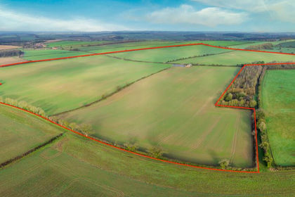
- Price
- Offers in Region of£1,200,000
- Size
- 138.38 acres
Land at East Barsham, Fakenham, Norfolk, Great Snoring, Norfolk NR21 England
Added on 27/02/2026Arable Land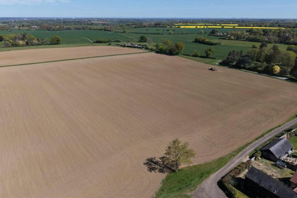
- Price
- £1,015,000
- Size
- 119.5 acres
Added on 17/07/2026Farmland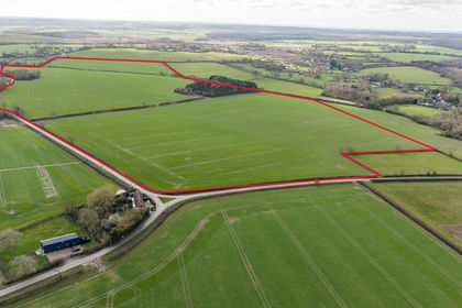
- Price
- Guide Price£950,000
- Size
- 89.35 acres
Lot 4 - Land Nr Kirtling And Ashley, Kirtling, Cambridgeshire CB8 England
Added on 01/09/2026Farmland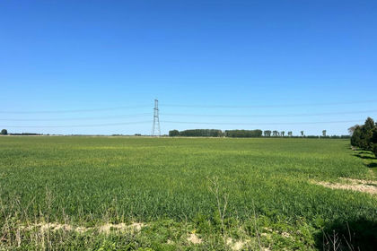
- Price
- Guide Price£1,378,000
- Size
- 164.07 acres
Cow Croft Field Farm, Marshland St. James, Norfolk PE14 England
Added on 17/05/2026Farmland