Rectory Road, Blaxhall, Woodbridge
- Land size
- 4.5 acres
- Bedrooms
- 8
- Bathrooms
- 4
Description
“Whimsical gardens merge quietly with the enveloping scenic Suffolk countryside”
This magnificent Grade II-listed former rectory lies on the edge of the picturesque Suffolk village of Blaxhall. The home is a portrait of classical detailing inside and out, retaining a wealth of original features and opening to a beautiful landscaped garden. The interiors span 4,737 sq ft and have been sensitively renovated to a high standard with curated finishes across seven bedrooms and numerous reception rooms. Extending over approximately 4.5 acres, the enchanting garden includes a vegetable garden, a natural lily pond, two paddocks, and tennis courts.
Setting the Scene
The former rectory dates to the early 19th century, with an older 17th-18th century timber-framed structure at the rear. Listed since 1966, the home presents a smart brick facade with a slated hipped roof and a symmetrical three-window range of three-light sash windows. The older part of the house retains a timber-framed core, reflecting the building’s earlier vernacular before the formal early 19th-century neoclassical expansion.
The Grand Tour
A private gravel driveway winds its way to the front of the house, entirely embedded within its wooded setting. The grand entrance features a prominent portico surrounding a front door with a semi-circular fanlight.
Inside, the entire ground floor lends itself to communing and hosting: the front of the house consists of two spacious reception rooms, while more intimate rooms open out to the rear. The first part of the house is Georgian – apparent through its generous proportions and floor-to-ceiling sash windows – and houses the formal dining room and the drawing room, each decorated with a distinct colour scheme and elegant period fireplaces.
A short set of stone steps descends to the older part of the house, where exposed ceiling beams and wonderfully wobbly walls define most of the rooms. To the right lies the kitchen, with white-painted shaker-style cabinets and an AGA range cooker enclosed in the original brick fireplace. A large walk-in pantry sits adjacent, along with a well-equipped utility/boot room with original pamment flooring.
Opposite are a breakfast room, with a wall of bespoke shelving, a study, and an intimate sitting room grounded by another brick fireplace. Exposed beams overhead and floorboards underfoot hint at the home’s storied past.
Two sets of stairs rise to the first floor, one lit by a pretty, restored cupola. Seven generous bedrooms occupy this floor with two well-sized bathrooms. The principal suite is arranged at the front of the house, with exceptionally large proportions and wide sash windows that frame the treetops and draw abundant light into the room. It has an adjoining study and an en suite with a large walk-in shower.
On the lower-ground level is a cellar with original brick wine vaults and slate shelving.
Set within the surrounding woodland is a one-bedroom coach house with a living room, kitchen and bright bathroom.
The Great Outdoors
Within its 4.5 acres of private grounds, the house is surrounded by expansive landscaped lawns, a tennis court, a natural pond, and areas of established woodland. There are two paddocks with stables serviced by electricity and water. The vegetable garden has raised beds filled with raspberries, rhubarb and herbs, and there are productive fruit trees bearing pears, plums, and quince. Paved terraces provide peaceful outdoor seating areas, and structured paths are forged with colourful perennial borders.
Out and About
The home is situated in a peaceful area of rural Suffolk on the edge of Blaxhall. The village has a local community pub, The Ship Inn, along with a 64-hectare heathland reserve managed by the Suffolk Wildlife Trust as part of the Suffolk Sandlings.
Blaxhall is situated roughly eight miles south-west of Aldeburgh and Leiston, and less than a 20-minute drive from Woodbridge, a thriving historic market town along the River Deben with a bustling high street filled with independent boutiques, artisan bakeries, restaurants, and the iconic Woodbridge Tide Mill. Nearby are the National Trust site at Sutton Hoo and the broader Suffolk Heritage Coast, within easy reach for coastal walks.
The area is well served by both state and independent schools. For transport, mainline rail services run directly from Ipswich railway station (around a 30-minute drive away) into London Liverpool Street in approximately 70 minutes, while local train links are also accessible from nearby Campsea Ashe (Wickham Market) station.
Council Tax Band: G
Map Location
Property details
- Tenure
- Freehold
- Council Tax Band
- G
- Date Posted
- 2026-09-28
Market Value Analysis
Compared with 1,144 Homes with Land listings in East Anglia (1+ acres).
Energy Performance Certificate
Energy Efficiency Rating
Based on UK Energy Performance Certificate standards (EU Directive 2002/91/EC)
Running costs are one side. Planning activity, flood history and ground risks for this location are in the full report.
Utilities & Restrictions
Utilities
- Electricity
- Ask Agent
- Water
- Ask Agent
- Heating
- Ask Agent
- Broadband
- Ask Agent
- Sewerage
- Ask Agent
Rights & Restrictions
- Public Rights of Way
- Ask Agent
- Private Rights of Way
- Ask Agent
- Listed Property
- Ask Agent
- Restrictions
- Ask Agent
Listed status, conservation areas and planning constraints for this location are in the full report.
Property Features
- Accessibility
- Ask Agent
- Parking
- Driveway
- Garden
- Garden
Beyond the particulars: planning activity, flood history, heritage and ground risks, checked for this exact spot.
Connectivity
Broadband
Fastest speed available at this postcode
1.8 Gbps
Gigabit full fibre
Suitable for
- 4K streaming on every screen
- Full-time home working
- Online gaming & big downloads
Mobile signal
Predicted 4G and 5G signal; indoor signal depends on building materials.
Ofcom Connected Nations postcode-level predictions. Speeds and signal are modelled, not measured, and vary between addresses and providers.
Signal is the easy part. Planning activity, flood history and protected designations here are in the full report.
Nearest Schools
Primary
- Snape Primary School2.2 milesNo Ofsted rating
- Ages
- 2 to 11
- Pupils
- 103
- Type
- Academy converter
- Benhall St Mary's Church of England Primary School2.7 milesNo Ofsted rating
- Ages
- 4 to 11
- Pupils
- 77
- Type
- Academy converter
- Faith
- Church of England
- Rendlesham Primary School3 milesNo Ofsted rating
- Ages
- 3 to 11
- Pupils
- 277
- Type
- Academy converter
- Saxmundham Primary School3.8 milesOfsted: Good
- Ages
- 3 to 11
- Pupils
- 252
- Type
- Academy converter
- Wickham Market Primary School4 milesNo Ofsted rating
- Ages
- 3 to 11
- Pupils
- 163
- Type
- Academy converter
Secondary
- Alde Valley Academy6.2 milesOfsted: Requires improvement
- Ages
- 11 to 16
- Pupils
- 645
- Type
- Academy sponsor led
- Thomas Mills High School & Sixth Form6.7 milesOfsted: Good
- Ages
- 11 to 18
- Pupils
- 1,056
- Type
- Academy converter
- Farlingaye High School7.8 milesOfsted report card · May 2026
- Ages
- 11 to 18
- Pupils
- 1,861
- Type
- Academy converter
- Kesgrave High School11 milesOfsted: Good
- Ages
- 11 to 18
- Pupils
- 1,875
- Type
- Academy converter
- Debenham High School13 milesOfsted: Good
- Ages
- 11 to 16
- Pupils
- 714
- Type
- Academy converter
- Faith
- Church of England
Distances are straight-line from the advertised location. Source: the national school registers (DfE, Welsh Government, Scottish Government) and Ofsted.
Schools are just the start: sold prices nearby, planning activity and any flood history are in the full report.
Amenities
Supermarket
GP surgery
Pharmacy
Hospital
Green space
Straight-line distances from the advertised location. Sources: NHS records, Geolytix supermarket locations, OS Open Greenspace and the national trails registers.
The area stacks up? Now check the location itself: planning nearby, protected designations and past flooding.
Getting Around
Nearest station
Nearest bus stop
Typical drive times
Straight-line distances from the advertised location; drive times are typical free-flow times over OpenStreetMap road data, so allow more at peak. Public transport locations from DfT NaPTAN.
Easy to reach matters. So do planning activity, flood history and ground risks: all in the full report.
Flood Risk
Environment Agency open data, checked around the advertised map pin for the listed acreage. Long-term risk counts flood defences; the planning map's flood zones do not. Provided by LandSale, not the listing agent, and not part of the agent's particulars. Risk varies across a holding, so verify before committing.
Rivers and the sea
Planning map: Flood Zone 1.
Surface water
Not at the pin: mapped about 30 metres away.
These bandings are the summary. Where this location sits on the flood maps, plus planning activity, heritage and ground risks, is in the full report.
Important notice: Information, maps and tags on this page are drawn from the advertising agent's marketing materials or generated automatically. LandSale has not verified them. Relying on these details is at your own risk, always carry out independent checks before committing to a purchase.
LandSale full disclaimer
Marketing information only - not formal particulars. The details on this website are provided for general guidance and do not constitute an offer or contract. Neither LandSale nor the advertising estate/land agent accepts responsibility for any inaccuracy.
1. Source of information
- Listing content: Core description, asking price, tenure, measurements, photographs and planning history originate from the marketing materials of the advertising estate or land agent. LandSale does not author this content and cannot guarantee its accuracy.
- Automated tags & categorisation: Property type, land-use class, acreage bands and similar labels may be applied by machine-learning models. They are intended as a helpful guide only and may not reflect the property's legal status or permitted use.
- Third-party & enriched data layers: Maps, boundary outlines, planning designations, soil reports, broadband coverage and other environmental or location-based insights are licensed from external suppliers. Such data are supplied “as is", may be incomplete or out of date and are subject to change without notice.
2. Verification required
Prospective purchasers must verify critical matters, including but not limited to planning permission, title boundaries, public rights of way, environmental constraints, acreage, services, access and VAT status, through their own inspections, specialist surveys, legal advisers and the selling agent before relying on the information or entering into any contract.
3. No warranty or liability
LandSale gives no warranty, express or implied, as to the accuracy, completeness or fitness for any particular purpose of the information displayed. LandSale shall not be liable for any loss, damage, cost or expense arising directly or indirectly from any use of or reliance on such information, save where liability may not be excluded by law.
4. Updates & feedback
If you believe any detail on this listing is inaccurate, please let us know. We will investigate and, where appropriate, update the listing or notify the agent.
© LandSale | Version 1.3 - August 2026
Listing agent
Inigo, London
St Alphege Hall Kings Bench Street, London, SE1 0QX
Similar properties for sale

- Price
- Guide Price£1,425,000
- Size
- 4.5 acres
Blaxhall, Nr Heritage Coast, Suffolk, Blaxhall, Suffolk IP12 England
Added on 28/09/2026House with Land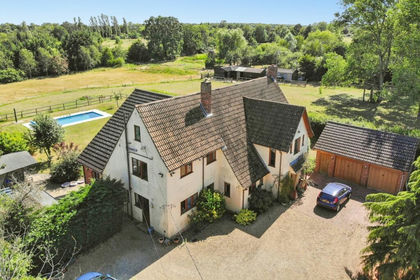
- Price
- Guide Price£1,250,000
- Size
- 2.5 acres
Rosemary Lane, Kelsale, Saxmundham, Suffolk, IP17, Kelsale cum Carlton, Suffolk IP17 England
Added on 07/09/2026House with Land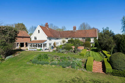
- Price
- Guide Price£1,275,000
- Size
- 7 acres
Added on 15/05/2026Farmhouse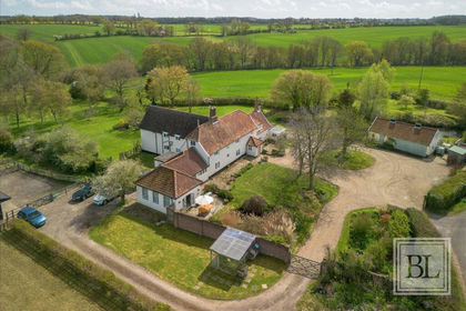
- Price
- £1,125,000
- Size
- 3.25 acres
Bruisyard Road, Peasenhall, Saxmundham, IP17, Peasenhall, Suffolk IP17 England
Added on 29/01/2026House with Land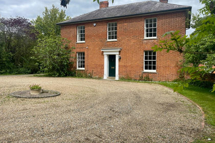
- Price
- £1,250,000
- Size
- 8.7 acres
Added on 23/05/2026Farmhouse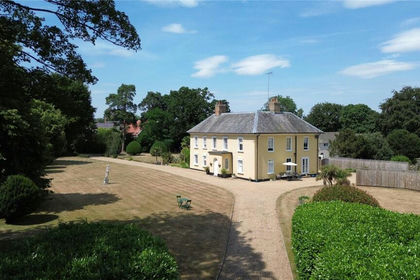
- Price
- Guide Price£1,450,000
- Size
- 6.6 acres
Added on 18/07/2026Country Home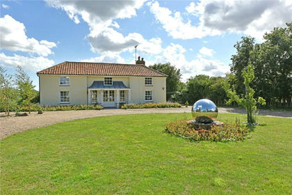
- Price
- Guide Price£1,100,000
- Size
- 3.25 acres
Added on 24/09/2026House with Land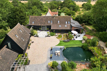
- Price
- Guide Price£1,450,000
- Size
- 5 acres
Debenham, Stowmarket, Suffolk, IP14, Debenham, Suffolk IP14 England
Added on 08/09/2026House with Land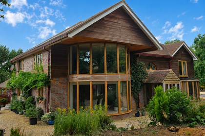
- Price
- Guide Price£1,650,000
- Size
- 8 acres
Greatwood House, Great Blakenham, Suffolk, IP6, Great Blakenham, Suffolk IP6 England
Added on 08/08/2026House with Land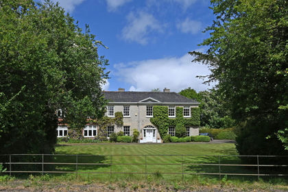
- Price
- Guide Price£1,250,000
- Size
- 12 acres
Added on 29/05/2026Country Home