Thorney Edge, Bagnall, ST9
- Land size
- 6.5 acres
- Bedrooms
- 5
- Bathrooms
- 2
Key Features
- Established glamping/holiday let opportunity boasting five self-contained Shepard's huts, each with their own separate wet room/WC. Infrared sauna, BBQ area, communal snug, and dedicated guest parking
- Three-bedroom farm house with spacious living areas, cellar with potential for home office, bar, or cinema. Plus an adjoining two-bedroom barn conversion with kitchen, living room, and dining room.
- Approximate 6.5 Acre plot with sprawling gardens, small stable block, paddock areas, all set within the beautiful Staffordshire moorlands
- Ideal location within driving distance from the well-known Alton Towers, the beautiful market town of Leek, a little further and you are in the beautiful Peak District with walks and days out.
- These two stunning homes can be perfect for air bnb or a separate annex for multigenerational living, or knock through to create your forever countryside home (STNPP)
Description
How do you like your eggs in the morning? I like mine sunny side up… preferably enjoyed in the kitchen of a gorgeous stone-built farmhouse with the countryside breeze drifting in. Perfectly situated on the outskirts of the quiet moorland village of Bagnall—a hub for rural charm and countryside living—Holly Grove Farm combines character, comfort, and opportunity in one idyllic package. The property includes a beautiful stone farmhouse, an equally impressive barn conversion, a variety of outbuildings, approximately 6.5 acres of land, and a highly established glamping/holiday let business. You’ll also find off-road parking, iron-gated access, and a double garage. To the front, an adaptable outbuilding — formerly a dog grooming space — now serves as a utility and laundry area for guest preparation.
Glamping at Holly Grove Farm is a fully established glamping/holiday let, featured proudly on Channel 4’s ‘Four In A Bed’. Boasting five fully self-contained Shepherds Huts, each with their own separate shower room/WC. Plus, a unique five-person infrared sauna, gardens, BBQ and play areas, a communal snug, plus a generous amount of dedicated guest parking. The ground of the property also includes two large fields, perfect for grazing horses or expanding the business. Perfectly located within driving distance of Alton Towers, the market town of Leek, top-rated wedding venues or anyone looking for a serene escape near the beautiful Peak District.
The three-bedroom farmhouse offers two generous reception rooms, three double bedrooms, a contemporary shower room with walk-in shower, and a welcoming kitchen/breakfast room with sleek cabinetry, ample appliance space, and a convenient breakfast bar. Across the hall are a W/C, utility area, and access to the cellar — perfect for a home office, playroom, wine cellar, or even a cosy cinema room. Throughout, you’ll find standout features including a log burner, rustic exposed beams, and historic stonework. To the rear, two stable blocks with an adjoining paddock make it ideal for keeping horses or other animals.
Holly Barn, the barn conversion, showcases the same charming stonework, a generous entrance hall, a practical kitchen, and an expansive dining room with French doors opening onto a beautifully laid patio with an impressive pergola with a bronze roof. The warm and inviting living room features a log burner, engineered oak flooring, and underfloor heating. Upstairs, two double bedrooms with fitted wardrobes and a stylish shower room complete the space. Holly Grove Farm isn’t just a property — it’s a lifestyle, a business opportunity, and a slice of countryside heaven.
EPC Rating: D
Map Location
Property details
- Tenure
- Freehold
- Council Tax Band
- C
- Date Posted
- 2026-01-29
Market Value Analysis
Compared with 287 Homes with Land listings in West Midlands (5+ acres).
Energy Performance Certificate
Energy Efficiency Rating
Based on UK Energy Performance Certificate standards (EU Directive 2002/91/EC)
Running costs are one side. Planning activity, flood history and ground risks for this location are in the full report.
Utilities & Restrictions
Utilities
- Electricity
- Mains
- Water
- Private Supply
- Heating
- Oil Heating, Gas Central Heating, Wood Burner
- Broadband
- Cable Internet
- Sewerage
- Septic Tank / Private
Rights & Restrictions
- Public Rights of Way
- Ask Agent
- Private Rights of Way
- Ask Agent
- Listed Property
- Ask Agent
- Restrictions
- Ask Agent
Listed status, conservation areas and planning constraints for this location are in the full report.
Property Features
- Accessibility
- Ask Agent
- Parking
- Parking Available
- Garden
- Garden
Beyond the particulars: planning activity, flood history, heritage and ground risks, checked for this exact spot.
Connectivity
Broadband
Fastest speed available at this postcode
26 Mbps
Standard (10-30 Mbps)
Suitable for
- Web & social
- Music streaming
- Standard video calls
Mobile signal
Predicted 4G and 5G signal; indoor signal depends on building materials.
Ofcom Connected Nations postcode-level predictions. Speeds and signal are modelled, not measured, and vary between addresses and providers.
Signal is the easy part. Planning activity, flood history and protected designations here are in the full report.
Nearest Schools
Primary
- Werrington Primary School1.3 milesNo Ofsted rating
- Ages
- 3 to 11
- Pupils
- 462
- Type
- Academy converter
- St John's CofE Primary School1.4 milesOfsted: Good
- Ages
- 3 to 11
- Pupils
- 198
- Type
- Academy converter
- Faith
- Church of England
- Carmountside Primary Academy1.8 milesOfsted: Good
- Ages
- 2 to 11
- Pupils
- 196
- Type
- Academy converter
- Hillside Primary School2 milesOfsted: Good
- Ages
- 3 to 11
- Pupils
- 224
- Type
- Community school
- Greenways Primary Academy2 milesNo Ofsted rating
- Ages
- 3 to 11
- Pupils
- 234
- Type
- Academy converter
Secondary
- Moorside High School1.4 milesOfsted: Good
- Ages
- 11 to 16
- Pupils
- 766
- Type
- Academy converter
- Endon High School2.3 milesOfsted: Good
- Ages
- 11 to 16
- Pupils
- 700
- Type
- Academy converter
- Birches Head Academy2.5 milesOfsted report card · Jun 2026
- Ages
- 11 to 16
- Pupils
- 925
- Type
- Academy converter
- Discovery Academy2.7 milesOfsted: Requires improvement
- Ages
- 11 to 16
- Pupils
- 1,435
- Type
- Academy sponsor led
- The Excel Academy2.7 milesNo Ofsted rating
- Ages
- 11 to 16
- Pupils
- 1,184
- Type
- Academy converter
Distances are straight-line from the advertised location. Source: the national school registers (DfE, Welsh Government, Scottish Government) and Ofsted.
Schools are just the start: sold prices nearby, planning activity and any flood history are in the full report.
Amenities
Supermarket
GP surgery
Pharmacy
Hospital
Straight-line distances from the advertised location. Sources: NHS records, Geolytix supermarket locations, OS Open Greenspace and the national trails registers.
The area stacks up? Now check the location itself: planning nearby, protected designations and past flooding.
Getting Around
Nearest station
Nearest bus stop
Typical drive times
Straight-line distances from the advertised location; drive times are typical free-flow times over OpenStreetMap road data, so allow more at peak. Public transport locations from DfT NaPTAN.
Easy to reach matters. So do planning activity, flood history and ground risks: all in the full report.
Flood Risk
Environment Agency open data, checked around the advertised map pin for the listed acreage. Long-term risk counts flood defences; the planning map's flood zones do not. Provided by LandSale, not the listing agent, and not part of the agent's particulars. Risk varies across a holding, so verify before committing.
Rivers and the sea
Planning map: Flood Zone 1.
Surface water
Not at the pin: mapped about 40 metres away.
These bandings are the summary. Where this location sits on the flood maps, plus planning activity, heritage and ground risks, is in the full report.
Important notice: Information, maps and tags on this page are drawn from the advertising agent's marketing materials or generated automatically. LandSale has not verified them. Relying on these details is at your own risk, always carry out independent checks before committing to a purchase.
LandSale full disclaimer
Marketing information only - not formal particulars. The details on this website are provided for general guidance and do not constitute an offer or contract. Neither LandSale nor the advertising estate/land agent accepts responsibility for any inaccuracy.
1. Source of information
- Listing content: Core description, asking price, tenure, measurements, photographs and planning history originate from the marketing materials of the advertising estate or land agent. LandSale does not author this content and cannot guarantee its accuracy.
- Automated tags & categorisation: Property type, land-use class, acreage bands and similar labels may be applied by machine-learning models. They are intended as a helpful guide only and may not reflect the property's legal status or permitted use.
- Third-party & enriched data layers: Maps, boundary outlines, planning designations, soil reports, broadband coverage and other environmental or location-based insights are licensed from external suppliers. Such data are supplied “as is", may be incomplete or out of date and are subject to change without notice.
2. Verification required
Prospective purchasers must verify critical matters, including but not limited to planning permission, title boundaries, public rights of way, environmental constraints, acreage, services, access and VAT status, through their own inspections, specialist surveys, legal advisers and the selling agent before relying on the information or entering into any contract.
3. No warranty or liability
LandSale gives no warranty, express or implied, as to the accuracy, completeness or fitness for any particular purpose of the information displayed. LandSale shall not be liable for any loss, damage, cost or expense arising directly or indirectly from any use of or reliance on such information, save where liability may not be excluded by law.
4. Updates & feedback
If you believe any detail on this listing is inaccurate, please let us know. We will investigate and, where appropriate, update the listing or notify the agent.
© LandSale | Version 1.3 - August 2026
Listing agent
James Du Pavey, Cheadle
1 Cheadle Shopping Centre, Cheadle, ST10 1UY
Similar properties for sale
- Price
- £825,000
- Size
- 8 acres
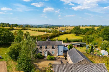
Old Mill Lane, Bagnall, Staffordshire, ST9, Bagnall, Staffordshire ST9 England
Added on 03/09/2026House with Land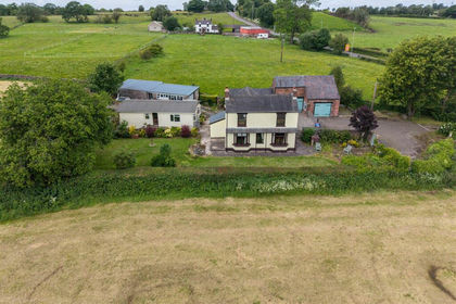
- Price
- Offers in Region of£750,000
- Size
- 5.65 acres
Blakeley Lane, Dilhorne, Stoke-On-Trent, Consall, Staffordshire ST10 England
Added on 16/06/2026House with Land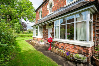
- Price
- Guide Price£750,000
- Size
- 6.95 acres
Meadow Cottage, The Village, Endon, Staffordshire, ST9, Endon and Stanley, Staffordshire ST9 England
Added on 22/06/2026Equestrian property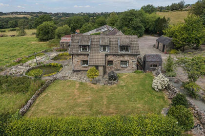
- Price
- Offers in Region of£750,000
- Size
- 5.99 acres
Gadshill Farm, Cowall moor lane, Lask edge, Biddulph, Staffordshire ST13 England
Added on 23/07/2026Smallholding
- Price
- Offers in Region of£800,000
- Size
- 4.5 acres
Added on 05/06/2026House with Land
- Price
- £945,000
- Size
- 12 acres
Added on 29/01/2026House with Land
- Price
- Guide Price£945,000
- Size
- 12 acres
Biddulph Moor STAFFORDSHIRE, Biddulph, Staffordshire ST8 England
Added on 17/09/2026House with Land
- Price
- Guide Price£1,000,000
- Size
- 3 acres
Added on 29/01/2026House with Land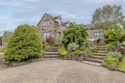
- Price
- Guide Price£825,000
- Size
- 3 acres
Hot Lane, Biddulph Moor, Staffordshire, ST8, Biddulph, Staffordshire ST8 England
Added on 17/06/2026House with Land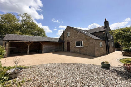
- Price
- Offers Over£900,000
- Size
- 10 acres
Added on 29/01/2026House with Land